


-
[Name]: Bedford District No. 6 School (Banner Oak School)
[Image]: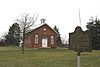
[Location]: 25 East Stearns Road
[Municipality]: Bedford Township
[Listing date]: August 12, 1983
(Current listings) -
[Name]: Bridge School
[Image]:
[Location]: 96 Ida-Maybee Road
[Municipality]: Monroe vicinity
[Listing date]: December 17, 1987
(Current listings) -
[Name]: George Armstrong Custer Equestrian Monument†
[Image]:
[Location]: SW corner of the intersection of Elm and North Monroe (M-125) streets
[Municipality]: Monroe
[Listing date]: June 15, 1992
(Current listings) -
[Name]: Exeter Township Hall
[Image]:
[Location]: Southwest corner of Sumpter Road and Grant Street
[Municipality]: Exeter Township
[Listing date]: September 3, 1998
(Current listings) -
[Name]: First Organized Public School District
[Image]:
[Location]: T7S, R8 & 9E
[Municipality]: Monroe vicinity
[Listing date]: September 17, 1957
(Current listings) -
[Name]: Fix House (Demolished, NR delisted 1981)
[Image]:
[Location]: Sterling State Park
[Municipality]: Monroe
[Listing date]: October 29, 1971
(Current listings) -
[Name]: Johnson-Phinney House
[Image]:
[Location]: 22 West Second
[Municipality]: Monroe
[Listing date]: February 23, 1978
(Current listings) -
[Name]: Lake Erie Informational Designation
[Image]:
[Location]: Dixie Highway at Sterling State Park, east of Monroe city limits
[Municipality]: Monroe vicinity
[Listing date]: January 19, 1957
(Current listings) -
[Name]: Edward Loranger House†
[Image]:
[Location]: 7211 South Stony Creek Road
[Municipality]: Monroe vicinity
[Listing date]: October 2, 1980
(Current listings) -
[Name]: Maybee Village Hall
[Image]:
[Location]: 9051 Raisin Street
[Municipality]: Maybee
[Listing date]: March 15, 1988
(Current listings) -
[Name]: Governor Robert McClelland House†
[Image]:
[Location]: 47 East Elm Street
[Municipality]: Monroe
[Listing date]: March 3, 1971
(Current listings) -
[Name]: Michigan Historic Crossroads Informational Site
[Image]:
[Location]: Information Center on I-75 near Monroe
[Municipality]: Monroe
[Listing date]: September 17, 1957
(Current listings) -
[Name]: Michigan Southern Railroad
[Image]:
[Location]: Flat Iron City Park at intersection of First and Front
[Municipality]: Monroe
[Listing date]: September 25, 1956
(Current listings) -
[Name]: Monroe County Informational Designation
[Image]:
[Location]: Inside of the Monroe County Historical Museum, 126 S Monroe, NW corner of Second
[Municipality]: Monroe
[Listing date]: July 19, 1956
(Current listings) -
[Name]: Monroe Paper Industry
[Image]:
[Location]: Near junction of East Elm and Old Dixie North
[Municipality]: Monroe
[Listing date]: September 25, 1956
(Current listings) -
[Name]: Navarre-Anderson Trading Post†
[Image]:
[Location]: West of Monroe at North Custer (M-130) and Raisinville roads
[Municipality]: Monroe vicinity
[Listing date]: June 16, 1972
(Current listings) -
[Name]: Rudolph Nims House†
[Image]:
[Location]: 206 West Noble Avenue
[Municipality]: Monroe
[Listing date]: October 29, 1971
(Current listings) -
[Name]: River Raisin Battlefield Site† (20MR227)
[Image]:
[Location]: Bounded by the River Raisin, Detroit Avenue, Mason Run, and south at Noble Avenue
[Municipality]: Monroe
[Listing date]: February 18, 1956
(Current listings) -
[Name]: St. John the Baptist Catholic Church
[Image]:
[Location]: 511 Monroe Street
[Municipality]: Monroe
[Listing date]: April 15, 1999
(Current listings) -
[Name]: Saint John's Evangelical Lutheran Church and Parsonage
[Image]:
[Location]: 460 Riley Street, between Plank and Maple streets
[Municipality]: Dundee
[Listing date]: September 19, 1991
(Current listings) -
[Name]: Saint Patrick's Catholic Church
[Image]:
[Location]: 2996 West Labo Road, east of Exeter Road
[Municipality]: Carleton vicinity
[Listing date]: October 10, 1989
(Current listings) -
[Name]: Sawyer House†
[Image]:
[Location]: 320 East Front Street
[Municipality]: Monroe
[Listing date]: June 19, 1975
(Current listings) -
[Name]: Seitz Inn
[Image]:
[Location]: 8941 North Custer Road, just west of Ida-Maybee Road
[Municipality]: Grape vicinity
[Listing date]: October 23, 1979
(Current listings) -
[Name]: Toledo War Informational Designation
[Image]:
[Location]: Rest Area and Welcome Center, northbound I-75
[Municipality]: Monroe vicinity
[Listing date]: November 27, 1956
(Current listings) -
[Name]: Alfred Wilkerson Grist Mill
[Image]:
[Location]: 242 Toledo Street
[Municipality]: Dundee
[Listing date]: August 3, 1979
(Current listings) -
[Name]: Woodland Cemetery
[Image]: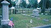
[Location]: Jerome Street near Fourth Street
[Municipality]: Monroe
[Listing date]: July 21, 1988
(Current listings)
New Random Display Display All Items(26)