


-
[Image ]:

[Name ]: Adeline
[Type ]: Village
[Township ]: Maryland Township
[Area in miles (km²) ]: 0.7 mi² (1.81 km²)
[Date founded ]:
[Population ]: 139
(Current communities) -
[Image ]:
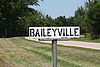
[Name ]: Baileyville
[Type ]: Unincorporated
[Township ]: Forreston Township
[Area in miles (km²) ]:
[Date founded ]:
[Population ]:
(Current communities) -
[Image ]:
[Name ]: Brooks Isle
[Type ]: Unincorporated
[Township ]: Oregon-Nashua Township
[Area in miles (km²) ]:
[Date founded ]:
[Population ]:
(Current communities) -
[Image ]:
[Name ]: Buffalo Grove
[Type ]: Unincorporated
[Township ]: Oregon-Nashua Township
[Area in miles (km²) ]: NA
[Date founded ]: 1830
[Population ]: NA
(Current communities) -
[Image ]:

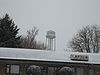
[Name ]: Byron
[Type ]: City
[Township ]: Byron Township
[Area in miles (km²) ]: 6.4 mi² (16.58 km²)
[Date founded ]:
[Population ]: 2,917
(Current communities) -
[Image ]:

[Name ]: Chana
[Type ]: Unincorporated
[Township ]: Pine Rock Township
[Area in miles (km²) ]:
[Date founded ]: 1871
[Population ]:
(Current communities) -
[Image ]:
[Name ]: Creston
[Type ]: Village
[Township ]: Dement Township
[Area in miles (km²) ]: 1.1 mi² (2.85 km²)
[Date founded ]:
[Population ]: 543
(Current communities) -
[Image ]:

[Name ]: Davis Junction
[Type ]: Village
[Township ]: Scott Township
[Area in miles (km²) ]: 9.8 mi² (25.38 km²)
[Date founded ]:
[Population ]: 491
(Current communities) -
[Image ]:
[Name ]: Daysville
[Type ]: Unincorporated
[Township ]: Oregon-Nashua Township
[Area in miles (km²) ]:
[Date founded ]:
[Population ]:
(Current communities) -
[Image ]:
[Name ]: Egan
[Type ]: Unincorporated
[Township ]: Leaf River Township
[Area in miles (km²) ]:
[Date founded ]:
[Population ]:
(Current communities) -
[Image ]:
[Name ]: Flagg Center
[Type ]: Unincorporated
[Township ]: Flagg Township
[Area in miles (km²) ]:
[Date founded ]:
[Population ]:
(Current communities) -
[Image ]:
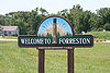
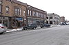
[Name ]: Forreston
[Type ]: Village
[Township ]: Forreston Township
[Area in miles (km²) ]: 2.1 mi² (5.44 km²)
[Date founded ]: 1854
[Population ]: 1,469
(Current communities) -
[Image ]:

[Name ]: Grand Detour
[Type ]: Unincorporated
[Township ]: Grand Detour Township
[Area in miles (km²) ]:
[Date founded ]:
[Population ]:
(Current communities) -
[Image ]:

[Name ]: Haldane
[Type ]: Unincorporated
[Township ]: Lincoln Township
[Area in miles (km²) ]:
[Date founded ]:
[Population ]:
(Current communities) -
[Image ]:
[Name ]: Harper
[Type ]: Unincorporated
[Township ]: Forreston Township
[Area in miles (km²) ]:
[Date founded ]:
[Population ]:
(Current communities) -
[Image ]:
[Name ]: Hazelhurst
[Type ]: Unincorporated
[Township ]: Eagle Point Township
[Area in miles (km²) ]:
[Date founded ]:
[Population ]:
(Current communities) -
[Image ]:
[Name ]: Hillcrest
[Type ]: Village
[Township ]: Flagg Township
[Area in miles (km²) ]: 0.6 mi² (1.55 km²)
[Date founded ]:
[Population ]: 1,158
(Current communities) -
[Image ]:
[Name ]: Holcomb
[Type ]: Unincorporated
[Township ]: White Rock Township
[Area in miles (km²) ]:
[Date founded ]:
[Population ]:
(Current communities) -
[Image ]:

[Name ]: Kings
[Type ]: Unincorporated
[Township ]: White Rock Township
[Area in miles (km²) ]:
[Date founded ]:
[Population ]:
(Current communities) -
[Image ]:
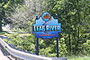
[Name ]: Leaf River
[Type ]: Village
[Township ]: Leaf River Township
[Area in miles (km²) ]: 2.2 mi² (5.7 km²)
[Date founded ]:
[Population ]: 555
(Current communities) -
[Image ]:

[Name ]: Lindenwood
[Type ]: Unincorporated
[Township ]: Lynnville Township
[Area in miles (km²) ]:
[Date founded ]:
[Population ]:
(Current communities) -
[Image ]:

[Name ]: Monroe Center
[Type ]: Village
[Township ]: Monroe Township
[Area in miles (km²) ]:
[Date founded ]:
[Population ]: 504
(Current communities) -
[Image ]:

[Name ]: Mount Morris
[Type ]: Village
[Township ]: Mt. Morris Township
[Area in miles (km²) ]: 3.0 mi² (7.77 km²)
[Date founded ]:
[Population ]: 3,013
(Current communities) -
[Image ]:

[Name ]: Oregon
[Type ]: City
[Township ]: Oregon-Nashua Township
[Area in miles (km²) ]: 2.1 mi² (5.44 km²)
[Date founded ]:
[Population ]: 4,060
(Current communities) -
[Image ]:

[Name ]: Paynes Point
[Type ]: Unincorporated
[Township ]: Pine Rock Township
[Area in miles (km²) ]:
[Date founded ]:
[Population ]:
(Current communities) -
[Image ]:
[Name ]: Polo
[Type ]: City
[Township ]: Buffalo Township
[Area in miles (km²) ]: 3.4 mi² (8.81 km²)
[Date founded ]:
[Population ]: 2,477
(Current communities) -
[Image ]:

[Name ]: Rochelle
[Type ]: City
[Township ]: Flagg Township and Dement Township
[Area in miles (km²) ]: 19.4 mi² (50.25 km²)
[Date founded ]:
[Population ]: 9,424
(Current communities) -
[Image ]:

[Name ]: Stillman Valley
[Type ]: Village
[Township ]: Marion Township
[Area in miles (km²) ]: 1.4 mi² (3.63 km²)
[Date founded ]: 1875
[Population ]: 1,048
(Current communities) -
[Image ]:
[Name ]: Stratford
[Type ]: Unincorporated
[Township ]: Pine Creek Township
[Area in miles (km²) ]:
[Date founded ]:
[Population ]:
(Current communities) -
[Image ]:
[Name ]: Woosung
[Type ]: Unincorporated
[Township ]: Woosung Township
[Area in miles (km²) ]:
[Date founded ]: June, 1855
[Population ]:
(Current communities)
New Random Display Display All Items(30)