


-
[Monument]: Makino Memorial Garden牧野記念庭園 (牧野富太郎宅跡)Makino kinen teien (Makino Tomitarō taku ato)
[Municipality]: Nerima
[Prefecture]: Tokyo
[Comments]: commemorates Makino Tomitarō, "Father of Japanese Botany"
[Designation]: Historic Site, Place of Scenic Beauty
[Image]:
[Coordinates]: 35°44′47″N 139°35′07″E / 35.74643672°N 139.58531895°E / 35.74643672; 139.58531895 (Makino Memorial Garden)
[Ref.]: [1] -
[Monument]: Okakura Tenshin Former Residence and Gardens with Ōizura-Koizura岡倉天心旧宅・庭園及び大五浦・小五浦Okakura Tenshin kyūtaku・teien oyobi Ōizura・Koizura
[Municipality]: Ibaraki
[Prefecture]: Ibaraki
[Comments]: includes the site of the Rokkakudō
[Designation]: Historic Site, Place of Scenic Beauty
[Image]:
[Coordinates]: 36°50′00″N 140°48′12″E / 36.833333°N 140.803333°E / 36.833333; 140.803333 (Okakura Tenshin Former Residence and Gardens with Ōizura-Koizura)
[Ref.]: [2] -
[Monument]: Tateyama Erosion Control Railway立山砂防工事専用軌道Tateyama sabō kōji sen'yō kidō
[Municipality]: Tateyama
[Prefecture]: Toyama
[Comments]: for servicing works on the Jōganji River
[Designation]: Historic Site
[Image]:
[Coordinates]: 36°33′55″N 137°29′20″E / 36.56516413°N 137.48890376°E / 36.56516413; 137.48890376 (Tateyama Erosion Control Railway)
[Ref.]: [3] -
[Monument]: Tachibai Canal立梅用水Tachibai yōsui
[Municipality]: Matsusaka, Taki
[Prefecture]: Mie
[Comments]:
[Designation]: Historic Site
[Image]:
[Coordinates]:
[Ref.]: [4] -
[Monument]: Kumohara Erosion Control Facilities雲原砂防関連施設群Kumohara sabō kanren shisetsugun
[Municipality]: Fukuchiyama
[Prefecture]: Kyoto
[Comments]:
[Designation]: Historic Site
[Image]:
[Coordinates]: 35°26′38″N 135°04′25″E / 35.443787°N 135.073563°E / 35.443787; 135.073563 (Kumohara Erosion Control Facilities)
[Ref.]: [5] -
[Monument]: Nagasaki Atomic Bomb Sites (Urakami Cathedral Former Bell Tower)長崎原爆遺跡(浦上天主堂旧鐘楼)Nagasaki genbaku iseki (Urakami Tenshudō kyū-shōrō)
[Municipality]: Nagasaki
[Prefecture]: Nagasaki
[Comments]:
[Designation]: Historic Site
[Image]: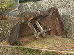
[Coordinates]: 32°46′34″N 129°52′06″E / 32.776194°N 129.868389°E / 32.776194; 129.868389 (Nagasaki Atomic Bomb Sites (Urakami Cathedral Former Bell Tower))
[Ref.]: [6] -
[Monument]: Nagasaki Atomic Bomb Sites (Former Shiroyama National School Buildings)長崎原爆遺跡(旧城山国民学校校舎)Nagasaki genbaku iseki (kyū-Shiroyama kokumin gakkō kōsha)
[Municipality]: Nagasaki
[Prefecture]: Nagasaki
[Comments]:
[Designation]: Historic Site
[Image]:
[Coordinates]: 32°46′25″N 129°51′27″E / 32.773528°N 129.857472°E / 32.773528; 129.857472 (Nagasaki Atomic Bomb Sites (Former Shiroyama National School Buildings))
[Ref.]: [7] -
[Monument]: Nagasaki Atomic Bomb Sites (Former Nagasaki Medical School Gateposts)長崎原爆遺跡(旧長崎医科大学門柱)Nagasaki genbaku iseki (kyū-Nagasaki Ika Daigaku monchū)
[Municipality]: Nagasaki
[Prefecture]: Nagasaki
[Comments]:
[Designation]: Historic Site
[Image]:
[Coordinates]:
[Ref.]: [8] -
[Monument]: Nagasaki Atomic Bomb Sites (Sannō Jinja Torii)長崎原爆遺跡(山王神社二の鳥居)Nagasaki genbaku iseki (Sannō Jinja ni-no-torii)
[Municipality]: Nagasaki
[Prefecture]: Nagasaki
[Comments]:
[Designation]: Historic Site
[Image]: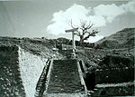
[Coordinates]: 32°46′03″N 129°52′07″E / 32.7675°N 129.868611°E / 32.7675; 129.868611 (Nagasaki Atomic Bomb Sites (Sannō Jinja Torii))
[Ref.]: [9] -
[Monument]: Heshikiya Sugar Refining Site平敷屋製糖工場跡Heshikiya seitō kōjō ato
[Municipality]: Uruma
[Prefecture]: Okinawa
[Comments]:
[Designation]: Historic Site
[Image]:
[Coordinates]:
[Ref.]: [10] -
[Monument]: Hakodate Park函館公園Hakodate kōen
[Municipality]: Hakodate
[Prefecture]: Hokkaidō
[Comments]:
[Designation]: Place of Scenic Beauty
[Image]:
[Coordinates]: 41°45′22″N 140°42′56″E / 41.7560967°N 140.71557982°E / 41.7560967; 140.71557982 (Hakodate Park)
[Ref.]: [11] -
[Monument]: Former Kikuchi Family Gardens (Hirosaki Akenoboshi Kindergarten Gardens)旧菊池氏庭園(弘前明の星幼稚園庭園)kyū-Kikuchi-shi teien (Hirosaki Akenoboshi yōchien teien)
[Municipality]: Hirosaki
[Prefecture]: Aomori
[Comments]:
[Designation]: Place of Scenic Beauty
[Image]:
[Coordinates]: 40°36′53″N 140°27′48″E / 40.6147151°N 140.46326972°E / 40.6147151; 140.46326972 (Former Kikuchi Family Gardens (Hirosaki Akenoboshi Kindergarten Gardens))
[Ref.]: [12] -
[Monument]: Narumi Family Gardens鳴海氏庭園Narumi-shi teien
[Municipality]: Kuroishi
[Prefecture]: Aomori
[Comments]:
[Designation]: Place of Scenic Beauty
[Image]:
[Coordinates]: 40°38′40″N 140°35′48″E / 40.64438095°N 140.59668668°E / 40.64438095; 140.59668668 (Narumi Family Gardens)
[Ref.]: [13] -
[Monument]: Yōki-en揚亀園Yōki-en
[Municipality]: Hirosaki
[Prefecture]: Aomori
[Comments]:
[Designation]: Place of Scenic Beauty
[Image]:
[Coordinates]: 40°36′41″N 140°28′10″E / 40.61139275°N 140.46940621°E / 40.61139275; 140.46940621 (Yōki-en)
[Ref.]: [14] -
[Monument]: Moriai Family Gardens盛合氏庭園Moriai-shi teien
[Municipality]: Miyako
[Prefecture]: Iwate
[Comments]:
[Designation]: Place of Scenic Beauty
[Image]:
[Coordinates]: 39°38′19″N 141°57′38″E / 39.638736°N 141.960450°E / 39.638736; 141.960450 (Moriai Family Gardens)
[Ref.]: [15] -
[Monument]: Former Nanbu Family Villa Gardens旧南部氏別邸庭園kyū-Nanbu-shi bettei teien
[Municipality]: Morioka
[Prefecture]: Iwate
[Comments]:
[Designation]: Place of Scenic Beauty
[Image]:
[Coordinates]: 39°42′39″N 141°09′44″E / 39.710818°N 141.162300°E / 39.710818; 141.162300 (Former Nanbu Family Villa Gardens)
[Ref.]: [16] -
[Monument]: Nanshōsō Gardens南昌荘庭園Nanshōsō teien
[Municipality]: Morioka
[Prefecture]: Iwate
[Comments]:
[Designation]: Place of Scenic Beauty
[Image]:
[Coordinates]: 39°41′44″N 141°08′55″E / 39.695552°N 141.148707°E / 39.695552; 141.148707 (Nanshōsō Gardens)
[Ref.]: [17] -
[Monument]: Butsugaiken Gardens物外軒庭園Butsugaiken teien
[Municipality]: Ashikaga
[Prefecture]: Tochigi
[Comments]:
[Designation]: Place of Scenic Beauty
[Image]:
[Coordinates]: 36°20′21″N 139°26′29″E / 36.33904491°N 139.4414391°E / 36.33904491; 139.4414391 (Butsugaiken Gardens)
[Ref.]: [18] -
[Monument]: Ganka-en巖華園Ganka-en
[Municipality]: Ashikaga
[Prefecture]: Tochigi
[Comments]:
[Designation]: Place of Scenic Beauty
[Image]:
[Coordinates]: 36°21′41″N 139°27′52″E / 36.36148261°N 139.46448691°E / 36.36148261; 139.46448691 (Ganka-en)
[Ref.]: [19] -
[Monument]: Former Yamasaki Family Villa Gardens旧山崎氏別邸庭園kyū-Yamasaki-shi bettei teien
[Municipality]: Kawagoe
[Prefecture]: Saitama
[Comments]:
[Designation]: Place of Scenic Beauty
[Image]:
[Coordinates]: 35°55′18″N 139°29′04″E / 35.92160897°N 139.48452707°E / 35.92160897; 139.48452707 (Former Yamasaki Family Villa Gardens)
[Ref.]: [20] -
[Monument]: Former Yoshida Family Gardens旧吉田氏庭園kyū-Yoshida-shi teien
[Municipality]: Kashiwa
[Prefecture]: Chiba
[Comments]:
[Designation]: Place of Scenic Beauty
[Image]:
[Coordinates]: 35°52′05″N 139°58′35″E / 35.86815527°N 139.97637472°E / 35.86815527; 139.97637472 (Former Yoshida Family Gardens)
[Ref.]: [21] -
[Monument]: Noda City Hall Gardens野田市市民会館 (旧茂木佐平治氏) 庭園Noda-shi shimin kaikan (kyū-Mogisa Beiji-shi) teien
[Municipality]: Noda
[Prefecture]: Chiba
[Comments]:
[Designation]: Place of Scenic Beauty
[Image]:
[Coordinates]: 35°56′44″N 139°51′57″E / 35.94560804°N 139.86570074°E / 35.94560804; 139.86570074 (Noda City Hall Gardens)
[Ref.]: [22] -
[Monument]: Grounds of the National Museum of Western Art野田市市民会館園地Kokuritsu Seiyō Bijutsukan enchi
[Municipality]: Taitō
[Prefecture]: Tokyo
[Comments]:
[Designation]: Place of Scenic Beauty
[Image]:
[Coordinates]: 35°42′54″N 139°46′32″E / 35.71507309°N 139.77563398°E / 35.71507309; 139.77563398 (Grounds of the National Museum of Western Art)
[Ref.]: [23] -
[Monument]: Yokohama Park横浜公園Yokohama kōen
[Municipality]: Yokohama
[Prefecture]: Kanagawa
[Comments]:
[Designation]: Place of Scenic Beauty
[Image]:
[Coordinates]: 35°26′37″N 139°38′25″E / 35.44371739°N 139.64023952°E / 35.44371739; 139.64023952 (Yokohama Park)
[Ref.]: [24] -
[Monument]: Onshi Hakone Park恩賜箱根公園Onshi Hakone kōen
[Municipality]: Hakone
[Prefecture]: Kanagawa
[Comments]:
[Designation]: Place of Scenic Beauty
[Image]:
[Coordinates]: 35°11′47″N 139°01′33″E / 35.196389°N 139.025917°E / 35.196389; 139.025917 (Onshi Hakone Park)
[Ref.]: [25] -
[Monument]: Gōra Park強羅公園Gōra kōen
[Municipality]: Hakone
[Prefecture]: Kanagawa
[Comments]:
[Designation]: Place of Scenic Beauty
[Image]:
[Coordinates]: 35°14′55″N 139°02′46″E / 35.248646°N 139.046032°E / 35.248646; 139.046032 (Gōra Park)
[Ref.]: [26] -
[Monument]: Yamashita Park山下公園Yamashita kōen
[Municipality]: Yokohama
[Prefecture]: Kanagawa
[Comments]:
[Designation]: Place of Scenic Beauty
[Image]:
[Coordinates]: 35°26′44″N 139°39′00″E / 35.44567277°N 139.65001822°E / 35.44567277; 139.65001822 (Yamashita Park)
[Ref.]: [27] -
[Monument]: Shinsenkyō神仙郷Shinsenkyō
[Municipality]: Hakone
[Prefecture]: Kanagawa
[Comments]: gardens of the Hakone Museum of Art (箱根美術館)
[Designation]: Place of Scenic Beauty
[Image]:
[Coordinates]: 35°14′53″N 139°02′34″E / 35.248160°N 139.042701°E / 35.248160; 139.042701 (Shinsenkyō)
[Ref.]: [28] -
[Monument]: Japan National Route 133日本大通りNihon ōdōri
[Municipality]: Yokohama
[Prefecture]: Kanagawa
[Comments]:
[Designation]: Place of Scenic Beauty
[Image]:
[Coordinates]: 35°26′47″N 139°38′33″E / 35.44651378°N 139.64241819°E / 35.44651378; 139.64241819 (Japan National Route 133)
[Ref.]: [29] -
[Monument]: Former Ishizaki Family Gardens旧石崎氏庭園 (石泉荘庭園)kyū-Ishizaki shi teien (Sekisensō teien)
[Municipality]: Shibata
[Prefecture]: Niigata
[Comments]:
[Designation]: Place of Scenic Beauty
[Image]:
[Coordinates]: 37°56′28″N 139°19′42″E / 37.94116972°N 139.32842453°E / 37.94116972; 139.32842453 (Former Ishizaki Family Gardens)
[Ref.]: [30] -
[Monument]: Former Saitō Family Villa Gardens旧齋藤氏別邸庭園kyū-Saitō-shi bettei teien
[Municipality]: Niigata
[Prefecture]: Niigata
[Comments]:
[Designation]: Place of Scenic Beauty
[Image]:
[Coordinates]: 37°55′33″N 139°02′25″E / 37.925852°N 139.040158°E / 37.925852; 139.040158 (Former Saitō Family Villa Gardens)
[Ref.]: [31] -
[Monument]: Kakyō Park花筐公園Kakyō kōen
[Municipality]: Echizen
[Prefecture]: Fukui
[Comments]:
[Designation]: Place of Scenic Beauty
[Image]:
[Coordinates]: 35°55′10″N 136°14′15″E / 35.91948067°N 136.23745443°E / 35.91948067; 136.23745443 (Kakyō Park)
[Ref.]: [32] -
[Monument]: Tsubokawa Family Gardens坪川氏庭園Tsubokawa-shi teien
[Municipality]: Sakai
[Prefecture]: Fukui
[Comments]:
[Designation]: Place of Scenic Beauty
[Image]:
[Coordinates]: 36°09′16″N 136°20′07″E / 36.15435425°N 136.33527168°E / 36.15435425; 136.33527168 (Tsubokawa Family Gardens)
[Ref.]: [33] -
[Monument]: Former Yamadera Jōzan Family Gardens旧山寺常山氏庭園Kyū-Yamadera Jōzan-shi teien
[Municipality]: Nagano
[Prefecture]: Nagano
[Comments]:
[Designation]: Place of Scenic Beauty
[Image]:
[Coordinates]: 36°33′28″N 138°11′49″E / 36.55765828°N 138.19694161°E / 36.55765828; 138.19694161 (Former Yamadera Jōzan Family Gardens)
[Ref.]: [34] -
[Monument]: Grounds of Zōzan Jinja象山神社園池Zōzan Jinja enchi
[Municipality]: Nagano
[Prefecture]: Nagano
[Comments]:
[Designation]: Place of Scenic Beauty
[Image]:
[Coordinates]: 36°33′35″N 138°11′47″E / 36.55973957°N 138.19637025°E / 36.55973957; 138.19637025 (Grounds of Zōzan Jinja)
[Ref.]: [35] -
[Monument]: Ōki Family Gardens大木氏庭園Ōki-shi teien
[Municipality]: Nagano
[Prefecture]: Nagano
[Comments]:
[Designation]: Place of Scenic Beauty
[Image]:
[Coordinates]: 36°33′32″N 138°11′47″E / 36.55885773°N 138.19630698°E / 36.55885773; 138.19630698 (Ōki Family Gardens)
[Ref.]: [36] -
[Monument]: Nonaka Family Gardens野中氏庭園Nonaka-shi teien
[Municipality]: Nagano
[Prefecture]: Nagano
[Comments]:
[Designation]: Place of Scenic Beauty
[Image]:
[Coordinates]: 36°33′39″N 138°11′45″E / 36.56070718°N 138.19588794°E / 36.56070718; 138.19588794 (Nonaka Family Gardens)
[Ref.]: [37] -
[Monument]: Imai Family Gardens今井氏庭園Imai-shi teien
[Municipality]: Nagano
[Prefecture]: Nagano
[Comments]:
[Designation]: Place of Scenic Beauty
[Image]:
[Coordinates]:
[Ref.]: [38] -
[Monument]: Handa Family Gardens半田氏庭園Handa-shi teien
[Municipality]: Nagano
[Prefecture]: Nagano
[Comments]:
[Designation]: Place of Scenic Beauty
[Image]:
[Coordinates]:
[Ref.]: [39] -
[Monument]: Miyazawa Family Gardens宮澤氏庭園Miyazawa-shi teien
[Municipality]: Nagano
[Prefecture]: Nagano
[Comments]:
[Designation]: Place of Scenic Beauty
[Image]:
[Coordinates]:
[Ref.]: [40] -
[Monument]: Taishō-en帯笑園Taishō-en
[Municipality]: Numazu
[Prefecture]: Shizuoka
[Comments]:
[Designation]: Place of Scenic Beauty
[Image]:
[Coordinates]: 35°05′44″N 138°51′49″E / 35.09560805°N 138.86350277°E / 35.09560805; 138.86350277 (Taishō-en)
[Ref.]: [41] -
[Monument]: Tsuruma Park鶴舞公園Tsuruma kōen
[Municipality]: Nagoya
[Prefecture]: Aichi
[Comments]:
[Designation]: Place of Scenic Beauty
[Image]:
[Coordinates]: 35°09′19″N 136°55′14″E / 35.1553853°N 136.92052899°E / 35.1553853; 136.92052899 (Tsuruma Park)
[Ref.]: [42] -
[Monument]: Eight Views of Omi (autumn geese at Katata)近江八景 (堅田落雁)Ōmi hakkei (Katata rakugan)
[Municipality]: Ōtsu
[Prefecture]: Shiga
[Comments]:
[Designation]: Place of Scenic Beauty
[Image]:
[Coordinates]: 35°06′35″N 135°55′18″E / 35.109816°N 135.921580°E / 35.109816; 135.921580 (Eight Views of Omi (autumn geese at Katata))
[Ref.]: [43] -
[Monument]: Eight Views of Omi (evening bell at Mii-dera)近江八景 (三井晩鐘)Ōmi hakkei (Mii no banshō)
[Municipality]: Ōtsu
[Prefecture]: Shiga
[Comments]:
[Designation]: Place of Scenic Beauty
[Image]:
[Coordinates]: 35°06′36″N 135°55′18″E / 35.10986147°N 135.92156815°E / 35.10986147; 135.92156815 (Eight Views of Omi (evening bell at Mii-dera))
[Ref.]: [44] -
[Monument]: Former Nishio Family Gardens旧西尾氏庭園kyū-Nishio-shi teien
[Municipality]: Suita
[Prefecture]: Osaka
[Comments]:
[Designation]: Place of Scenic Beauty
[Image]:
[Coordinates]: 34°45′23″N 135°31′25″E / 34.756511°N 135.523481°E / 34.756511; 135.523481 (Former Nishio Family Gardens)
[Ref.]: [45] -
[Monument]: Former Nakanishi Family Gardens旧中西氏庭園kyū-Nakanishi-shi teien
[Municipality]: Suita
[Prefecture]: Osaka
[Comments]:
[Designation]: Place of Scenic Beauty
[Image]:
[Coordinates]:
[Ref.]: [46] -
[Monument]: Nishiyama Family Gardens西山氏庭園Nishiyama-shi teien
[Municipality]: Toyonaka
[Prefecture]: Osaka
[Comments]:
[Designation]: Place of Scenic Beauty
[Image]:
[Coordinates]: 34°46′38″N 135°27′44″E / 34.77733866°N 135.46224746°E / 34.77733866; 135.46224746 (Nishiyama Family Gardens)
[Ref.]: [47] -
[Monument]: Minami Family Gardens南氏庭園Minami-shi teien
[Municipality]: Hannan
[Prefecture]: Osaka
[Comments]:
[Designation]: Place of Scenic Beauty
[Image]:
[Coordinates]:
[Ref.]: [48] -
[Monument]: Mitoro Gardensみとろ苑庭園Mitoro-en teien
[Municipality]: Kakogawa
[Prefecture]: Hyōgo
[Comments]:
[Designation]: Place of Scenic Beauty
[Image]:
[Coordinates]: 34°48′02″N 134°53′56″E / 34.80066958°N 134.89880312°E / 34.80066958; 134.89880312 (Mitoro Gardens)
[Ref.]: [49] -
[Monument]: Kajiwara Family Gardens梶原氏(西梶原)庭園Kajiwara-shi (Nishi-Kajiwara) teien
[Municipality]: Himeji
[Prefecture]: Hyōgo
[Comments]:
[Designation]: Place of Scenic Beauty
[Image]:
[Coordinates]: 34°46′44″N 134°45′34″E / 34.77902376°N 134.7594249°E / 34.77902376; 134.7594249 (Kajiwara Family Gardens)
[Ref.]: [50] -
[Monument]: Ogawa Family Gardens小河氏庭園Ogawa-shi teien
[Municipality]: Miki
[Prefecture]: Hyōgo
[Comments]:
[Designation]: Place of Scenic Beauty
[Image]:
[Coordinates]: 34°47′44″N 134°58′59″E / 34.79567361°N 134.98306075°E / 34.79567361; 134.98306075 (Ogawa Family Gardens)
[Ref.]: [51] -
[Monument]: Sōraku-en相楽園Sōraku-en
[Municipality]: Kobe
[Prefecture]: Hyōgo
[Comments]:
[Designation]: Place of Scenic Beauty
[Image]:
[Coordinates]: 34°41′33″N 135°10′54″E / 34.69259395°N 135.18172469°E / 34.69259395; 135.18172469 (Sōraku-en)
[Ref.]: [52] -
[Monument]: Higashi Yuenchi東遊園地Higashi yuenchi
[Municipality]: Kobe
[Prefecture]: Hyōgo
[Comments]:
[Designation]: Place of Scenic Beauty
[Image]:
[Coordinates]: 34°41′19″N 135°11′47″E / 34.6885202°N 135.19628323°E / 34.6885202; 135.19628323 (Higashi Yuenchi)
[Ref.]: [53] -
[Monument]: Kōdai-in Gardens光臺院庭園Kōdai'in teien
[Municipality]: Kōya
[Prefecture]: Wakayama
[Comments]:
[Designation]: Place of Scenic Beauty
[Image]:
[Coordinates]: 34°13′02″N 135°35′07″E / 34.21721505°N 135.58525869°E / 34.21721505; 135.58525869 (Kōdai-in Gardens)
[Ref.]: [54] -
[Monument]: Yōchi-in Gardens桜池院庭園Yōchi'in teien
[Municipality]: Kōya
[Prefecture]: Wakayama
[Comments]:
[Designation]: Place of Scenic Beauty
[Image]:
[Coordinates]: 34°12′42″N 135°34′44″E / 34.21169151°N 135.57885849°E / 34.21169151; 135.57885849 (Yōchi-in Gardens)
[Ref.]: [55] -
[Monument]: Shōchi-in Gardens正智院庭園Shōchi'in teien
[Municipality]: Kōya
[Prefecture]: Wakayama
[Comments]:
[Designation]: Place of Scenic Beauty
[Image]:
[Coordinates]: 34°12′53″N 135°34′43″E / 34.21468176°N 135.57860525°E / 34.21468176; 135.57860525 (Shōchi-in Gardens)
[Ref.]: [56] -
[Monument]: Saizen-in Gardens西禅院庭園Saizen'in teien
[Municipality]: Kōya
[Prefecture]: Wakayama
[Comments]:
[Designation]: Place of Scenic Beauty
[Image]:
[Coordinates]: 34°12′51″N 135°34′47″E / 34.21429546°N 135.57962884°E / 34.21429546; 135.57962884 (Saizen-in Gardens)
[Ref.]: [57] -
[Monument]: Hongaku-in Gardens本覚院庭園Hongaku-in teien
[Municipality]: Kōya
[Prefecture]: Wakayama
[Comments]:
[Designation]: Place of Scenic Beauty
[Image]:
[Coordinates]: 34°12′57″N 135°35′14″E / 34.21573028°N 135.58721954°E / 34.21573028; 135.58721954 (Hongaku-in Gardens)
[Ref.]: [58] -
[Monument]: Ogawa Family Gardens小川氏庭園Ogawa-shi teien
[Municipality]: Kurayoshi
[Prefecture]: Tottori
[Comments]:
[Designation]: Place of Scenic Beauty
[Image]:
[Coordinates]: 35°25′46″N 133°48′43″E / 35.42941181°N 133.81192293°E / 35.42941181; 133.81192293 (Ogawa Family Gardens)
[Ref.]: [59] -
[Monument]: Ishitani Family Gardens石谷氏庭園Ishitani-shi teien
[Municipality]: Chizu
[Prefecture]: Tottori
[Comments]:
[Designation]: Place of Scenic Beauty
[Image]:
[Coordinates]: 35°16′12″N 134°13′50″E / 35.27002985°N 134.23057054°E / 35.27002985; 134.23057054 (Ishitani Family Gardens)
[Ref.]: [60] -
[Monument]: Okazaki Family Gardens岡﨑氏庭園Okazaki-shi teien
[Municipality]: Tsuwano
[Prefecture]: Shimane
[Comments]:
[Designation]: Place of Scenic Beauty
[Image]:
[Coordinates]:
[Ref.]: [61] -
[Monument]: Kamei Family Gardens亀井氏庭園Kamei-shi teien
[Municipality]: Tsuwano
[Prefecture]: Shimane
[Comments]:
[Designation]: Place of Scenic Beauty
[Image]:
[Coordinates]: 34°27′15″N 131°46′00″E / 34.45426366°N 131.76670203°E / 34.45426366; 131.76670203 (Kamei Family Gardens)
[Ref.]: [62] -
[Monument]: Zaima Family Gardens財間氏庭園Zaima-shi teien
[Municipality]: Tsuwano
[Prefecture]: Shimane
[Comments]:
[Designation]: Place of Scenic Beauty
[Image]:
[Coordinates]:
[Ref.]: [63] -
[Monument]: Tsubaki Family Gardens椿氏庭園Tsubaki-shi teien
[Municipality]: Tsuwano
[Prefecture]: Shimane
[Comments]:
[Designation]: Place of Scenic Beauty
[Image]:
[Coordinates]:
[Ref.]: [64] -
[Monument]: Tanaka Family Gardens田中氏庭園Tanaka-shi teien
[Municipality]: Tsuwano
[Prefecture]: Shimane
[Comments]:
[Designation]: Place of Scenic Beauty
[Image]:
[Coordinates]:
[Ref.]: [65] -
[Monument]: Former Kajimura Family Gardens旧梶村氏庭園Kyū-Kajimura-shi teien
[Municipality]: Tsuyama
[Prefecture]: Okayama
[Comments]:
[Designation]: Place of Scenic Beauty
[Image]:
[Coordinates]: 35°03′58″N 134°00′25″E / 35.066223°N 134.006826°E / 35.066223; 134.006826 (Former Kajimura Family Gardens)
[Ref.]: [66] -
[Monument]: Funaki Family Gardens舩木氏庭園Funaki-shi teien
[Municipality]: Mihara
[Prefecture]: Hiroshima
[Comments]:
[Designation]: Place of Scenic Beauty
[Image]:
[Coordinates]: 34°24′10″N 133°04′33″E / 34.40278668°N 133.07596159°E / 34.40278668; 133.07596159 (Funaki Family Gardens)
[Ref.]: [67] -
[Monument]: Hyotan-jima瓢箪島Hyotan-Jima
[Municipality]: Onomichi, Imabari
[Prefecture]: Hiroshima, Ehime
[Comments]:
[Designation]: Place of Scenic Beauty
[Image]: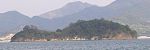
[Coordinates]:
[Ref.]: [68] -
[Monument]: Tokiwa Park常盤公園Tokiwa kōen
[Municipality]: Ube
[Prefecture]: Yamaguchi
[Comments]:
[Designation]: Place of Scenic Beauty
[Image]:
[Coordinates]: 33°57′11″N 131°17′05″E / 33.95308631°N 131.28476172°E / 33.95308631; 131.28476172 (Tokiwa Park)
[Ref.]: [69] -
[Monument]: Masui Family Gardens増井氏庭園(雲門庵露地)Masui-shi teien (Unmonnan roji)
[Municipality]: Takamatsu
[Prefecture]: Kagawa
[Comments]:
[Designation]: Place of Scenic Beauty
[Image]:
[Coordinates]:
[Ref.]: [70] -
[Monument]: Shijūshima四十島Shijūshima
[Municipality]: Matsuyama
[Prefecture]: Ehime
[Comments]:
[Designation]: Place of Scenic Beauty
[Image]:
[Coordinates]: 33°52′43″N 132°41′49″E / 33.87873652°N 132.69693778°E / 33.87873652; 132.69693778 (Shijūshima)
[Ref.]: [71] -
[Monument]: Ōhori Park大濠公園Ōhori kōen
[Municipality]: Fukuoka
[Prefecture]: Fukuoka
[Comments]:
[Designation]: Place of Scenic Beauty
[Image]:
[Coordinates]: 33°35′10″N 130°22′35″E / 33.58600388°N 130.37632816°E / 33.58600388; 130.37632816 (Ōhori Park)
[Ref.]: [72] -
[Monument]: Former Nabeshima Family Villa Gardens旧武雄邑主鍋島氏別邸庭園(御船山楽園)kyū-Takeo yūshu Nabeshima-shi bettei teien (Mifuneyamaraku-en)
[Municipality]: Takeo
[Prefecture]: Saga
[Comments]:
[Designation]: Place of Scenic Beauty
[Image]:
[Coordinates]: 33°10′53″N 130°01′01″E / 33.18137079°N 130.01695567°E / 33.18137079; 130.01695567 (Former Nabeshima Family Villa Gardens)
[Ref.]: [73] -
[Monument]: Former Itō Family Gardens旧伊東氏庭園(四明荘庭園)Kyū-Itō-shi teien (Shimeisō teien)
[Municipality]: Shimabara
[Prefecture]: Nagasaki
[Comments]:
[Designation]: Place of Scenic Beauty
[Image]:
[Coordinates]: 32°47′04″N 130°22′14″E / 32.7843346°N 130.3705602°E / 32.7843346; 130.3705602 (Former Itō Family Gardens)
[Ref.]: [74] -
[Monument]: Seika-en棲霞園Seika-en
[Municipality]: Hirado
[Prefecture]: Nagasaki
[Comments]:
[Designation]: Place of Scenic Beauty
[Image]:
[Coordinates]: 33°22′09″N 129°33′20″E / 33.36919476°N 129.55546699°E / 33.36919476; 129.55546699 (Seika-en)
[Ref.]: [75] -
[Monument]: Peace Park平和公園Heiwa kōen
[Municipality]: Nagasaki
[Prefecture]: Nagasaki
[Comments]:
[Designation]: Place of Scenic Beauty
[Image]:
[Coordinates]: 32°46′33″N 129°51′48″E / 32.77589411°N 129.86345058°E / 32.77589411; 129.86345058 (Peace Park)
[Ref.]: [76] -
[Monument]: Kobayakawa Family Gardens小早川氏庭園Kobayakawa-shi teien
[Municipality]: Shimabara
[Prefecture]: Nagasaki
[Comments]:
[Designation]: Place of Scenic Beauty
[Image]:
[Coordinates]:
[Ref.]: [77] -
[Monument]: Shiramizu Falls白水の滝Shiramizu-no-taki
[Municipality]: Takamori, Taketa
[Prefecture]: Kumamoto, Ōita
[Comments]:
[Designation]: Place of Scenic Beauty
[Image]:
[Coordinates]: 32°52′54″N 131°16′23″E / 32.88178436°N 131.27299679°E / 32.88178436; 131.27299679 (Shiramizu Falls)
[Ref.]: [78] -
[Monument]: Chinda Falls沈堕の滝Chinda-no-taki
[Municipality]: Bungo-ōno
[Prefecture]: Ōita
[Comments]:
[Designation]: Place of Scenic Beauty
[Image]: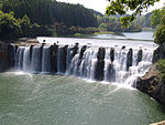
[Coordinates]: 32°59′03″N 131°31′22″E / 32.98423434°N 131.52291226°E / 32.98423434; 131.52291226 (Chinda Falls)
[Ref.]: [79] -
[Monument]: Kōmori Falls蝙蝠の滝Kōmori-no-taki
[Municipality]: Bungo-ōno
[Prefecture]: Ōita
[Comments]:
[Designation]: Place of Scenic Beauty
[Image]:
[Coordinates]: 32°58′39″N 131°25′31″E / 32.97755205°N 131.42517707°E / 32.97755205; 131.42517707 (Kōmori Falls)
[Ref.]: [80] -
[Monument]: Tekizansō Gardens旧成清博愛別邸庭園 (的山荘庭園)kyū-Narikiyo Hiroe bettei teien (Tekizansō teien)
[Municipality]: Hiji
[Prefecture]: Ōita
[Comments]:
[Designation]: Place of Scenic Beauty
[Image]:
[Coordinates]: 33°22′00″N 131°32′02″E / 33.366601°N 131.533846°E / 33.366601; 131.533846 (Tekizansō Gardens)
[Ref.]: [81] -
[Monument]: Kiyomizu Family Gardens清水氏庭園Kiyomizu-shi teien
[Municipality]: Shibushi
[Prefecture]: Kagoshima
[Comments]:
[Designation]: Place of Scenic Beauty
[Image]:
[Coordinates]: 31°29′02″N 131°06′36″E / 31.48398692°N 131.11007859°E / 31.48398692; 131.11007859 (Kiyomizu Family Gardens)
[Ref.]: [82] -
[Monument]: Former Hōonji Gardens旧報恩寺庭園kyū-Hōonji teien
[Municipality]: Nichinan
[Prefecture]: Miyazaki
[Comments]:
[Designation]: Place of Scenic Beauty
[Image]:
[Coordinates]: 35°42′47″N 139°47′05″E / 35.712924°N 139.784782°E / 35.712924; 139.784782 (Former Hōonji Gardens)
[Ref.]: [83] -
[Monument]: Former Itō Denzaemon Gardens旧伊東伝左衛門庭園kyū-Itō Denzaemon teien
[Municipality]: Nichinan
[Prefecture]: Miyazaki
[Comments]:
[Designation]: Place of Scenic Beauty
[Image]: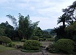
[Coordinates]:
[Ref.]: [84] -
[Monument]: Torihama Family Gardens鳥濱氏庭園Torihama-shi teien
[Municipality]: Shibushi
[Prefecture]: Kagoshima
[Comments]:
[Designation]: Place of Scenic Beauty
[Image]:
[Coordinates]: 31°29′04″N 131°06′24″E / 31.48448177°N 131.10655228°E / 31.48448177; 131.10655228 (Torihama Family Gardens)
[Ref.]: [85] -
[Monument]: Kiyan Coast and Arasaki Coast喜屋武海岸及び荒崎海岸Kiyan kaigan oyobi Arasaki kaigan
[Municipality]: Itoman
[Prefecture]: Okinawa
[Comments]:
[Designation]: Place of Scenic Beauty
[Image]:
[Coordinates]: 26°04′33″N 127°40′36″E / 26.07571399°N 127.67653967°E / 26.07571399; 127.67653967 (Kiyan Coast and Arasaki Coast)
[Ref.]: [86] -
[Monument]: Nakamoto Family Gardens仲本氏庭園Nakamoto-shi teien
[Municipality]: Ishigaki
[Prefecture]: Okinawa
[Comments]:
[Designation]: Place of Scenic Beauty
[Image]:
[Coordinates]: 24°20′07″N 124°08′52″E / 24.335327°N 124.147761°E / 24.335327; 124.147761 (Nakamoto Family Gardens)
[Ref.]: [87] -
[Monument]: Lake Tazawa Salmon (kunimasu) (Specimens)田沢湖のクニマス (標本)Tazawa-ko no kunimasu (hyōhon)
[Municipality]: Akita, Semboku
[Prefecture]: Akita
[Comments]: once believed extinct
[Designation]: Natural Monument
[Image]:
[Coordinates]: 39°43′11″N 140°06′09″E / 39.7198076°N 140.10236116°E / 39.7198076; 140.10236116 (Lake Tazawa Salmon (kunimasu) (Specimens))
[Ref.]: [88] -
[Monument]: Zenjimaru Persimmon禅寺丸柿zenjimaru-gaki
[Municipality]: Kawasaki
[Prefecture]: Kanagawa
[Comments]:
[Designation]: Natural Monument
[Image]:
[Coordinates]: 35°35′06″N 139°31′19″E / 35.584881°N 139.521927°E / 35.584881; 139.521927 (Zenjimaru Persimmon)
[Ref.]: [89] -
[Monument]: Ichikawa Mineral Laboratory Specimen Collection市川鉱物研究室収蔵標本Ichikawa kōbutsu kenkyūshitsu shūzō hyōhon
[Municipality]: Echizen
[Prefecture]: Fukui
[Comments]:
[Designation]: Natural Monument
[Image]:
[Coordinates]: 35°54′13″N 136°10′09″E / 35.90352777°N 136.16921638°E / 35.90352777; 136.16921638 (Ichikawa Mineral Laboratory Specimen Collection)
[Ref.]: [90] -
[Monument]: Toyotamaphimeia Fossilsマチカネワニ化石Machikanewani kaseki
[Municipality]: Toyonaka
[Prefecture]: Osaka
[Comments]:
[Designation]: Natural Monument
[Image]:
[Coordinates]:
[Ref.]: [91] -
[Monument]: Kikuchi Riverbank Hazenoki Avenue菊池川堤防のハゼ並木Kikuchigawa teibō no hazenamiki
[Municipality]: Tamana
[Prefecture]: Kumamoto
[Comments]:
[Designation]: Natural Monument
[Image]:
[Coordinates]: 32°55′14″N 130°32′33″E / 32.92051795°N 130.54257509°E / 32.92051795; 130.54257509 (Kikuchi Riverbank)
[Ref.]: [92] -
[Monument]: Kaku Hika's Specimen Collection賀来飛霞標本Kaku Hika hyōhon
[Municipality]: Miyazaki
[Prefecture]: Miyazaki
[Comments]:
[Designation]: Natural Monument
[Image]:
[Coordinates]: 31°56′24″N 131°25′26″E / 31.93995399°N 131.42381228°E / 31.93995399; 131.42381228 (Kaku Hika's Specimen Collection)
[Ref.]: [93]
New Random Display Display All Items(93)