


-
[Name]: Bridgend Flats, Islay
[Council area]: Argyll and Bute
[Designated]: 1988-07-14
[Area (hectares)]: 331
[Coordinates]: 55°46′0″N 6°16′0″W / 55.76667°N 6.26667°W / 55.76667; -6.26667 (Bridgend Flats)
[Site code]: UK13001
[Image]:
(List of Ramsar sites in Scotland) -
[Name]: Cairngorm Lochs
[Council area]: Aberdeenshire / Highland / Moray
[Designated]: 1981-07-24
[Area (hectares)]: 173
[Coordinates]: 57°4′0″N 3°47′0″W / 57.06667°N 3.78333°W / 57.06667; -3.78333 (Cairngorm Lochs)
[Site code]: UK13002
[Image]:
(List of Ramsar sites in Scotland) -
[Name]: Caithness and Sutherland Peatlands
[Council area]: Highland
[Designated]: 1999-02-02
[Area (hectares)]: 143,503
[Coordinates]: 58°20′0″N 3°56′0″W / 58.33333°N 3.93333°W / 58.33333; -3.93333 (Caithness and Sutherland Peatlands)
[Site code]: UK13003
[Image]:
(List of Ramsar sites in Scotland) -
[Name]: Caithness Lochs
[Council area]: Highland
[Designated]: 1998-02-02
[Area (hectares)]: 1,379
[Coordinates]: 58°29′0″N 3°20′0″W / 58.48333°N 3.33333°W / 58.48333; -3.33333 (Caithness Lochs)
[Site code]: UK13004
[Image]:
(List of Ramsar sites in Scotland) -
[Name]: Cameron Reservoir
[Council area]: Fife
[Designated]: 1994-03-14
[Area (hectares)]: 69
[Coordinates]: 56°18′0″N 2°51′0″W / 56.30000°N 2.85000°W / 56.30000; -2.85000 (Cameron Reservoir)
[Site code]: UK13005
[Image]: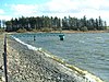
(List of Ramsar sites in Scotland) -
[Name]: Castle Loch, Lochmaben
[Council area]: Dumfries and Galloway
[Designated]: 1996-03-15
[Area (hectares)]: 108
[Coordinates]: 55°7′0″N 3°26′0″W / 55.11667°N 3.43333°W / 55.11667; -3.43333 (Castle Loch)
[Site code]: UK13006
[Image]:
(List of Ramsar sites in Scotland) -
[Name]: Claish Moss
[Council area]: Highland
[Designated]: 1981-07-24
[Area (hectares)]: 568
[Coordinates]: 56°44′0″N 5°44′0″W / 56.73333°N 5.73333°W / 56.73333; -5.73333 (Claish Moss)
[Site code]: UK13007
[Image]:
(List of Ramsar sites in Scotland) -
[Name]: Coll
[Council area]: Argyll and Bute
[Designated]: 1995-03-31
[Area (hectares)]: 2,209
[Coordinates]: 56°39′0″N 6°30′0″W / 56.65000°N 6.50000°W / 56.65000; -6.50000 (Coll)
[Site code]: UK13008
[Image]:
(List of Ramsar sites in Scotland) -
[Name]: Cromarty Firth
[Council area]: Highland
[Designated]: 1999-07-22
[Area (hectares)]: 3,747
[Coordinates]: 57°41′0″N 4°12′0″W / 57.68333°N 4.20000°W / 57.68333; -4.20000 (Cromarty Firth)
[Site code]: UK13009
[Image]:
(List of Ramsar sites in Scotland) -
[Name]: Din Moss - Hoselaw Loch
[Council area]: Scottish Borders
[Designated]: 1988-07-14
[Area (hectares)]: 51
[Coordinates]: 55°35′0″N 2°18′0″W / 55.58333°N 2.30000°W / 55.58333; -2.30000 (Din Moss - Hoselaw Loch)
[Site code]: UK13010
[Image]:
(List of Ramsar sites in Scotland) -
[Name]: Dornoch Firth and Loch Fleet
[Council area]: Highland
[Designated]: 1997-03-24
[Area (hectares)]: 7,837
[Coordinates]: 57°51′0″N 4°2′0″W / 57.85000°N 4.03333°W / 57.85000; -4.03333 (Dornoch Firth andLoch Fleet)
[Site code]: UK13011
[Image]: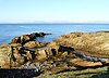
(List of Ramsar sites in Scotland) -
[Name]: East Sanday Coast
[Council area]: Orkney
[Designated]: 1997-08-11
[Area (hectares)]: 1,515
[Coordinates]: 59°16′0″N 2°34′0″W / 59.26667°N 2.56667°W / 59.26667; -2.56667 (East Sanday Coast)
[Site code]: UK13013
[Image]:
(List of Ramsar sites in Scotland) -
[Name]: Eilean na Muice Duibhe (Duich Moss), Islay
[Council area]: Argyll and Bute
[Designated]: 1988-07-14
[Area (hectares)]: 576
[Coordinates]: 55°43′0″N 6°15′0″W / 55.71667°N 6.25000°W / 55.71667; -6.25000 (Eilean na Muice Duibhe)
[Site code]: UK13014
[Image]:
(List of Ramsar sites in Scotland) -
[Name]: Fala Flow
[Council area]: Midlothian
[Designated]: 1990-04-25
[Area (hectares)]: 318
[Coordinates]: 55°49′0″N 2°54′0″W / 55.81667°N 2.90000°W / 55.81667; -2.90000 (Fala Flow)
[Site code]: UK13015
[Image]:
(List of Ramsar sites in Scotland) -
[Name]: Firth of Forth
[Council area]: Clackmannanshire / East Lothian / Edinburgh / Falkirk / Fife /Stirling / West Lothian
[Designated]: 2001-10-30
[Area (hectares)]: 6,314
[Coordinates]: 56°1′0″N 2°53′0″W / 56.01667°N 2.88333°W / 56.01667; -2.88333 (Firth of Forth)
[Site code]: UK13017
[Image]:
(List of Ramsar sites in Scotland) -
[Name]: Firth of Tay & Eden Estuary
[Council area]: Angus / Dundee / Fife / Perth and Kinross
[Designated]: 2000-07-28
[Area (hectares)]: 6,918
[Coordinates]: 56°24′0″N 3°5′0″W / 56.40000°N 3.08333°W / 56.40000; -3.08333 (Firth of Tay and Eden Estuary)
[Site code]: UK13018
[Image]:
(List of Ramsar sites in Scotland) -
[Name]: Gladhouse Reservoir
[Council area]: Midlothian
[Designated]: 1988-07-14
[Area (hectares)]: 186
[Coordinates]: 55°47′0″N 3°6′0″W / 55.78333°N 3.10000°W / 55.78333; -3.10000 (Gladhouse Reservoir)
[Site code]: UK13021
[Image]: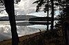
(List of Ramsar sites in Scotland) -
[Name]: Greenlaw Moor
[Council area]: Scottish Borders
[Designated]: 1996-03-15
[Area (hectares)]: 248
[Coordinates]: 55°44′0″N 2°27′0″W / 55.73333°N 2.45000°W / 55.73333; -2.45000 (Greenlaw Moor)
[Site code]: UK13022
[Image]:
(List of Ramsar sites in Scotland) -
[Name]: Gruinart Flats, Islay
[Council area]: Argyll and Bute
[Designated]: 1988-07-14
[Area (hectares)]: 3,261
[Coordinates]: 55°51′0″N 6°20′0″W / 55.85000°N 6.33333°W / 55.85000; -6.33333 (Gruinart Flats)
[Site code]: UK13023
[Image]:
(List of Ramsar sites in Scotland) -
[Name]: Inner Clyde Estuary
[Council area]: East Dunbartonshire / Inverclyde / Renfrewshire / West Dunbartonshire
[Designated]: 2000-09-05
[Area (hectares)]: 1,825
[Coordinates]: 55°57′0″N 4°38′0″W / 55.95000°N 4.63333°W / 55.95000; -4.63333 (Inner Clyde Estuary)
[Site code]: UK13024
[Image]:
(List of Ramsar sites in Scotland) -
[Name]: Inner Moray Firth
[Council area]: Highland
[Designated]: 1999-07-22
[Area (hectares)]: 2,339
[Coordinates]: 56°50′0″N 4°21′0″W / 56.83333°N 4.35000°W / 56.83333; -4.35000 (Inner Moray Firth)
[Site code]: UK13025
[Image]:
(List of Ramsar sites in Scotland) -
[Name]: Kintyre Goose Roosts
[Council area]: Argyll and Bute
[Designated]: 1998-10-28
[Area (hectares)]: 312
[Coordinates]: 55°31′0″N 5°37′0″W / 55.51667°N 5.61667°W / 55.51667; -5.61667 (Kintyre Goose Roosts)
[Site code]: UK13027
[Image]: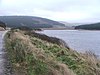
(List of Ramsar sites in Scotland) -
[Name]: Lewis Peatlands
[Council area]: Na h-Eileanan Siar
[Designated]: 2000-12-22
[Area (hectares)]: 58,984
[Coordinates]: 58°15′0″N 6°35′0″W / 58.25000°N 6.58333°W / 58.25000; -6.58333 (Lewis Peatlands)
[Site code]: UK13028
[Image]:
(List of Ramsar sites in Scotland) -
[Name]: Loch an Duin
[Council area]: Na h-Eileanan Siar
[Designated]: 1990-04-25
[Area (hectares)]: 2,621
[Coordinates]: 57°38′0″N 7°9′0″W / 57.63333°N 7.15000°W / 57.63333; -7.15000 (Loch an Dùin)
[Site code]: UK13029
[Image]:
(List of Ramsar sites in Scotland) -
[Name]: Loch Eye
[Council area]: Highland
[Designated]: 1986-10-01
[Area (hectares)]: 205
[Coordinates]: 57°47′0″N 3°58′0″W / 57.78333°N 3.96667°W / 57.78333; -3.96667 (Loch Eye)
[Site code]: UK13031
[Image]:
(List of Ramsar sites in Scotland) -
[Name]: Loch Ken and River Dee Marshes
[Council area]: Dumfries and Galloway
[Designated]: 1992-08-31
[Area (hectares)]: 769
[Coordinates]: 54°59′0″N 4°1′0″W / 54.98333°N 4.01667°W / 54.98333; -4.01667 (Loch Ken and River Dee Marshes)
[Site code]: UK13032
[Image]:
(List of Ramsar sites in Scotland) -
[Name]: Loch Leven
[Council area]: Perth and Kinross
[Designated]: 1976-01-05
[Area (hectares)]: 1,612
[Coordinates]: 56°12′0″N 3°23′0″W / 56.20000°N 3.38333°W / 56.20000; -3.38333 (Loch Leven)
[Site code]: UK13033
[Image]:
(List of Ramsar sites in Scotland) -
[Name]: Loch Lomond
[Council area]: Stirling / West Dunbartonshire
[Designated]: 1976-01-05
[Area (hectares)]: 237
[Coordinates]: 56°4′0″N 4°30′0″W / 56.06667°N 4.50000°W / 56.06667; -4.50000 (Loch Lomond)
[Site code]: UK13034
[Image]:
(List of Ramsar sites in Scotland) -
[Name]: Loch Maree
[Council area]: Highland
[Designated]: 1994-09-19
[Area (hectares)]: 3,174
[Coordinates]: 57°41′0″N 5°28′0″W / 57.68333°N 5.46667°W / 57.68333; -5.46667 (Loch Maree)
[Site code]: UK13035
[Image]:
(List of Ramsar sites in Scotland) -
[Name]: Loch of Inch and Torrs Warren
[Council area]: Dumfries and Galloway
[Designated]: 1999-02-02
[Area (hectares)]: 2,111
[Coordinates]: 54°50′0″N 4°52′0″W / 54.83333°N 4.86667°W / 54.83333; -4.86667 (Loch of Inch and Torrs Warren)
[Site code]: UK13037
[Image]:
(List of Ramsar sites in Scotland) -
[Name]: Loch of Kinnordy
[Council area]: Angus
[Designated]: 1994-03-29
[Area (hectares)]: 85
[Coordinates]: 56°40′0″N 3°3′0″W / 56.66667°N 3.05000°W / 56.66667; -3.05000 (Loch of Kinnordy)
[Site code]: UK13038
[Image]:
(List of Ramsar sites in Scotland) -
[Name]: Loch of Lintrathen
[Council area]: Angus
[Designated]: 1981-07-24
[Area (hectares)]: 217
[Coordinates]: 56°41′0″N 3°11′0″W / 56.68333°N 3.18333°W / 56.68333; -3.18333 (Loch of Lintrathen)
[Site code]: UK13039
[Image]:
(List of Ramsar sites in Scotland) -
[Name]: Loch of Skene
[Council area]: Aberdeenshire
[Designated]: 1986-10-01
[Area (hectares)]: 121
[Coordinates]: 57°9′0″N 2°21′0″W / 57.15000°N 2.35000°W / 57.15000; -2.35000 (Loch of Skene)
[Site code]: UK13040
[Image]:
(List of Ramsar sites in Scotland) -
[Name]: Loch of Strathbeg
[Council area]: Aberdeenshire
[Designated]: 1995-11-27
[Area (hectares)]: 616
[Coordinates]: 57°37′0″N 1°53′0″W / 57.61667°N 1.88333°W / 57.61667; -1.88333 (Loch of Strathbeg)
[Site code]: UK13041
[Image]:
(List of Ramsar sites in Scotland) -
[Name]: Loch Ruthven
[Council area]: Highland
[Designated]: 1996-08-16
[Area (hectares)]: 201
[Coordinates]: 57°20′0″N 4°17′0″W / 57.33333°N 4.28333°W / 57.33333; -4.28333 (Loch Ruthven)
[Site code]: UK13042
[Image]:
(List of Ramsar sites in Scotland) -
[Name]: Loch Spynie
[Council area]: Moray
[Designated]: 1992-08-31
[Area (hectares)]: 94
[Coordinates]: 57°41′0″N 3°17′0″W / 57.68333°N 3.28333°W / 57.68333; -3.28333 (Loch Spynie)
[Site code]: UK13043
[Image]:
(List of Ramsar sites in Scotland) -
[Name]: Montrose Basin
[Council area]: Angus
[Designated]: 1995-02-03
[Area (hectares)]: 985
[Coordinates]: 56°43′0″N 2°30′0″W / 56.71667°N 2.50000°W / 56.71667; -2.50000 (Montrose Basin)
[Site code]: UK13046
[Image]:
(List of Ramsar sites in Scotland) -
[Name]: Moray and Nairn Coast
[Council area]: Highland / Moray
[Designated]: 1997-02-02
[Area (hectares)]: 2,412
[Coordinates]: 57°39′0″N 3°44′0″W / 57.65000°N 3.73333°W / 57.65000; -3.73333 (Moray and Nairn Coast)
[Site code]: UK13048
[Image]:
(List of Ramsar sites in Scotland) -
[Name]: Muir of Dinnet
[Council area]: Aberdeenshire
[Designated]: 1999-07-22
[Area (hectares)]: 158
[Coordinates]: 57°5′0″N 2°55′0″W / 57.08333°N 2.91667°W / 57.08333; -2.91667 (Muir of Dinnet)
[Site code]: UK13049
[Image]:
(List of Ramsar sites in Scotland) -
[Name]: North Uist Machair and Islands
[Council area]: Na h-Eileanan Siar
[Designated]: 1999-07-22 (extended 2000-11-03)
[Area (hectares)]: 4,705
[Coordinates]: 57°32′0″N 7°23′0″W / 57.53333°N 7.38333°W / 57.53333; -7.38333 (North Uist Machair and Islands)
[Site code]: UK13050
[Image]:
(List of Ramsar sites in Scotland) -
[Name]: Rannoch Moor
[Council area]: Perth and Kinross
[Designated]: 1976-01-05
[Area (hectares)]: 1,519
[Coordinates]: 56°39′0″N 4°36′0″W / 56.65000°N 4.60000°W / 56.65000; -4.60000 (Rannoch Moor)
[Site code]: UK13051
[Image]:
(List of Ramsar sites in Scotland) -
[Name]: Rinns of Islay
[Council area]: Argyll and Bute
[Designated]: 1990-04-25
[Area (hectares)]: 3,571
[Coordinates]: 55°51′0″N 6°23′0″W / 55.85000°N 6.38333°W / 55.85000; -6.38333 (Rinns of Islay)
[Site code]: UK13052
[Image]:
(List of Ramsar sites in Scotland) -
[Name]: River Spey – Insh Marshes
[Council area]: Highland
[Designated]: 1997-02-02
[Area (hectares)]: 1,159
[Coordinates]: 57°5′0″N 4°0′0″W / 57.08333°N 4.00000°W / 57.08333; -4.00000 (River Spey - Insh Marshes)
[Site code]: UK13053
[Image]:
(List of Ramsar sites in Scotland) -
[Name]: Ronas Hill – North Roe and Tingon
[Council area]: Shetland
[Designated]: 1997-08-11
[Area (hectares)]: 5,470
[Coordinates]: 60°33′0″N 1°25′0″W / 60.55000°N 1.41667°W / 60.55000; -1.41667 (Ronas Hill – North Roe and Tingon)
[Site code]: UK13054
[Image]: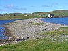
(List of Ramsar sites in Scotland) -
[Name]: Silver Flowe
[Council area]: Dumfries and Galloway
[Designated]: 1981-07-24
[Area (hectares)]: 620
[Coordinates]: 55°7′0″N 4°24′0″W / 55.11667°N 4.40000°W / 55.11667; -4.40000 (Silver Flowe)
[Site code]: UK13055
[Image]:
(List of Ramsar sites in Scotland) -
[Name]: Sléibhtean agus Cladach Thiriodh (Tiree Wetlands and Coast)
[Council area]: Argyll and Bute
[Designated]: 2001-11-16
[Area (hectares)]: 1,939
[Coordinates]: 56°30′0″N 6°52′0″W / 56.50000°N 6.86667°W / 56.50000; -6.86667 (Sléibhtean agus Cladach Thiriodh)
[Site code]: UK13056
[Image]:
(List of Ramsar sites in Scotland) -
[Name]: South Tayside Goose Roosts
[Council area]: Perth and Kinross
[Designated]: 1993-04-22
[Area (hectares)]: 331
[Coordinates]: 56°16′0″N 3°50′0″W / 56.26667°N 3.83333°W / 56.26667; -3.83333 (South Tayside Goose Roosts)
[Site code]: UK13057
[Image]:
(List of Ramsar sites in Scotland) -
[Name]: South Uist Machair and Lochs
[Council area]: Na h-Eileanan Siar
[Designated]: 1976-01-05
[Area (hectares)]: 5,019
[Coordinates]: 57°19′0″N 7°20′0″W / 57.31667°N 7.33333°W / 57.31667; -7.33333 (South Uist Machair and Lochs)
[Site code]: UK13058
[Image]:
(List of Ramsar sites in Scotland) -
[Name]: Upper Solway Flats and Marshes
[Council area]: Dumfries and Galloway / Cumbria
[Designated]: 1986-10-01
[Area (hectares)]: 43,637
[Coordinates]: 54°54′0″N 3°25′0″W / 54.90000°N 3.41667°W / 54.90000; -3.41667 (Upper Solway Flats and Marshes)
[Site code]: UK11079
[Image]:
(List of Ramsar sites in Scotland) -
[Name]: Westwater
[Council area]: Scottish Borders
[Designated]: 1995-11-27
[Area (hectares)]: 50
[Coordinates]: 55°45′0″N 3°24′0″W / 55.75000°N 3.40000°W / 55.75000; -3.40000 (Westwater Reservoir)
[Site code]: UK13060
[Image]: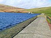
(List of Ramsar sites in Scotland) -
[Name]: Ythan Estuary and Meikle Loch
[Council area]: Aberdeenshire
[Designated]: 1998-03-30
[Area (hectares)]: 314
[Coordinates]: 57°20′0″N 1°57′0″W / 57.33333°N 1.95000°W / 57.33333; -1.95000 (Ythan Estuary and Meikle Loch)
[Site code]: UK13061
[Image]:
(List of Ramsar sites in Scotland)
New Random Display Display All Items(51)