


-
[Name]: Ballynahone Bog
[Location]: County Londonderry54°49′N 6°40′W / 54.817°N 6.667°W / 54.817; -6.667 (Ballynahone Bog)
[Area (km2)]: 2.43
[Designated]: 31 December 1998
[Description]: One of the two largest intact active bogs in Northern Ireland with hummock and hollow pool complexes.
[Image]:
(Ramsar sites in Northern Ireland) -
[Name]: Belfast Lough
[Location]: County Antrim and County Down54°38′N 5°54′W / 54.633°N 5.900°W / 54.633; -5.900 (Belfast Lough)
[Area (km2)]: 4.32
[Designated]: 5 August 1998
[Description]:
[Image]:
(Ramsar sites in Northern Ireland) -
[Name]: Black Bog
[Location]: County Tyrone
[Area (km2)]: 1.83
[Designated]: 28 July 2000
[Description]:
[Image]:
(Ramsar sites in Northern Ireland) -
[Name]: Carlingford Lough
[Location]: County Down
[Area (km2)]: 8.31
[Designated]: 9 March 1998
[Description]:
[Image]:
(Ramsar sites in Northern Ireland) -
[Name]: Cuilcagh Mountain
[Location]: County Fermanagh
[Area (km2)]: 27.44
[Designated]: 31 December 1998
[Description]:
[Image]: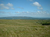
(Ramsar sites in Northern Ireland) -
[Name]: Derryleckagh (proposed)
[Location]: County Down
[Area (km2)]:
[Designated]:
[Description]:
[Image]:
(Ramsar sites in Northern Ireland) -
[Name]: Dundrum Bay (proposed)
[Location]: County Down
[Area (km2)]:
[Designated]:
[Description]:
[Image]:
(Ramsar sites in Northern Ireland) -
[Name]: Fairy Water Bogs
[Location]: County Tyrone
[Area (km2)]: 2.24
[Designated]: 28 July 2000
[Description]:
[Image]:
(Ramsar sites in Northern Ireland) -
[Name]: Fardrum and Roosky Turloughs
[Location]: County Fermanagh
[Area (km2)]: 0.43
[Designated]: 10 June 2002
[Description]:
[Image]:
(Ramsar sites in Northern Ireland) -
[Name]: Garron Plateau
[Location]: County Antrim
[Area (km2)]: 46.50
[Designated]: 31 December 1998
[Description]:
[Image]:
(Ramsar sites in Northern Ireland) -
[Name]: Garry Bog
[Location]: County Antrim
[Area (km2)]: 1.55
[Designated]: 8 November 2000
[Description]:
[Image]:
(Ramsar sites in Northern Ireland) -
[Name]: Killough Bay
[Location]: County Down
[Area (km2)]:
[Designated]:
[Description]:
[Image]:
(Ramsar sites in Northern Ireland) -
[Name]: Larne Lough
[Location]: County Antrim
[Area (km2)]: 3.96
[Designated]: 4 March 1997
[Description]:
[Image]:
(Ramsar sites in Northern Ireland) -
[Name]: Lough Foyle
[Location]: County Londonderry
[Area (km2)]: 22.04
[Designated]: 2 February 1999
[Description]:
[Image]: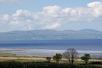
(Ramsar sites in Northern Ireland) -
[Name]: Lough Neagh and Lough Beg
[Location]:
[Area (km2)]: 501.66
[Designated]: 5 January 1976
[Description]:
[Image]:
(Ramsar sites in Northern Ireland) -
[Name]: Magheraveely Marl Loughs (proposed)
[Location]:
[Area (km2)]: 0.59
[Designated]: 7 February 2007
[Description]:
[Image]:
(Ramsar sites in Northern Ireland) -
[Name]: Outer Ards
[Location]: County Down
[Area (km2)]:
[Designated]:
[Description]:
[Image]:
(Ramsar sites in Northern Ireland) -
[Name]: Pettigoe Plateau
[Location]: County Fermanagh
[Area (km2)]: 9.0
[Designated]: 31 July 1986
[Description]:
[Image]:
(Ramsar sites in Northern Ireland) -
[Name]: Slieve Beagh
[Location]: County Fermanagh and County Tyrone
[Area (km2)]: 18.85
[Designated]: 28 July 2000
[Description]:
[Image]:
(Ramsar sites in Northern Ireland) -
[Name]: Strangford Lough
[Location]: County Down
[Area (km2)]: 155.81
[Designated]: 9 March 1998
[Description]:
[Image]:
(Ramsar sites in Northern Ireland) -
[Name]: Teal Lough (proposed)
[Location]:
[Area (km2)]:
[Designated]:
[Description]:
[Image]:
(Ramsar sites in Northern Ireland) -
[Name]: Turmennan Lough
[Location]: County Down
[Area (km2)]: 0.15
[Designated]: 10 June 2002
[Description]:
[Image]:
(Ramsar sites in Northern Ireland) -
[Name]: Upper Lough Erne
[Location]: County Fermanagh
[Area (km2)]: 58.18
[Designated]: 4 March 1997
[Description]:
[Image]:
(Ramsar sites in Northern Ireland)
New Random Display Display All Items(23)