


-
[Name]: Hungry Bay Mangrove Swamp
[Location]: Paget Parish32°16′N 64°45′W / 32.267°N 64.750°W / 32.267; -64.750 (Hungry Bay Mangrove Swamp)
[Area (km2)]: 0.02
[Designated]: 11 May 1999
[Description]:
[Image]:
(Bermuda) -
[Name]: Lover's Lake Nature Reserve
[Location]: St. George's Parish32°21′N 64°42′W / 32.350°N 64.700°W / 32.350; -64.700 (Lover's Lake Nature Reserve)
[Area (km2)]: 0.02
[Designated]: 11 May 1999
[Description]:
[Image]:
(Bermuda) -
[Name]: Paget Marsh
[Location]: Paget Parish32°16′N 64°46′W / 32.267°N 64.767°W / 32.267; -64.767 (Paget Marsh)
[Area (km2)]: 0.11
[Designated]: 11 May 1999
[Description]: An important site for crustaceans, native crabs and wintering birds including the blue land crab, the Caribbean hermit crab, the yellow-crowned night heron, the belted kingfisher.
[Image]:
(Bermuda) -
[Name]: Pembroke Marsh East
[Location]: Pembroke Parish32°17′N 64°46′W / 32.283°N 64.767°W / 32.283; -64.767 (Pembroke Marsh East)
[Area (km2)]: 0.08
[Designated]: 11 May 1999
[Description]:
[Image]:
(Bermuda) -
[Name]: Somerset Long Bay Pond
[Location]: Sandys Parish32°18′N 64°52′W / 32.300°N 64.867°W / 32.300; -64.867 (Somerset Long Bay Pond)
[Area (km2)]: 0.01
[Designated]: 11 May 1999
[Description]:
[Image]:
(Bermuda) -
[Name]: Spittal Pond
[Location]: Smith's Parish32°18′N 64°43′W / 32.300°N 64.717°W / 32.300; -64.717 (Spittal Pond)
[Area (km2)]: 0.10
[Designated]: 11 May 1999
[Description]:
[Image]:
(Bermuda) -
[Name]: Warwick Pond
[Location]: Warwick Parish32°16′N 64°48′W / 32.267°N 64.800°W / 32.267; -64.800 (Warwick Pond)
[Area (km2)]: 0.02
[Designated]: 11 May 1999
[Description]:
[Image]:
(Bermuda) -
[Name]: Diego Garcia
[Location]: Chagos Archipelago7°19′S 72°28′E / 7.317°S 72.467°E / -7.317; 72.467 (Diego Garcia)
[Area (km2)]: 354.24
[Designated]: 4 July 2001
[Description]: A tropical coral atoll south of the equator in the central Indian Ocean.
[Image]:
(British Indian Ocean Territory) -
[Name]: Western Salt Ponds of Anegada
[Location]: Anegada18°43′N 64°19′W / 18.717°N 64.317°W / 18.717; -64.317 (Western Salt Ponds of Anegada)
[Area (km2)]: 10.71
[Designated]: 11 May 1999
[Description]: The Western Salt Ponds includes mudflats, a mangrove, and brackish saline lagoons. It provides habitat for Caribbean flamingos and the endangered Anegada rock iguana.
[Image]:
(British Virgin Islands) -
[Name]: North, Middle and East Caicos Islands
[Location]: Caicos Islands21°45′N 71°45′W / 21.750°N 71.750°W / 21.750; -71.750 (North, Middle & East Caicos Island)
[Area (km2)]: 586.17
[Designated]: 27 June 1990
[Description]: A coastal wetland site, it is an important site for the West Indian whistling duck which has been listed as vulnerable by the IUCN.
[Image]:
(Turks and Caicos Islands) -
[Name]: Booby Pond and Rookery
[Location]: Little Cayman19°40′N 80°4′W / 19.667°N 80.067°W / 19.667; -80.067 (Booby Pond and Rookery)
[Area (km2)]: 0.82
[Designated]: 21 September 1994
[Description]: A landlocked saline lagoon that supports the largest red-footed booby population in the Caribbean.
[Image]:
(Cayman Islands) -
[Name]: Akrotiri
[Location]: Sovereign Base Area34°37′N 32°58′E / 34.617°N 32.967°E / 34.617; 32.967 (Akrotiri)
[Area (km2)]: 21.71
[Designated]: 20 March 2003
[Description]: Located on Akrotiri Peninsula, the southernmost part of the island, Akrotiri includes marshes and a salt lake and flats.
[Image]:
(Cyprus) -
[Name]: Bertha's Beach
[Location]: East Falkland51°55′S 58°25′W / 51.917°S 58.417°W / -51.917; -58.417 (Bertha's Beach)
[Area (km2)]: 40
[Designated]: 24 September 2001
[Description]: A sandy beach on the northern shore of Choiseul Sound, East Falkland. Bertha's Beach provides habitat for several threatened species including the Falkland steamer duck.
[Image]:
(Falkland Islands) -
[Name]: Sea Lion Island
[Location]: near Lafonia52°25′S 59°5′W / 52.417°S 59.083°W / -52.417; -59.083 (Sea Lion Island)
[Area (km2)]: 10
[Designated]: 24 September 2001
[Description]: An important breeding site for the southern sea lion and the southern elephant seal.
[Image]:
(Falkland Islands) -
[Name]: Gough Island
[Location]: Tristan da Cunha40°19′S 9°56′W / 40.317°S 9.933°W / -40.317; -9.933 (Gough Island)
[Area (km2)]: 2298.11
[Designated]: 20 November 2008
[Description]: One of five islands forming the archipelago of Tristan da Cunha, Gough Island is an important breeding site for threatened species including the sooty albatross and the northern rockhopper penguin.
[Image]: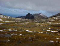
(Saint Helena, Ascension and Tristan da Cunha) -
[Name]: Inaccessible Island
[Location]: Tristan da Cunha37°18′S 12°41′W / 37.300°S 12.683°W / -37.300; -12.683 (Inaccessible Island)
[Area (km2)]: 1265.24
[Designated]: 20 November 2008
[Description]: An extinct volcano that is part of the archipelago of Tristan da Cunha, Inaccessible Island is an important breeding site for seabirds and endemic landbirds.
[Image]:
(Saint Helena, Ascension and Tristan da Cunha)
New Random Display Display All Items(16)