


-
[Marker title]: 9th Street Curb Market
[Image]:
[Date dedicated]: October 12, 2007
[Location]: NE corner of 9th & Christian Sts., Philadelphia39°56′20″N 75°09′28″W / 39.939°N 75.1578°W / 39.939; -75.1578 (9th Street Curb Market)
[Marker type]: Roadside
[Topics]: Business & Industry, Ethnic & Immigration, Roads
[Notes]:
(Historical markers) -
[Marker title]: A.M.E. Book Concern
[Image]:
[Date dedicated]: June 1, 1991
[Location]: 631 Pine St., Philadelphia39°56′39″N 75°09′11″W / 39.94426°N 75.15304°W / 39.94426; -75.15304 (A.M.E. Book Concern)
[Marker type]: City
[Topics]: African American, Religion
[Notes]:
(Historical markers) -
[Marker title]: Academy of Natural Sciences
[Image]:
[Date dedicated]: May 13, 2013
[Location]: 302 Market St., Philadelphia39°57′01″N 75°08′45″W / 39.95021°N 75.14581°W / 39.95021; -75.14581
[Marker type]: City
[Topics]: Education, Science & Medicine
[Notes]:
(Historical markers) -
[Marker title]: African American Baseball in Philadelphia
[Image]:
[Date dedicated]: April 25, 1998
[Location]: Belmont & Parkside Aves., Philadelphia39°58′40″N 75°12′49″W / 39.9777°N 75.21362°W / 39.9777; -75.21362 (African American Baseball in Philadelphia)
[Marker type]: Roadside
[Topics]: African American, Baseball, Sports
[Notes]:
(Historical markers) -
[Marker title]: African Zoar Methodist Episcopal Church
[Image]:
[Date dedicated]: June 2, 1990
[Location]: 4th & Brown Sts., Philadelphia
[Marker type]: City
[Topics]: African American, Religion, Underground Railroad
[Notes]:
(Historical markers) -
[Marker title]: Alain Leroy Locke (1886-1954)
[Image]:
[Date dedicated]: 1991
[Location]: 2221 S 5th St., Philadelphia39°55′15″N 75°09′19″W / 39.9207°N 75.1554°W / 39.9207; -75.1554 (Alain Leroy Locke)
[Marker type]: City
[Topics]: African American, Education, Professions & Vocations, Writers
[Notes]: --Missing--
(Historical markers) -
[Marker title]: Albert M. Greenfield (1887-1967)
[Image]:
[Date dedicated]: April 21, 2016
[Location]: 1315 Walnut St., Philadelphia39°56′58″N 75°09′47″W / 39.94931°N 75.16294°W / 39.94931; -75.16294
[Marker type]: City
[Topics]: African American, Business & Industry, Government & Politics 20th Century, Religion
[Notes]:
(Historical markers) -
[Marker title]: Alfred J. Reach (1840-1928)
[Image]:
[Date dedicated]: April 4, 2003
[Location]: 1820 Chestnut St., Philadelphia39°57′06″N 75°10′14″W / 39.95163°N 75.17062°W / 39.95163; -75.17062 (Alfred J. Reach)
[Marker type]: City
[Topics]: Baseball, Sports
[Notes]:
(Historical markers) -
[Marker title]: American Bandstand
[Image]:
[Date dedicated]: August 5, 1997
[Location]: 4601 Market St., Philadelphia39°57′31″N 75°12′46″W / 39.9585°N 75.2129°W / 39.9585; -75.2129 (American Bandstand)
[Marker type]: Roadside
[Topics]: Business & Industry, Motion Pictures & Television
[Notes]:
(Historical markers) -
[Marker title]: American Friends Service Committee
[Image]:
[Date dedicated]: November 6, 1999
[Location]: 1501 Cherry St., Philadelphia39°57′20″N 75°09′54″W / 39.95567°N 75.16492°W / 39.95567; -75.16492 (American Friends Service Committee)
[Marker type]: City
[Topics]: Religion
[Notes]:
(Historical markers) -
[Marker title]: American Pharmaceutical Association
[Image]:
[Date dedicated]: September 24, 2001
[Location]: Market & Seventh Sts., Philadelphia39°57′04″N 75°09′07″W / 39.951°N 75.15192°W / 39.951; -75.15192 (American Pharmaceutical Association)
[Marker type]: City
[Topics]: Medicine & Science, Professions & Vocations
[Notes]:
(Historical markers) -
[Marker title]: America's First Lager
[Image]:
[Date dedicated]: 2001
[Location]: 455 St. John St., Philadelphia (800 block N. American St. post 1857)
[Marker type]: City
[Topics]: Business & Industry
[Notes]:
(Historical markers) -
[Marker title]: Anne Brancato Wood (1903-1972)
[Image]:
[Date dedicated]: June 17, 1994
[Location]: SW corner, Broad & Chestnut Sts., Philadelphia39°57′06″N 75°09′53″W / 39.95165°N 75.16461°W / 39.95165; -75.16461
[Marker type]: City
[Topics]: Ethnic & Immigration, Government & Politics, Government & Politics 20th Century, Women
[Notes]:
(Historical markers) -
[Marker title]: Anthony Benezet (1713-1784)
[Image]:
[Date dedicated]: June 4, 2016
[Location]: 325 Chestnut St., Philadelphia39°56′57″N 75°08′50″W / 39.94904°N 75.14721°W / 39.94904; -75.14721
[Marker type]: City
[Topics]: African American, Education, Religion, Women, Writers
[Notes]:
(Historical markers) -
[Marker title]: Anthony J. Drexel (1826-1893)
[Image]:
[Date dedicated]: April 2005
[Location]: 48 South Third St., Philadelphia39°56′56″N 75°08′45″W / 39.94899°N 75.14581°W / 39.94899; -75.14581
[Marker type]: City
[Topics]: Business & Industry, Education, Entrepreneurs, Railroads
[Notes]:
(Historical markers) -
[Marker title]: Anthony Palmer (1664-1749)
[Image]:
[Date dedicated]: October 17, 2015
[Location]: at Palmer Cemetery, just inside main gate on Palmer St., between Belgrade & Memphis Sts., Philadelphia39°58′27″N 75°07′48″W / 39.97425°N 75.13013°W / 39.97425; -75.13013
[Marker type]: Roadside
[Topics]: Early Settlement, Government & Politics 18th Century, Governors, Native American, Professions & Vocations
[Notes]:
(Historical markers) -
[Marker title]: Arch Street Meeting House
[Image]:
[Date dedicated]: December 17, 1954
[Location]: Arch St., between 3rd & 4th Sts., Philadelphia39°57′09″N 75°08′45″W / 39.95237°N 75.14577°W / 39.95237; -75.14577
[Marker type]: City
[Topics]: Buildings & Architecture, Religion, William Penn
[Notes]:
(Historical markers) -
[Marker title]: Arthur Lee Hall (1934-2000)
[Image]:
[Date dedicated]: June 11, 2011
[Location]: 2544 N Germantown Ave., Philadelphia39°59′27″N 75°08′54″W / 39.9909°N 75.14826°W / 39.9909; -75.14826
[Marker type]: City
[Topics]: African American, Music & Theater, Performers
[Notes]:
(Historical markers) -
[Marker title]: Baker Bowl National League Park
[Image]:
[Date dedicated]: August 16, 2000
[Location]: Broad St. & Lehigh Ave., Philadelphia39°59′33″N 75°09′18″W / 39.9925°N 75.155°W / 39.9925; -75.155 (Baker Bowl National League Park)
[Marker type]: City
[Topics]: African American, Baseball, Sports
[Notes]:
(Historical markers) -
[Marker title]: Baldwin Locomotive Works
[Image]:
[Date dedicated]: September 26, 2009
[Location]: Franklintown Park, 19th & Hamilton Sts., Philadelphia39°57′43″N 75°10′11″W / 39.962°N 75.1696°W / 39.962; -75.1696 (Baldwin Locomotive Works)
[Marker type]: Roadside
[Topics]: Business & Industry, Railroads
[Notes]:
(Historical markers) -
[Marker title]: Barbara Gittings (1932-2007)
[Image]:
[Date dedicated]: July 26, 2016
[Location]: 21st & Locust Sts., Philadelphia39°56′58″N 75°10′34″W / 39.94956°N 75.17609°W / 39.94956; -75.17609
[Marker type]: City
[Topics]: Civil Rights, Education, Science & Medicine, Publishing & Journalism
[Notes]:
(Historical markers) -
[Marker title]: Barrymores, The
[Image]:
[Date dedicated]: October 1, 1996
[Location]: 6th & Arch Sts., Philadelphia39°57′09″N 75°09′00″W / 39.95262°N 75.15002°W / 39.95262; -75.15002 (Barrymores, The)
[Marker type]: City
[Topics]: Performers
[Notes]:
(Historical markers) -
[Marker title]: Baruch S. Blumberg (1925-2001)
[Image]:
[Date dedicated]: September 24, 2016
[Location]: 323 S Lawrence Ct., Philadelphia39°56′40″N 75°08′58″W / 39.94447°N 75.14932°W / 39.94447; -75.14932
[Marker type]: City
[Topics]: Science & Medicine, Professions & Vocations
[Notes]:
(Historical markers) -
[Marker title]: Battle of Germantown
[Image]:
[Date dedicated]: October 5, 1996
[Location]: 6401 Germantown Ave. at Cliveden, Germantown, Philadelphia40°02′47″N 75°10′57″W / 40.0463°N 75.1825°W / 40.0463; -75.1825 (Battle of Germantown)
[Marker type]: City
[Topics]: American Revolution, George Washington, Military
[Notes]:
(Historical markers) -
[Marker title]: Benjamin Banneker Institute
[Image]:
[Date dedicated]: 1991
[Location]: 409 S. 11th St, Philadelphia39°56′40″N 75°09′36″W / 39.94457°N 75.15998°W / 39.94457; -75.15998 (Benjamin Banneker Institute)
[Marker type]: City
[Topics]: African American, Education
[Notes]:
(Historical markers) -
[Marker title]: Benjamin Franklin (1706-1790)
[Image]:
[Date dedicated]: June 30, 1990
[Location]: Chestnut St. between 3rd & 4th Sts., Philadelphia39°56′56″N 75°08′48″W / 39.94883°N 75.14672°W / 39.94883; -75.14672 (Benjamin Franklin)
[Marker type]: City
[Topics]: Government & Politics, Government & Politics 18th Century, Invention, Medicine & Science, Professions & Vocations, Publishing, Writers
[Notes]:
(Historical markers) -
[Marker title]: Benjamin Rush (1745-1813)
[Image]:
[Date dedicated]: June 20, 2002
[Location]: Keswick & Rayland Roads, Philadelphia40°04′39″N 74°59′08″W / 40.07738°N 74.98563°W / 40.07738; -74.98563
[Marker type]: City
[Topics]: American Revolution, Education, Government & Politics, Government & Politics 18th Century, Medicine & Science, Professions & Vocations
[Notes]:
(Historical markers) -
[Marker title]: Benjamin Smith Barton (1766-1815)
[Image]:
[Date dedicated]: December 19, 2004
[Location]: 712 Arch St., Philadelphia39°57′14″N 75°09′01″W / 39.95398°N 75.1504°W / 39.95398; -75.1504
[Marker type]: City
[Topics]: Education, Exploration, Medicine & Science, Writers
[Notes]:
(Historical markers) -
[Marker title]: Berean Institute
[Image]:
[Date dedicated]: October 17, 1990
[Location]: 1901 W. Girard Ave., Philadelphia39°58′21″N 75°10′03″W / 39.97258°N 75.16755°W / 39.97258; -75.16755
[Marker type]: City
[Topics]: African American, Education, Religion
[Notes]:
(Historical markers) -
[Marker title]: Bethel Burying Ground
[Image]:
[Date dedicated]: October 1, 2019
[Location]: 425 Queen St., Philadelphia39°56′16″N 75°09′04″W / 39.93778°N 75.15105°W / 39.93778; -75.15105
[Marker type]: City
[Topics]: African Americans, Religion
[Notes]:
(Historical markers) -
[Marker title]: Betsy Ross (1752–1836)
[Image]:
[Date dedicated]: April 27, 2009
[Location]: 239 Arch St., Philadelphia39°57′08″N 75°08′41″W / 39.9522°N 75.1446°W / 39.9522; -75.1446 (Betsy Ross)
[Marker type]: City
[Topics]: American Revolution, Professions & Vocations, Women
[Notes]:
(Historical markers) -
[Marker title]: Billie Holiday (1915-1959)
[Image]:
[Date dedicated]: 1993
[Location]: 1409 Lombard St., Philadelphia39°56′41″N 75°09′57″W / 39.94478°N 75.1659°W / 39.94478; -75.1659 (Billie Holiday)
[Marker type]: City
[Topics]: African American, Music & Theater, Performers, Women
[Notes]:
(Historical markers) -
[Marker title]: Booth Maternity Center
[Image]:
[Date dedicated]: April 21, 2017
[Location]: St. Joseph's Univ. - Moore Hall, 6051 Overbrook Dr., Philadelphia39°59′28″N 75°14′52″W / 39.99104°N 75.2478°W / 39.99104; -75.2478
[Marker type]: Roadside
[Topics]: Science & Medicine, Professions & Vocations, Women
[Notes]:
(Historical markers) -
[Marker title]: Broad Street Station
[Image]:
[Date dedicated]: May 18, 1999
[Location]: NW corner, N 15th & Market Sts.39°57′11″N 75°09′55″W / 39.95295°N 75.16521°W / 39.95295; -75.16521
[Marker type]: City
[Topics]: Buildings & Architecture, Railroads, Transportation
[Notes]:
(Historical markers) -
[Marker title]: Byberry Hall
[Image]:
[Date dedicated]: July 19, 2014
[Location]: 3003 Byberry Rd., Philadelphia40°06′06″N 74°58′51″W / 40.10173°N 74.98084°W / 40.10173; -74.98084
[Marker type]: Roadside
[Topics]: African American, Government & Politics 19th Century, Underground Railroad
[Notes]:
(Historical markers) -
[Marker title]: C. DeLores Tucker (1927–2005)
[Image]:
[Date dedicated]: July 22, 2006
[Location]: 6700 Lincoln Dr., Philadelphia40°02′48″N 75°11′33″W / 40.0466°N 75.1925°W / 40.0466; -75.1925 (C. DeLores Tucker)
[Marker type]: Roadside
[Topics]: African American, Civil Rights, Government & Politics 20th Century, Women
[Notes]:
(Historical markers) -
[Marker title]: Captain Thomas Holme (1624–1695)
[Image]:
[Date dedicated]: November 1924
[Location]: 113 Arch St., Philadelphia39°57′07″N 75°08′32″W / 39.951896°N 75.142235°W / 39.951896; -75.142235
[Marker type]: Plaque
[Topics]: Government & Politics 17th Century, William Penn
[Notes]: --Missing--
(Historical markers) -
[Marker title]: Caspar Wistar (1761-1818)
[Image]:
[Date dedicated]: December 5, 2000
[Location]: 240 South 4th St., Philadelphia39°56′35″N 75°09′07″W / 39.94297°N 75.15195°W / 39.94297; -75.15195 (Caspar Wistar)
[Marker type]: City
[Topics]: Education, Exploration, Medicine & Science, Professions & Vocations
[Notes]:
(Historical markers) -
[Marker title]: Central Library
[Image]:
[Date dedicated]: June 2, 2002
[Location]: 1901 Vine St., Philadelphia39°57′33″N 75°10′16″W / 39.95925°N 75.1712°W / 39.95925; -75.1712 (Central Library)
[Marker type]: City
[Topics]: Buildings, Education
[Notes]:
(Historical markers) -
[Marker title]: Charles Willson Peale
[Image]:
[Date dedicated]: 1999
[Location]: SW corner of 3rd & Lombard Sts., Philadelphia39°56′33″N 75°08′51″W / 39.94237°N 75.1474°W / 39.94237; -75.1474
[Marker type]: City
[Topics]: Artists, George Washington
[Notes]: --Missing--
(Historical markers) -
[Marker title]: Children's Hospital of Philadelphia, The
[Image]:
[Date dedicated]: September 24, 2002
[Location]: 34th St. & Civic Center Boulevard, Philadelphia39°56′55″N 75°11′35″W / 39.9487°N 75.1931°W / 39.9487; -75.1931 (Children's Hospital of Philadelphia, The)
[Marker type]: City
[Topics]: Buildings, Invention, Medicine & Science, Professions & Vocations
[Notes]:
(Historical markers) -
[Marker title]: Christ Church
[Image]:
[Date dedicated]: December 17, 1954
[Location]: 2nd St. between Market & Arch Sts., Philadelphia39°57′03″N 75°08′37″W / 39.95085°N 75.14368°W / 39.95085; -75.14368 (Christ Church)
[Marker type]: City
[Topics]: Government & Politics 18th Century, Religion
[Notes]:
(Historical markers) -
[Marker title]: Christian Street Hospital
[Image]:
[Date dedicated]: September 9, 2005
[Location]: 924 Christian St., Philadelphia39°56′20″N 75°09′30″W / 39.93902°N 75.15845°W / 39.93902; -75.15845 (Christian Street Hospital)
[Marker type]: City
[Topics]: Civil War, Invention, Medicine & Science
[Notes]:
(Historical markers) -
[Marker title]: Christian Street YMCA
[Image]:
[Date dedicated]: 1991
[Location]: 1724 Christian St., Philadelphia39°56′27″N 75°10′20″W / 39.94075°N 75.1722°W / 39.94075; -75.1722 (Christian Street YMCA)
[Marker type]: City
[Topics]: African American, Education, Sports
[Notes]:
(Historical markers) -
[Marker title]: Christopher Saur (1693–1758)
[Image]:
[Date dedicated]: April 19, 2009
[Location]: at Trinity Lutheran Church, 5300 Germantown Ave., Phila.40°01′56″N 75°10′08″W / 40.03211°N 75.16885°W / 40.03211; -75.16885
[Marker type]: City
[Topics]: Ethnic & Immigration, Professions & Vocations, Publishing, Religion
[Notes]:
(Historical markers) -
[Marker title]: Church of the Advocate
[Image]:
[Date dedicated]: July 29, 1999
[Location]: 18th & Diamond Sts., Philadelphia39°59′09″N 75°09′48″W / 39.9858°N 75.1633°W / 39.9858; -75.1633 (Church of the Advocate)
[Marker type]: City
[Topics]: African American, Buildings, Government & Politics 20th Century, Religion, Women
[Notes]:
(Historical markers) -
[Marker title]: Citizens and Southern Bank
[Image]:
[Date dedicated]: 1991
[Location]: 19th & South Sts., Philadelphia39°56′40″N 75°10′24″W / 39.9445°N 75.1734°W / 39.9445; -75.1734 (Citizens and Southern Bank)
[Marker type]: City
[Topics]: African American, Business & Industry
[Notes]:
(Historical markers) -
[Marker title]: Civilian Public Service
[Image]:
[Date dedicated]: October 26, 1996
[Location]: Friends Center at 1501 Cherry St., Philadelphia39°57′20″N 75°09′54″W / 39.95567°N 75.16502°W / 39.95567; -75.16502 (Civilian Public Service)
[Marker type]: Roadside
[Topics]: Agriculture, Business & Industry, Labor, Medicine & Science, Military, Military Post-Civil War, Religion
[Notes]:
(Historical markers) -
[Marker title]: Commercial Digital Computer Birthplace
[Image]:
[Date dedicated]: September 28, 2006
[Location]: 3747 Ridge Ave., Philadelphia40°00′08″N 75°11′13″W / 40.0022°N 75.187°W / 40.0022; -75.187 (Commercial Digital Computer Birthplace)
[Marker type]: Roadside
[Topics]: Business & Industry, Invention
[Notes]:
(Historical markers) -
[Marker title]: Commodore John Barry (1745-1803)
[Image]:
[Date dedicated]: September 3, 2014
[Location]: S Columbus Blvd. at Dock St. (near Hyatt and Indep. Seaport Mus.), Philadelphia39°56′44″N 75°08′31″W / 39.94548°N 75.14204°W / 39.94548; -75.14204
[Marker type]: Roadside
[Topics]: American Revolution, George Washington, Government & Politics 18th Century, Military, Professions & Vocations
[Notes]:
(Historical markers) -
[Marker title]: "Common Sense"
[Image]:
[Date dedicated]: 1993
[Location]: SE corner of S 3rd St. & Thomas Paine Place (Chancellor St), Philadelphia39°56′49″N 75°08′53″W / 39.94692°N 75.14793°W / 39.94692; -75.14793 (Common Sense)
[Marker type]: City
[Topics]: American Revolution, Government & Politics, Government & Politics 18th Century, Military, Professions & Vocations, Publishing
[Notes]:
(Historical markers) -
[Marker title]: Connie Mack (1862-1956)
[Image]:
[Date dedicated]: May 30, 1998
[Location]: 604 Cliveden St., Philadelphia40°02′16″N 75°11′31″W / 40.0379°N 75.192°W / 40.0379; -75.192 (Connie Mack)
[Marker type]: Roadside
[Topics]: Baseball, Sports
[Notes]:
(Historical markers) -
[Marker title]: Crystal Bird Fauset
[Image]:
[Date dedicated]: 1991
[Location]: 5403 Vine St., Philadelphia39°57′54″N 75°13′41″W / 39.9651°N 75.228°W / 39.9651; -75.228 (Crystal Bird Fauset)
[Marker type]: City
[Topics]: African American, Civil Rights, Government & Politics, Women
[Notes]:
(Historical markers) -
[Marker title]: Cyrus Bustill (1732-1806)
[Image]:
[Date dedicated]: 1992
[Location]: 210 Arch St., Philadelphia (missing)39°57′07″N 75°08′40″W / 39.952°N 75.1444°W / 39.952; -75.1444 (Cyrus Bustill)
[Marker type]: City
[Topics]: African American, Education, Native American, Professions & Vocations
[Notes]:
(Historical markers) -
[Marker title]: David Bustill Bowser (1820-1900)
[Image]:
[Date dedicated]: 1991
[Location]: 841 N. 4th St., Philadelphia39°57′36″N 75°08′43″W / 39.96011°N 75.14527°W / 39.96011; -75.14527
[Marker type]: Roadside
[Topics]: African American, Artists
[Notes]:
(Historical markers) -
[Marker title]: David Salisbury Franks (c.1740–1793)
[Image]:
[Date dedicated]: October 13, 2004
[Location]: South side of Arch St. near 5th St., Philadelphia39°57′09″N 75°08′54″W / 39.95243°N 75.1484°W / 39.95243; -75.1484 (David Salisbury Franks)
[Marker type]: City
[Topics]: American Revolution, Religion
[Notes]:
(Historical markers) -
[Marker title]: Dewey's Sit-in
[Image]:
[Date dedicated]: October 1, 2018
[Location]: SE corner of 17th & Latimer Sts., Philadelphia39°56′57″N 75°10′09″W / 39.94912°N 75.16921°W / 39.94912; -75.16921
[Marker type]: City
[Topics]: LGBT Rights, Civil Rights
[Notes]:
(Historical markers) -
[Marker title]: Dixie Hummingbirds, The
[Image]:
[Date dedicated]: June 6, 2017
[Location]: 2435 N College Ave., Philadelphia39°58′28″N 75°10′37″W / 39.97454°N 75.17682°W / 39.97454; -75.17682
[Marker type]: Roadside
[Topics]: African American, Music & Theater, Performers, Religion
[Notes]:
(Historical markers) -
[Marker title]: Dr. A. S. W. Rosenbach (1876-1952)
[Image]:
[Date dedicated]: April 2, 2008
[Location]: 2010 Delancey Place (Philadelphia)39°56′51″N 75°10′30″W / 39.9475°N 75.175°W / 39.9475; -75.175 (Dr. A. S. W. Rosenbach)
[Marker type]: City
[Topics]: Education, Professions & Vocations
[Notes]:
(Historical markers) -
[Marker title]: Dr. Constantine Hering (1800-1880)
[Image]:
[Date dedicated]: November 8, 2015
[Location]: NW corner of 12th & Arch Sts., Philadelphia39°57′15″N 75°09′34″W / 39.95404°N 75.15953°W / 39.95404; -75.15953
[Marker type]: City
[Topics]: Education, Science & Medicine, Professions & Vocations
[Notes]:
(Historical markers) -
[Marker title]: Dr. Mary Davis Ridgway (1873-1927)
[Image]:
[Date dedicated]: September 8, 2001
[Location]: Wissahickon Ave. between Lincoln Drive and Walnut Lane, Philadelphia40°01′53″N 75°11′19″W / 40.0313°N 75.1886°W / 40.0313; -75.1886 (Dr. Mary Davis Ridgway)
[Marker type]: Roadside
[Topics]: Civil Rights, Medicine & Science, Professions & Vocations, Women
[Notes]:
(Historical markers) -
[Marker title]: Dunbar Theatre, The
[Image]:
[Date dedicated]: 1992
[Location]: South & Broad Sts., Philadelphia39°56′40″N 75°09′56″W / 39.94455°N 75.16543°W / 39.94455; -75.16543 (Dunbar Theatre, The)
[Marker type]: City
[Topics]: African American, Buildings, Music & Theater, Performers
[Notes]:
(Historical markers) -
[Marker title]: Eastern State Penitentiary
[Image]:
[Date dedicated]: May 2, 1996
[Location]: 2200 Fairmount Ave., Philadelphia39°58′02″N 75°10′23″W / 39.96735°N 75.17315°W / 39.96735; -75.17315 (Eastern State Penitentiary)
[Marker type]: City
[Topics]: Education, Government & Politics, Government & Politics 19th Century
[Notes]:
(Historical markers) -
[Marker title]: Ebenezer Don Carlos Bassett (1833-1908)
[Image]:
[Date dedicated]: 1993
[Location]: 2121 N 29th St., Philadelphia39°59′18″N 75°10′49″W / 39.98827°N 75.18039°W / 39.98827; -75.18039
[Marker type]: City
[Topics]: African American, Education
[Notes]:
(Historical markers) -
[Marker title]: Ebenezer Maxwell Mansion
[Image]:
[Date dedicated]: September 27, 2008
[Location]: 200 W Tulpehocken St., Germantown, Philadelphia40°02′19″N 75°11′01″W / 40.0386°N 75.1837°W / 40.0386; -75.1837 (Ebenezer Maxwell Mansion)
[Marker type]: City
[Topics]: Buildings, Cities & Towns, Mansions & Manors, Railroads
[Notes]:
(Historical markers) -
[Marker title]: Eddie Gottlieb (1898-1979)
[Image]:
[Date dedicated]: May 21, 2014
[Location]: S Phila. High School, Snyder Ave. & Broad St., Philadelphia39°55′27″N 75°10′10″W / 39.92416°N 75.16956°W / 39.92416; -75.16956
[Marker type]: Roadside
[Topics]: Basketball, Professions & Vocations, Sports & Recreation
[Notes]:
(Historical markers) -
[Marker title]: Eddie Lang
[Image]:
[Date dedicated]: October 15, 1995
[Location]: 7th St., just N of Clymer St., Philadelphia39°56′24″N 75°09′16″W / 39.9401°N 75.15437°W / 39.9401; -75.15437 (Eddie Lang)
[Marker type]: City
[Topics]: Performers
[Notes]:
(Historical markers) -
[Marker title]: Edmund N. Bacon (1910–2005)
[Image]:
[Date dedicated]: September 13, 2006
[Location]: NW corner of 15th St. & JFK Blvd., Phila.39°57′14″N 75°09′55″W / 39.9539°N 75.1652°W / 39.9539; -75.1652 (Edmund N. Bacon)
[Marker type]: City
[Topics]: Buildings, Cities & Towns, Professions & Vocations
[Notes]:
(Historical markers) -
[Marker title]: Edward Drinker Cope
[Image]:
[Date dedicated]: November 6, 2002
[Location]: 2100–02 Pine St., Philadelphia39°56′50″N 75°10′36″W / 39.9471°N 75.1768°W / 39.9471; -75.1768 (Edward Drinker Cope)
[Marker type]: City
[Topics]: Education, Medicine & Science, Professions & Vocations, Writers
[Notes]:
(Historical markers) -
[Marker title]: Elfreth's Alley
[Image]:
[Date dedicated]: June 3, 2016
[Location]: 2nd St. & Elfreth's Alley, Philadelphia39°57′10″N 75°08′35″W / 39.95279°N 75.14292°W / 39.95279; -75.14292
[Marker type]: City
[Topics]: Buildings & Architecture, Business & Industry, Ethnic & Immigration, Labor
[Notes]:
(Historical markers) -
[Marker title]: Elisha Kent Kane (1820-1857)
[Image]:
[Date dedicated]: August 26, 2016
[Location]: Laurel Hill Cemetery, 3822 Ridge Ave., Philadelphia40°00′16″N 75°11′25″W / 40.00437°N 75.19037°W / 40.00437; -75.19037
[Marker type]: Roadside
[Topics]: Exploration
[Notes]:
(Historical markers) -
[Marker title]: Elizabeth T. Greenfield
[Image]: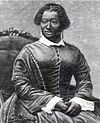
[Date dedicated]: 1992
[Location]: 1013 Rodman St., Philadelphia39°56′36″N 75°09′32″W / 39.9433°N 75.159°W / 39.9433; -75.159 (Elizabeth T. Greenfield)
[Marker type]: City
[Topics]: African American, Music & Theater, Performers, Women
[Notes]:
(Historical markers) -
[Marker title]: Engine Company No. 11
[Image]:
[Date dedicated]: April 23, 2005
[Location]: 1016 South St., Philadelphia39°56′34″N 75°09′33″W / 39.94285°N 75.15922°W / 39.94285; -75.15922 (Engine Company No. 11)
[Marker type]: City
[Topics]: African American, Police and Safety
[Notes]:
(Historical markers) -
[Marker title]: ENIAC
[Image]:
[Date dedicated]: June 15, 2000
[Location]: S 33rd St., S of Walnut St.39°57′08″N 75°11′24″W / 39.9522°N 75.1901°W / 39.9522; -75.1901 (ENIAC)
[Marker type]: City
[Topics]: Business & Industry, Invention
[Notes]:
(Historical markers) -
[Marker title]: Fairmount Park - Commonwealth Treasure
[Image]:
[Date dedicated]: October 9, 2001
[Location]: Kelly Dr. & Sedgely Dr., Philadelphia39°58′11″N 75°11′05″W / 39.96961°N 75.18482°W / 39.96961; -75.18482
[Marker type]: Roadside
[Topics]: Buildings & Architecture, Environment, Sports & Recreation
[Notes]:
(Historical markers) -
[Marker title]: Fairmount Water Works
[Image]:
[Date dedicated]: April 9, 1997
[Location]: At waterworks, corner of Waterworks Dr. & Kelly Dr., Philadelphia39°58′09″N 75°11′05″W / 39.96906°N 75.18461°W / 39.96906; -75.18461
[Marker type]: Roadside
[Topics]: Buildings & Architecture, Business & Industry, Science & Medicine
[Notes]:
(Historical markers) -
[Marker title]: Father Divine
[Image]:
[Date dedicated]: September 11, 1994
[Location]: NE corner, N Broad St. & Ridge Ave., Philadelphia39°58′00″N 75°09′37″W / 39.96675°N 75.16029°W / 39.96675; -75.16029
[Marker type]: City
[Topics]: African American, Civil Rights, Religion, Inns & Taverns
[Notes]:
(Historical markers) -
[Marker title]: Federal Street Burial Ground
[Image]:
[Date dedicated]: October 4, 1990
[Location]: Federal St. between 11th & 12th Sts., Philadelphia39°56′06″N 75°09′46″W / 39.935°N 75.1627°W / 39.935; -75.1627 (Federal Street Burial Ground)
[Marker type]: City
[Topics]: Civil War, Education, Military, Professions & Vocations, Publishing, Religion
[Notes]:
(Historical markers) -
[Marker title]: Female Medical College of Pennsylvania
[Image]:
[Date dedicated]: September 30, 1996
[Location]: 2900 W Queen Ln., at Drexel College of Med. entrance, Philadelphia40°01′11″N 75°10′52″W / 40.01972°N 75.18103°W / 40.01972; -75.18103
[Marker type]: City
[Topics]: Education, Medicine & Science, Women
[Notes]:
(Historical markers) -
[Marker title]: First African Baptist Church
[Image]:
[Date dedicated]: September 23, 2017
[Location]: 6700 Lansdowne Ave., Philadelphia39°58′28″N 75°15′13″W / 39.97443°N 75.2537°W / 39.97443; -75.2537
[Marker type]: Roadside
[Topics]: African American, Education, Religion
[Notes]:
(Historical markers) -
[Marker title]: First African Baptist Church
[Image]:
[Date dedicated]: January 1, 1992
[Location]: 16th & Christian Sts., Philadelphia39°56′16″N 75°09′55″W / 39.93767°N 75.16533°W / 39.93767; -75.16533 (First African Baptist Church)
[Marker type]: City
[Topics]: African American, Religion
[Notes]:
(Historical markers) -
[Marker title]: First African Baptist Church Cemetery
[Image]:
[Date dedicated]: 1992
[Location]: SW corner, N 8th & Vine Sts., Philadelphia39°57′23″N 75°09′11″W / 39.95649°N 75.15302°W / 39.95649; -75.15302
[Marker type]: City
[Topics]: African American, Religion
[Notes]:
(Historical markers) -
[Marker title]: First African Presbyterian Church
[Image]:
[Date dedicated]: 1993
[Location]: 42nd & Girard Ave., Philadelphia39°58′25″N 75°12′35″W / 39.9736°N 75.2096°W / 39.9736; -75.2096 (First African Presbyterian Church)
[Marker type]: City
[Topics]: African American, Religion
[Notes]:
(Historical markers) -
[Marker title]: First Protest Against Slavery
[Image]:
[Date dedicated]: September 8, 1990
[Location]: 5109 Germantown Ave. at Wister St., Philadelphia40°01′48″N 75°09′54″W / 40.03003°N 75.16496°W / 40.03003; -75.16496 (First Protest Against Slavery)
[Marker type]: City
[Topics]: African American, Ethnic & Immigration, Government & Politics, Religion
[Notes]:
(Historical markers) -
[Marker title]: First Republican National Convention
[Image]:
[Date dedicated]: June 17, 2000
[Location]: 808 Locust St., Philadelphia39°56′50″N 75°09′18″W / 39.94712°N 75.15495°W / 39.94712; -75.15495 (First Republican National Convention)
[Marker type]: City
[Topics]: Abraham Lincoln, Government & Politics, Government & Politics 19th Century
[Notes]:
(Historical markers) -
[Marker title]: Fort Mifflin
[Image]:
[Date dedicated]: May 10, 1990
[Location]: At site near Fort Mifflin Rd., Philadelphia39°53′36″N 75°12′32″W / 39.8933°N 75.2089°W / 39.8933; -75.2089 (Fort Mifflin)
[Marker type]: City
[Topics]: American Revolution, Forts, Military
[Notes]:
(Historical markers) -
[Marker title]: Frances E.W. Harper
[Image]: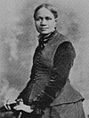
[Date dedicated]: March 25, 1992
[Location]: 1006 Bainbridge St., Philadelphia39°56′31″N 75°09′34″W / 39.942°N 75.15938°W / 39.942; -75.15938 (Frances E.W. Harper)
[Marker type]: City
[Topics]: African American, Civil Rights, Education, Underground Railroad, Women, Writers
[Notes]:
(Historical markers) -
[Marker title]: Francis Daniel Pastorius – PLAQUE
[Image]:
[Date dedicated]: October 1924
[Location]: 502 S. Front St. (west side, near South St.), Philadelphia39°56′31″N 75°08′39″W / 39.941826°N 75.144086°W / 39.941826; -75.144086
[Marker type]: Plaque
[Topics]: Cities & Towns, Early Settlement, Ethnic & Immigration, Government & Politics 17th Century
[Notes]: --Missing--
(Historical markers) -
[Marker title]: Francis Johnson (1792-1844)
[Image]:
[Date dedicated]: October 3, 1992
[Location]: 536 Pine St., Philadelphia39°56′38″N 75°09′06″W / 39.94383°N 75.15166°W / 39.94383; -75.15166 (Francis Johnson)
[Marker type]: City
[Topics]: African American, Performers
[Notes]:
(Historical markers) -
[Marker title]: Frank Furness (1839-1912)
[Image]:
[Date dedicated]: September 14, 2012
[Location]: 39.94567|-75.16642}}
[Marker type]: City
[Topics]: Buildings & Architecture, Professions & Vocations
[Notes]:
(Historical markers) -
[Marker title]: Frank Gasparro (1909-2001)
[Image]:
[Date dedicated]: November 1, 2002
[Location]: 727 Carpenter St., Philadelphia39°56′13″N 75°09′21″W / 39.93703°N 75.15597°W / 39.93703; -75.15597 (Frank Gasparro)
[Marker type]: Roadside
[Topics]: Artists, Government & Politics, Professions & Vocations
[Notes]:
(Historical markers) -
[Marker title]: Frank N. Piasecki (1919-2008)
[Image]:
[Date dedicated]: April 17, 2010
[Location]: 1937 Callowhill St., north side of Callowhill between 19th & 20th
[Marker type]: Roadside
[Topics]: Business & Industry, Invention, Military, Professions & Vocations
[Notes]:
(Historical markers) -
[Marker title]: Fraunces Tavern
[Image]:
[Date dedicated]: 1991
[Location]: 166 S 2nd St. (just W of Dock St.), Philadelphia39°56′47″N 75°08′41″W / 39.9465°N 75.14465°W / 39.9465; -75.14465 (Fraunces Tavern)
[Marker type]: City
[Topics]: Buildings, Business & Industry, George Washington, Professions & Vocations, Inns & Taverns
[Notes]:
(Historical markers) -
[Marker title]: Frederick Douglass Memorial Hospital
[Image]:
[Date dedicated]: 1992
[Location]: 1522 Lombard St., Philadelphia39°56′42″N 75°10′05″W / 39.94498°N 75.16807°W / 39.94498; -75.16807 (Frederick Douglass Memorial Hospital)
[Marker type]: City
[Topics]: African American, Medicine & Science, Professions & Vocations
[Notes]:
(Historical markers) -
[Marker title]: Free African Society
[Image]:
[Date dedicated]: 1992
[Location]: 6th & Lombard Sts., Philadelphia39°56′36″N 75°09′07″W / 39.94325°N 75.15195°W / 39.94325; -75.15195 (Free African Society)
[Marker type]: City
[Topics]: African American, Government & Politics
[Notes]:
(Historical markers) -
[Marker title]: Freedom Now Rally
[Image]:
[Date dedicated]: June 19, 2010
[Location]: intersection of 40th St., Lancaster Ave., and Haverford Ave., Philadelphia39°57′47″N 75°12′08″W / 39.96296°N 75.20232°W / 39.96296; -75.20232
[Marker type]: Roadside
[Topics]: African American, Civil Rights, Government & Politics 20th Century
[Notes]:
(Historical markers) -
[Marker title]: Freedom Theatre
[Image]:
[Date dedicated]: May 16, 1991
[Location]: 1346 N. Broad St. (Pa. 611), Philadelphia39°58′28″N 75°09′32″W / 39.9744°N 75.15898°W / 39.9744; -75.15898 (Freedom Theatre)
[Marker type]: City
[Topics]: African American, Music & Theater, Performers
[Notes]:
(Historical markers) -
[Marker title]: Gay Rights Demonstrations July 4, 1965 - 1969
[Image]:
[Date dedicated]: July 1, 2005
[Location]: NW corner of 6th & Chestnut Sts.39°56′57″N 75°09′03″W / 39.9492°N 75.1508°W / 39.9492; -75.1508 (Gay Rights Demonstrations)
[Marker type]: City
[Topics]: Civil Rights, Government & Politics 20th Century
[Notes]:
(Historical markers) -
[Marker title]: George Gordon Meade (1815-1872)
[Image]:
[Date dedicated]: November 6, 1999
[Location]: 1836 Delancey St., Philadelphia39°56′50″N 75°10′23″W / 39.9473°N 75.17302°W / 39.9473; -75.17302 (George Gordon Meade)
[Marker type]: City
[Topics]: Civil War, Military
[Notes]:
(Historical markers) -
[Marker title]: German Society of Pennsylvania (The)
[Image]:
[Date dedicated]: October 6, 2008
[Location]: 611 Spring Garden St. (at N 7th), Philadelphia39°57′42″N 75°08′57″W / 39.96155°N 75.14922°W / 39.96155; -75.14922
[Marker type]: Roadside
[Topics]: Ethnic & Immigration
[Notes]:
(Historical markers) -
[Marker title]: Germantown Meetinghouse
[Image]:
[Date dedicated]: September 10, 2008
[Location]: 6611 Germantown Ave., Philadelphia40°03′00″N 75°11′03″W / 40.05004°N 75.1842°W / 40.05004; -75.1842
[Marker type]: City
[Topics]: Buildings, Religion
[Notes]:
(Historical markers) -
[Marker title]: Gertrude E. H. Bustill Mossell (1855-1948)
[Image]:
[Date dedicated]: 1993
[Location]: 1423 Lombard St., Philadelphia39°56′41″N 75°09′59″W / 39.94469°N 75.16629°W / 39.94469; -75.16629
[Marker type]: City
[Topics]: Women, Writers
[Notes]:
(Historical markers) -
[Marker title]: Giannini Family
[Image]:
[Date dedicated]: October 1, 2005
[Location]: 735 Christian St., Philadelphia39°56′18″N 75°09′21″W / 39.93842°N 75.15573°W / 39.93842; -75.15573 (Giannini Family)
[Marker type]: City
[Topics]: Music & Theater, Performers
[Notes]:
(Historical markers) -
[Marker title]: Giovanni's Room
[Image]:
[Date dedicated]: October 9, 2011
[Location]: NE corner, S 12th & Pine Sts., Philadelphia39°56′42″N 75°09′41″W / 39.94501°N 75.16128°W / 39.94501; -75.16128
[Marker type]: City
[Topics]: Buildings & Architecture, Civil Rights
[Notes]:
(Historical markers) -
[Marker title]: Girard College Civil Rights Landmark
[Image]:
[Date dedicated]: 1992
[Location]: NE corner, Corinthian and Girard Aves., Philadelphia39°58′23″N 75°10′11″W / 39.97312°N 75.16986°W / 39.97312; -75.16986
[Marker type]: City
[Topics]: African American, Civil Rights, Education, Government & Politics, Professions & Vocations
[Notes]:
(Historical markers) -
[Marker title]: Girl Scout Cookies
[Image]:
[Date dedicated]: January 16, 2001
[Location]: 1401 Arch St., Philadelphia39°57′18″N 75°09′49″W / 39.95487°N 75.16367°W / 39.95487; -75.16367 (Girl Scout Cookies)
[Marker type]: City
[Topics]: Business & Industry, Women
[Notes]:
(Historical markers) -
[Marker title]: Glomar Explorer
[Image]:
[Date dedicated]: August 2, 2006
[Location]: At Independence Seaport Mus., 211 S Columbus Blvd. & Walnut St., Philadelphia39°56′47″N 75°08′25″W / 39.94633°N 75.14014°W / 39.94633; -75.14014
[Marker type]: Roadside
[Topics]: Government & Politics 20th Century, Military
[Notes]:
(Historical markers) -
[Marker title]: Gloria Dei Church (Old Swedes')
[Image]:
[Date dedicated]: December 17, 1954
[Location]: 916 Swanson St. at N facade of bldg., near Christian St. & Christopher Columbus Blvd.39°56′05″N 75°08′37″W / 39.9346°N 75.1436°W / 39.9346; -75.1436 (Gloria Dei Church 'Old Swedes')
[Marker type]: City
[Topics]: Buildings, Early Settlement, Ethnic & Immigration, Religion
[Notes]:
(Historical markers) -
[Marker title]: Grand Battery, The
[Image]:
[Date dedicated]: December 7, 1997
[Location]: S Columbus Blvd., at to US Coast Guard Station, Philadelphia39°55′58″N 75°08′37″W / 39.9327°N 75.1435°W / 39.9327; -75.1435 (Grand Battery, The)
[Marker type]: Roadside
[Topics]: Forts, French & Indian War, Military
[Notes]:
(Historical markers) -
[Marker title]: Grand United Order of Odd Fellows, The
[Image]:
[Date dedicated]: 1992
[Location]: S 12th & Spruce Sts., Philadelphia39°56′47″N 75°09′40″W / 39.946522°N 75.161056°W / 39.946522; -75.161056
[Marker type]: City
[Topics]: African American, Medicine & Science
[Notes]: --Missing--
(Historical markers) -
[Marker title]: Greenbelt Knoll
[Image]:
[Date dedicated]: June 10, 2007
[Location]: SW corner of Holme Ave. & Longford St., Philadelphia40°03′23″N 75°01′20″W / 40.0563°N 75.0221°W / 40.0563; -75.0221 (Greenbelt Knoll)
[Marker type]: Roadside
[Topics]: African American, Buildings, Cities & Towns, Civil Rights, Houses & Homesteads
[Notes]:
(Historical markers) -
[Marker title]: Hannah Callowhill Penn
[Image]:
[Date dedicated]: October 24, 2000
[Location]: S 2nd St. & Sansom St. Walkway (Welcome Park), Philadelphia39°56′51″N 75°08′39″W / 39.94743°N 75.14415°W / 39.94743; -75.14415 (Hannah Callowhill Penn)
[Marker type]: City
[Topics]: Government & Politics, William Penn, Women
[Notes]:
(Historical markers) -
[Marker title]: Hannah Penn – PLAQUE
[Image]:
[Date dedicated]: December 1926
[Location]: 135 S. 2nd St. (SE corner of 2nd & Sansom), Philadelphia39°56′50″N 75°08′40″W / 39.947155°N 75.144338°W / 39.947155; -75.144338
[Marker type]: Plaque
[Topics]: Government & Politics 18th Century, William Penn, Women
[Notes]: --Missing--
(Historical markers) -
[Marker title]: Harvey Pollack (1922-2015)
[Image]:
[Date dedicated]: May 19, 2016
[Location]: Grounds of Wells Fargo Center, near Xfinity, off Zinkoff Blvd., Philadelphia39°54′13″N 75°10′12″W / 39.90361°N 75.17009°W / 39.90361; -75.17009
[Marker type]: Roadside
[Topics]: Professions & Vocations, Sports & Recreation
[Notes]:
(Historical markers) -
[Marker title]: Haym Salomon (1740-1785)
[Image]:
[Date dedicated]: September 7, 1997
[Location]: 45 N. 5th St., Philadelphia39°57′05″N 75°08′54″W / 39.9513°N 75.14847°W / 39.9513; -75.14847 (Haym Salomon)
[Marker type]: City
[Topics]: American Revolution, Ethnic & Immigration, Military, Professions & Vocations, Religion
[Notes]:
(Historical markers) -
[Marker title]: Henry George
[Image]:
[Date dedicated]: November 18, 1984
[Location]: 413 S. 10th St., Philadelphia39°56′39″N 75°09′30″W / 39.9443°N 75.1584°W / 39.9443; -75.1584 (Henry George)
[Marker type]: City
[Topics]: Business & Industry, Government & Politics, Writers
[Notes]:
(Historical markers) -
[Marker title]: Henry L. Phillips (1847-1935)
[Image]:
[Date dedicated]: 1993
[Location]: 620 S. 8th St., Philadelphia39°56′31″N 75°09′20″W / 39.94192°N 75.15563°W / 39.94192; -75.15563 (Henry L. Phillips)
[Marker type]: City
[Topics]: African American, Religion
[Notes]:
(Historical markers) -
[Marker title]: Henry O. Tanner (1859-1937)
[Image]:
[Date dedicated]: January 19, 1991
[Location]: 2908 W. Diamond St., Philadelphia39°59′17″N 75°10′52″W / 39.98792°N 75.18123°W / 39.98792; -75.18123
[Marker type]: City
[Topics]: African American, Artists, Religion
[Notes]:
(Historical markers) -
[Marker title]: Herman Herzog (1831-1932)
[Image]:
[Date dedicated]: September 12, 2011
[Location]: 4101 Pine St.39°57′04″N 75°12′21″W / 39.95107°N 75.20582°W / 39.95107; -75.20582
[Marker type]: Roadside
[Topics]: Artists, Ethnic & Immigration
[Notes]:
(Historical markers) -
[Marker title]: Hershey's First Candy Store
[Image]:
[Date dedicated]: June 1, 2009
[Location]: 935 Spring Garden St., Philadelphia39°57′42″N 75°09′15″W / 39.96163°N 75.1543°W / 39.96163; -75.1543
[Marker type]: Roadside
[Topics]: Business & Industry, Entrepreneurs, Professions & Vocations
[Notes]:
(Historical markers) -
[Marker title]: Historical Society of Pennsylvania
[Image]:
[Date dedicated]: October 25, 2010
[Location]: 1300 Locust St.39°56′53″N 75°09′45″W / 39.94806°N 75.16261°W / 39.94806; -75.16261
[Marker type]: City
[Topics]: Education
[Notes]:
(Historical markers) -
[Marker title]: Hotel Brotherhood USA
[Image]:
[Date dedicated]: October 22, 2016
[Location]: 1523-29 Bainbridge St., Philadelphia39°56′35″N 75°10′06″W / 39.94317°N 75.16839°W / 39.94317; -75.16839
[Marker type]: City
[Topics]: African American, Labor, Professions & Vocations
[Notes]:
(Historical markers) -
[Marker title]: House of Industry
[Image]:
[Date dedicated]: June 27, 1996
[Location]: 714 Catharine St., Philadelphia39°56′21″N 75°09′18″W / 39.93903°N 75.15502°W / 39.93903; -75.15502 (House of Industry)
[Marker type]: City
[Topics]: Education, Ethnic & Immigration, Labor
[Notes]:
(Historical markers) -
[Marker title]: Institute for Colored Youth
[Image]:
[Date dedicated]: 1991
[Location]: 915 Bainbridge Sts., Philadelphia39°56′30″N 75°09′27″W / 39.94177°N 75.15753°W / 39.94177; -75.15753 (Institute for Colored Youth)
[Marker type]: City
[Topics]: African American, Agriculture, Education, Labor
[Notes]:
(Historical markers) -
[Marker title]: Insurance Company of North America
[Image]:
[Date dedicated]: April 26, 2017
[Location]: 436 Walnut St., Philadelphia39°56′51″N 75°08′57″W / 39.94742°N 75.14904°W / 39.94742; -75.14904
[Marker type]: Roadside
[Topics]: Business & Industry, Invention
[Notes]:
(Historical markers) -
[Marker title]: Isaac Leeser
[Image]:
[Date dedicated]: September 28, 1998
[Location]: Market St. between 54th & 55th, Philadelphia39°57′39″N 75°13′51″W / 39.9608°N 75.2307°W / 39.9608; -75.2307 (Isaac Leeser)
[Marker type]: City
[Topics]: Ethnic & Immigration, Publishing, Religion, Writers
[Notes]:
(Historical markers) -
[Marker title]: Israel Goldstein (1896-1986)
[Image]:
[Date dedicated]: November 20, 2002
[Location]: At S Phila. High School, 2101 S Broad St., Philadelphia39°55′25″N 75°10′11″W / 39.92364°N 75.16969°W / 39.92364; -75.16969
[Marker type]: Roadside
[Topics]: Education, Ethnic & Immigration, Government & Politics 20th Century, Religion
[Notes]:
(Historical markers) -
[Marker title]: Jack and Jill of America Foundation
[Image]:
[Date dedicated]: 1993
[Location]: 1605 Christian St., Philadelphia39°56′26″N 75°10′11″W / 39.94065°N 75.16978°W / 39.94065; -75.16978 (Jack and Jill of America Foundation)
[Marker type]: City
[Topics]: African American, Education, Women
[Notes]:
(Historical markers) -
[Marker title]: Jacob C. White Jr. (1837-1902)
[Image]:
[Date dedicated]: 1991
[Location]: 1032 Lombard St., Philadelphia39°56′38″N 75°09′35″W / 39.944°N 75.1596°W / 39.944; -75.1596 (Jacob C. White Jr.)
[Marker type]: City
[Topics]: African American, Baseball, Education, Medicine & Science, Sports, Underground Railroad
[Notes]:
(Historical markers) -
[Marker title]: James Forten (1766-1842)
[Image]:
[Date dedicated]: April 24, 1990
[Location]: 336 Lombard St., Philadelphia39°56′33″N 75°08′55″W / 39.94262°N 75.14858°W / 39.94262; -75.14858 (James Forten)
[Marker type]: City
[Topics]: African American, Professions & Vocations, Underground Railroad
[Notes]:
(Historical markers) -
[Marker title]: Jefferson House
[Image]:
[Date dedicated]: September 10, 1954
[Location]: 7th St. near Market St., Philadelphia (Missing)39°57′03″N 75°09′07″W / 39.950936°N 75.152°W / 39.950936; -75.152
[Marker type]: City
[Topics]: Government & Politics, Government & Politics 18th Century, Houses & Homesteads
[Notes]: --Missing--
(Historical markers) -
[Marker title]: Jefferson Street Ballparks
[Image]:
[Date dedicated]: September 30, 2017
[Location]: outside park on Jefferson St. at Bailey St., Philadelphia39°58′42″N 75°10′43″W / 39.97844°N 75.17868°W / 39.97844; -75.17868
[Marker type]: Roadside
[Topics]: African American, Baseball, Sports & Recreation
[Notes]:
(Historical markers) -
[Marker title]: Jessie Redmon Fauset
[Image]:
[Date dedicated]: 1993
[Location]: 1853 N. 17th St., Philadelphia39°58′58″N 75°09′43″W / 39.98284°N 75.16189°W / 39.98284; -75.16189
[Marker type]: City
[Topics]: African American, Women, Writers
[Notes]:
(Historical markers) -
[Marker title]: Jewish Hospital, The
[Image]:
[Date dedicated]: October 11, 2017
[Location]: At hospital, 5501 Old York Rd., at intersection of Albert Einstein Dr., Philadelphia40°02′13″N 75°08′41″W / 40.03695°N 75.14461°W / 40.03695; -75.14461
[Marker type]: Roadside
[Topics]: Ethnic & Immigration, Science & Medicine, Religion
[Notes]:
(Historical markers) -
[Marker title]: Joe Venuti (1903-1978)
[Image]:
[Date dedicated]: April 18, 1997
[Location]: NE corner 8th & Fitzwater Sts., Philadelphia39°56′27″N 75°09′21″W / 39.9407°N 75.1558°W / 39.9407; -75.1558 (Joe Venuti)
[Marker type]: City
[Topics]: Music & Theater, Performers
[Notes]:
(Historical markers) -
[Marker title]: John Bartram (1699-1777)
[Image]:
[Date dedicated]: June 6, 1955
[Location]: Harley Ave. at Lindbergh Blvd., West Philadelphia39°55′58″N 75°12′56″W / 39.9329°N 75.21546°W / 39.9329; -75.21546 (John Bartram)
[Marker type]: City
[Topics]: Environment, Professions & Vocations
[Notes]:
(Historical markers) -
[Marker title]: John C. Asbury (1862-1941)
[Image]:
[Date dedicated]: April 24, 2014
[Location]: 1710 Christian St., Philadelphia39°56′26″N 75°10′18″W / 39.94058°N 75.17157°W / 39.94058; -75.17157
[Marker type]: City
[Topics]: African American, Government & Politics 20th Century, Science & Medicine, Publishing & Journalism
[Notes]:
(Historical markers) -
[Marker title]: John E. Fryer, M.D. (1937-2003)
[Image]:
[Date dedicated]: October 3, 2017
[Location]: 13th St. at Locust, Philadelphia39°56′53″N 75°09′44″W / 39.94807°N 75.16228°W / 39.94807; -75.16228
[Marker type]: Roadside
[Topics]: Civil Rights, Science & Medicine
[Notes]:
(Historical markers) -
[Marker title]: John J. McDermott (1891-1971)
[Image]:
[Date dedicated]: October 9, 2014
[Location]: Kingsessing Library, 1201 S 51st St., Philadelphia39°56′31″N 75°13′06″W / 39.94203°N 75.21821°W / 39.94203; -75.21821
[Marker type]: Roadside
[Topics]: Professions & Vocations, Sports & Recreation
[Notes]:
(Historical markers) -
[Marker title]: Johann Nepomuk Maelzel (1772-1838)
[Image]:
[Date dedicated]: July 5, 2004
[Location]: NW corner, S 5th St. & St. James Ct., Philadelphia39°56′49″N 75°09′02″W / 39.94694°N 75.15044°W / 39.94694; -75.15044 (John Nepomuk Maelzel)
[Marker type]: City
[Topics]: Business & Industry, Entrepreneurs, Ethnic & Immigration, Invention, Performers, Sports
[Notes]: --Missing--
(Historical markers) -
[Marker title]: John Page Nicholson (1842-1922)
[Image]:
[Date dedicated]: May 2, 1998
[Location]: 1805 Pine St., Philadelphia39°56′48″N 75°10′18″W / 39.94665°N 75.1716°W / 39.94665; -75.1716 (John Page Nicholson)
[Marker type]: City
[Topics]: Civil War, Military, Professions & Vocations
[Notes]:
(Historical markers) -
[Marker title]: John Penn - PLAQUE
[Image]:
[Date dedicated]: October 1932
[Location]: 242 S 3rd St., Philadelphia39°56′45″N 75°08′48″W / 39.94572°N 75.14658°W / 39.94572; -75.14658 (John Penn's Home)
[Marker type]: Plaque
[Topics]: Government & Politics 18th Century, William Penn
[Notes]:
(Historical markers) -
[Marker title]: John W. Coltrane (1926-1967)
[Image]:
[Date dedicated]: July 17, 1990
[Location]: 1511 N. 33rd St., Philadelphia39°58′49″N 75°11′20″W / 39.9803°N 75.18878°W / 39.9803; -75.18878
[Marker type]: City
[Topics]: African American, Music & Theater, Performers
[Notes]:
(Historical markers) -
[Marker title]: John Wanamaker (1838-1922)
[Image]:
[Date dedicated]: July 11, 1998
[Location]: S 13th & Market Sts., Philadelphia39°57′04″N 75°09′58″W / 39.95123°N 75.16621°W / 39.95123; -75.16621
[Marker type]: Roadside
[Topics]: Business & Industry, Education, Entrepreneurs, Government & Politics 19th Century, Invention, Professions & Vocations, Religion
[Notes]:
(Historical markers) -
[Marker title]: Johnson House (The)
[Image]:
[Date dedicated]: June 1, 1995
[Location]: 6306 Germantown Ave., Philadelphia40°02′36″N 75°10′52″W / 40.0434°N 75.1811°W / 40.0434; -75.1811 (Johnson House, The)
[Marker type]: City
[Topics]: African American, Houses & Homesteads, Religion, Underground Railroad
[Notes]:
(Historical markers) -
[Marker title]: Joseph and Amy Cassey (1789–1848)/(1809-56)
[Image]:
[Date dedicated]: March 13, 2009
[Location]: S 4th St., between Chestnut and Market, Philadelphia39°56′57″N 75°08′52″W / 39.94924°N 75.14785°W / 39.94924; -75.14785
[Marker type]: City
[Topics]: African American, Professions & Vocations
[Notes]:
(Historical markers) -
[Marker title]: Joseph Bonaparte (1768-1844)
[Image]:
[Date dedicated]: January 9, 2000
[Location]: 260 South 9th St., Philadelphia39°56′47″N 75°09′23″W / 39.94628°N 75.15628°W / 39.94628; -75.15628 (Joseph Bonaparte)
[Marker type]: City
[Topics]: Government & Politics, Government & Politics 19th Century
[Notes]:
(Historical markers) -
[Marker title]: Joseph Huston (1866-1940)
[Image]:
[Date dedicated]: October 20, 2005
[Location]: 5829 Wissahickon Ave., Germantown, Philadelphia40°01′44″N 75°11′07″W / 40.0289°N 75.1854°W / 40.0289; -75.1854 (Joseph Miller Huston)
[Marker type]: City
[Topics]: Buildings, Houses & Homesteads, Professions & Vocations
[Notes]:
(Historical markers) -
[Marker title]: Julian Abele
[Image]:
[Date dedicated]: February 12, 1991
[Location]: At Philadelphia Museum of Art steps, 26th & Franklin Pkwy.39°57′54″N 75°10′46″W / 39.965°N 75.17958°W / 39.965; -75.17958 (Julian Francis Abele)
[Marker type]: Roadside
[Topics]: African American, Buildings, Professions & Vocations
[Notes]:
(Historical markers) -
[Marker title]: Kahal Kodosh Mikveh Israel
[Image]:
[Date dedicated]: 1991
[Location]: 313 Cherry St. at Orianna St., Philadelphia39°57′11″N 75°08′45″W / 39.95311°N 75.14584°W / 39.95311; -75.14584
[Marker type]: City
[Topics]: Ethnic & Immigration, Religion
[Notes]:
(Historical markers) -
[Marker title]: Kelly Family, The
[Image]:
[Date dedicated]: October 27, 2012
[Location]: At the corner of W Coulter St. & Henry Ave., Philadelphia40°01′04″N 75°11′20″W / 40.01784°N 75.18896°W / 40.01784; -75.18896
[Marker type]: Roadside
[Topics]: Government & Politics 20th Century, Motion Pictures & Television, Performers, Sports & Recreation, Women
[Notes]:
(Historical markers) -
[Marker title]: Kelpius Community
[Image]:
[Date dedicated]: April 17, 2004
[Location]: Hermit Lane near Henry Ave., Fairmount Park, Philadelphia40°01′30″N 75°12′03″W / 40.0251°N 75.2009°W / 40.0251; -75.2009 (Kelpius Community)
[Marker type]: Roadside
[Topics]: Education, Ethnic & Immigration, Native American, Religion, William Penn
[Notes]:
(Historical markers) -
[Marker title]: Knowlton
[Image]:
[Date dedicated]: November 12, 1994
[Location]: 8001 Verree Road, Philadelphia40°04′20″N 75°04′28″W / 40.07233°N 75.07452°W / 40.07233; -75.07452
[Marker type]: City
[Topics]: Buildings, Houses & Homesteads
[Notes]:
(Historical markers) -
[Marker title]: Laura Wheeler Waring
[Image]:
[Date dedicated]: 1992
[Location]: 756 N. 43rd St., Philadelphia39°57′59″N 75°12′34″W / 39.9663°N 75.2095°W / 39.9663; -75.2095 (Laura Wheeler Waring)
[Marker type]: City
[Topics]: African American, Artists, Education, Women
[Notes]:
(Historical markers) -
[Marker title]: Laurel Hill Cemetery
[Image]:
[Date dedicated]: May 20, 2000
[Location]: 3822 Ridge Ave., Philadelphia40°00′15″N 75°11′15″W / 40.00427°N 75.18743°W / 40.00427; -75.18743 (Laurel Hill Cemetery)
[Marker type]: Roadside
[Topics]: Environment
[Notes]:
(Historical markers) -
[Marker title]: Legendary Blue Horizon, The
[Image]:
[Date dedicated]: October 24, 2003
[Location]: 1314 N. Broad St., Philadelphia39°58′26″N 75°09′33″W / 39.97382°N 75.1591°W / 39.97382; -75.1591 (Legendary Blue Horizon, The)
[Marker type]: City
[Topics]: African American, Sports
[Notes]:
(Historical markers) -
[Marker title]: Liberation of Jane Johnson, The
[Image]:
[Date dedicated]: July 18, 2009
[Location]: Penn's Landing near Walnut St. pedestrian walkway and entrance to Independence Seaport Museum, Philadelphia39°56′47″N 75°08′28″W / 39.9464°N 75.141°W / 39.9464; -75.141 (Liberation of Jane Johnson, The)
[Marker type]: Roadside
[Topics]: African American, Government & Politics 19th Century, Women
[Notes]:
(Historical markers) -
[Marker title]: Lombard Street Riot
[Image]:
[Date dedicated]: November 23, 2005
[Location]: SE corner of 6th & Lombard Sts., Philadelphia39°56′35″N 75°09′07″W / 39.94298°N 75.15197°W / 39.94298; -75.15197 (Lombard Street Riot)
[Marker type]: City
[Topics]: African American
[Notes]:
(Historical markers) -
[Marker title]: London Coffee House
[Image]:
[Date dedicated]: 1991
[Location]: SW corner, Front & Market Sts., Philadelphia39°56′59″N 75°08′32″W / 39.9496°N 75.14222°W / 39.9496; -75.14222 (London Coffee House)
[Marker type]: City
[Topics]: African American, Business & Industry
[Notes]:
(Historical markers) -
[Marker title]: Lorenzo L. Langstroth (1810-1895)
[Image]:
[Date dedicated]: September 10, 2010
[Location]: 106 S Front St., Phila.39°56′53″N 75°08′33″W / 39.94802°N 75.14248°W / 39.94802; -75.14248
[Marker type]: City
[Topics]: Business & Industry, Invention, Science & Medicine, Writers
[Notes]:
(Historical markers) -
[Marker title]: Louis I. Kahn (1901-1974)
[Image]:
[Date dedicated]: June 24, 2004
[Location]: 1501 Walnut St., Philadelphia39°56′57″N 75°09′57″W / 39.94903°N 75.16572°W / 39.94903; -75.16572
[Marker type]: City
[Topics]: Buildings, Education, Professions & Vocations
[Notes]:
(Historical markers) -
[Marker title]: Louisa May Alcott
[Image]:
[Date dedicated]: November 7, 1996
[Location]: 5427 Germantown Ave., Philadelphia40°02′01″N 75°10′18″W / 40.0337°N 75.1716°W / 40.0337; -75.1716 (Louisa May Alcott)
[Marker type]: City
[Topics]: Women, Writers
[Notes]:
(Historical markers) -
[Marker title]: Marc Blitzstein (1905-1964)
[Image]:
[Date dedicated]: June 12, 2017
[Location]: 419 Pine St., Philadelphia39°56′38″N 75°08′59″W / 39.94386°N 75.14961°W / 39.94386; -75.14961
[Marker type]: City
[Topics]: Music & Theater, Performers, Professions & Vocations, Writers
[Notes]:
(Historical markers) -
[Marker title]: Marian Anderson
[Image]:
[Date dedicated]: 1993
[Location]: At Union Baptist Church, 1910 Fitzwater St., Philadelphia39°56′35″N 75°10′28″W / 39.94312°N 75.1745°W / 39.94312; -75.1745 (Marian Anderson)
[Marker type]: City
[Topics]: African American, Performers, Women
[Notes]:
(Historical markers) -
[Marker title]: Mario Lanza (1921-1959)
[Image]:
[Date dedicated]: November 7, 1993
[Location]: 634-36 Christian St., Philadelphia39°56′17″N 75°09′16″W / 39.9381°N 75.15453°W / 39.9381; -75.15453 (Mario Lanza)
[Marker type]: City
[Topics]: Motion Pictures & Television, Music & Theater, Performers
[Notes]:
(Historical markers) -
[Marker title]: Mason-Dixon Survey
[Image]:
[Date dedicated]: August 30, 2013
[Location]: Front & South Sts., Philadelphia39°56′27″N 75°08′37″W / 39.94089°N 75.14369°W / 39.94089; -75.14369
[Marker type]: Roadside
[Topics]: Exploration, Government & Politics 17th Century, Government & Politics 18th Century, Science & Medicine, Native American, Professions & Vocations
[Notes]:
(Historical markers) -
[Marker title]: Masonic Temple Philadelphia
[Image]:
[Date dedicated]: December 5, 2007
[Location]: One N Broad St.39°57′20″N 75°09′41″W / 39.95544°N 75.16145°W / 39.95544; -75.16145
[Marker type]: City
[Topics]: Buildings & Architecture
[Notes]:
(Historical markers) -
[Marker title]: Mathew Carey (1760-1839)
[Image]:
[Date dedicated]: September 14, 2014
[Location]: 324 Marker St., Philadelphia39°57′02″N 75°08′48″W / 39.95063°N 75.14668°W / 39.95063; -75.14668
[Marker type]: Roadside
[Topics]: Ethnic & Immigration, Government & Politics 18th Century, Government & Politics 19th Century, Professions & Vocations, Publishing & Journalism, Writers
[Notes]:
(Historical markers) -
[Marker title]: Maxfield Parrish (1870-1966)
[Image]:
[Date dedicated]: September 16, 2015
[Location]: in front of Curtis Bldg., S 6th St. between Sansom & Walnut.39°56′53″N 75°09′04″W / 39.94796°N 75.15114°W / 39.94796; -75.15114
[Marker type]: Roadside
[Topics]: Artists, Professions & Vocations
[Notes]:
(Historical markers) -
[Marker title]: McClellan House
[Image]:
[Date dedicated]: October 14, 1997
[Location]: 912 Walnut St., Philadelphia39°56′53″N 75°09′23″W / 39.94817°N 75.15652°W / 39.94817; -75.15652
[Marker type]: City
[Topics]: Education
[Notes]:
(Historical markers) -
[Marker title]: Mechanics' Union of Trade Associations
[Image]:
[Date dedicated]: June 30, 2004
[Location]: Chestnut and Bank Sts., Philadelphia39°56′55″N 75°08′42″W / 39.94865°N 75.14505°W / 39.94865; -75.14505 (Mechanics' Union of Trade Associations)
[Marker type]: City
[Topics]: Education, Government & Politics 19th Century, Labor
[Notes]:
(Historical markers) -
[Marker title]: Medical Library Association
[Image]:
[Date dedicated]: November 4, 2015
[Location]: 1420-22 Chestnut St., Philadelphia39°57′02″N 75°09′54″W / 39.95065°N 75.16508°W / 39.95065; -75.16508
[Marker type]: City
[Topics]: Education, Science & Medicine, Women
[Notes]:
(Historical markers) -
[Marker title]: Mercy Hospital
[Image]:
[Date dedicated]: 1992
[Location]: NW corner, S 17th & Fitzwater Sts., Philadelphia39°56′33″N 75°10′15″W / 39.9424°N 75.1708°W / 39.9424; -75.1708 (Mercy Hospital)
[Marker type]: City
[Topics]: African American, Science & Medicine, Professions & Vocations
[Notes]:
(Historical markers) -
[Marker title]: Meriwether Lewis (1774-1809)
[Image]:
[Date dedicated]: August 12, 2003
[Location]: 1900 Ben Franklin Pky., Philadelphia39°57′26″N 75°10′16″W / 39.95728°N 75.17115°W / 39.95728; -75.17115 (Meriwether Lewis)
[Marker type]: City
[Topics]: Education, Environment, Exploration, Science & Medicine
[Notes]:
(Historical markers) -
[Marker title]: Meta V.W. Fuller (1877–1968)
[Image]:
[Date dedicated]: 1992
[Location]: 254 S 12th St., Philadelphia39°56′49″N 75°09′40″W / 39.94697°N 75.16101°W / 39.94697; -75.16101
[Marker type]: City
[Topics]: African American, Artists, Women
[Notes]:
(Historical markers) -
[Marker title]: Mikveh Israel Cemetery
[Image]:
[Date dedicated]: 1957
[Location]: Spruce St. between Schell & Darien Sts., Philadelphia39°56′47″N 75°09′23″W / 39.9464°N 75.1564°W / 39.9464; -75.1564 (Mikveh Israel Cemetery)
[Marker type]: City
[Topics]: Ethnic & Immigration, Religion
[Notes]:
(Historical markers) -
[Marker title]: Mother Bethel A.M.E. Church
[Image]:
[Date dedicated]: March 19, 1991
[Location]: NE corner, S 6th & Lombard Sts., Philadelphia39°56′35″N 75°09′07″W / 39.94298°N 75.15198°W / 39.94298; -75.15198 (Mother Bethel A.M.E. Church)
[Marker type]: City
[Topics]: African American, Religion, Underground Railroad
[Notes]:
(Historical markers) -
[Marker title]: Mother Jones (1830-1930)
[Image]:
[Date dedicated]: November 12, 1994
[Location]: N Broad St. & JFK Blvd., N side of City Hall, Philadelphia39°57′12″N 75°09′53″W / 39.95347°N 75.16473°W / 39.95347; -75.16473 (Mother Jones)
[Marker type]: City
[Topics]: Labor, Women
[Notes]:
(Historical markers) -
[Marker title]: Mother's Day
[Image]:
[Date dedicated]: June 1, 1998
[Location]: Traffic island, Market & Juniper Sts. (E side of City Hall), Philadelphia39°57′08″N 75°09′46″W / 39.95228°N 75.16282°W / 39.95228; -75.16282 (Mother's Day)
[Marker type]: City
[Topics]: Women
[Notes]:
(Historical markers) -
[Marker title]: Mower General Hospital
[Image]:
[Date dedicated]: September 17, 2000
[Location]: Willow Grove Ave. & Wyndmoor St., Philadelphia40°04′26″N 75°11′51″W / 40.07381°N 75.19753°W / 40.07381; -75.19753
[Marker type]: City
[Topics]: Civil War, Military
[Notes]:
(Historical markers) -
[Marker title]: Moyamensing Prison
[Image]:
[Date dedicated]: May 4, 2011
[Location]: E Passyunk Ave. & S 10th St., at corner of Reed, Philadelphia39°55′55″N 75°09′40″W / 39.9319°N 75.16111°W / 39.9319; -75.16111
[Marker type]: Roadside
[Topics]:
[Notes]:
(Historical markers) -
[Marker title]: Muhammad's Temple of Islam #12
[Image]:
[Date dedicated]: August 20, 2016
[Location]: 4218 Lancaster Ave., Philadelphia39°58′01″N 75°12′31″W / 39.96687°N 75.20848°W / 39.96687; -75.20848
[Marker type]: City
[Topics]: African American, Religion
[Notes]:
(Historical markers) -
[Marker title]: National Funeral for President Washington
[Image]:
[Date dedicated]: December 14, 1999
[Location]: SE corner, N 4th & Cherry Streets, Philadelphia39°57′10″N 75°08′48″W / 39.9529°N 75.1467°W / 39.9529; -75.1467 (National Funeral Service for President Washington)
[Marker type]: Roadside
[Topics]: George Washington, Government & Politics, Government & Politics 18th Century
[Notes]:
(Historical markers) -
[Marker title]: New Century Guild
[Image]:
[Date dedicated]: June 19, 1997
[Location]: 1307 Locust St., Philadelphia39°56′52″N 75°09′46″W / 39.9479°N 75.1628°W / 39.9479; -75.1628 (New Century Guild)
[Marker type]: City
[Topics]: Labor, Women
[Notes]:
(Historical markers) -
[Marker title]: NFL Films
[Image]:
[Date dedicated]: July 23, 2009
[Location]: 230 N 13th St.39°57′24″N 75°09′37″W / 39.95678°N 75.16031°W / 39.95678; -75.16031
[Marker type]: City
[Topics]:
[Notes]:
(Historical markers) -
[Marker title]: Nicholas Biddle (1786-1844)
[Image]:
[Date dedicated]: 2000
[Location]: 715 Spruce St., Philadelphia39°56′44″N 75°09′13″W / 39.94562°N 75.15357°W / 39.94562; -75.15357 (Nicholas Biddle)
[Marker type]: City
[Topics]: Business & Industry, Entrepreneurs, Exploration
[Notes]:
(Historical markers) -
[Marker title]: Nicola Monachesi (c. 1795-1851)
[Image]:
[Date dedicated]: May 24, 2017
[Location]: at St. Augustine's R.C. Church, 246-60 N 4th St., Philadelphia39°57′20″N 75°08′46″W / 39.95552°N 75.14621°W / 39.95552; -75.14621
[Marker type]: Roadside
[Topics]: Artists, Buildings & Architecture, Ethnic & Immigration, Professions & Vocations, Religion
[Notes]:
(Historical markers) -
[Marker title]: Octavius V. Catto (1839-1871)
[Image]:
[Date dedicated]: 1992
[Location]: 812 South St., Philadelphia39°56′33″N 75°09′21″W / 39.9425°N 75.15593°W / 39.9425; -75.15593 (Octavius V. Catto)
[Marker type]: City
[Topics]: African American, Civil Rights, Civil War, Education, Government & Politics, Military
[Notes]:
(Historical markers) -
[Marker title]: Old St. Joseph's Roman Catholic Church
[Image]:
[Date dedicated]: July 31, 2014
[Location]: 324 Walnut St., Philadelphia39°56′50″N 75°08′52″W / 39.94722°N 75.14765°W / 39.94722; -75.14765
[Marker type]: Roadside
[Topics]: Buildings & Architecture, Religion
[Notes]:
(Historical markers) -
[Marker title]: Old St. Mary's Roman Catholic Church
[Image]:
[Date dedicated]: 2013
[Location]: at church, 250-252 S 4th St., Philadelphia39°56′44″N 75°08′54″W / 39.94563°N 75.14838°W / 39.94563; -75.14838
[Marker type]: Roadside
[Topics]: American Revolution, Buildings & Architecture, Government & Politics 18th Century, Religion
[Notes]:
(Historical markers) -
[Marker title]: Oldest Photograph
[Image]:
[Date dedicated]: September 25, 1989
[Location]: NW corner, Chestnut & Juniper Sts., Philadelphia39°57′02″N 75°09′48″W / 39.95067°N 75.16322°W / 39.95067; -75.16322 (Oldest Photograph)
[Marker type]: City
[Topics]: Artists, Business & Industry, Invention, Medicine & Science, Professions & Vocations
[Notes]:
(Historical markers) -
[Marker title]: Opportunities Industrialization Centers
[Image]:
[Date dedicated]: November 23, 1990
[Location]: N 19th St., between Turner & Oxford Sts., Philadelphia39°58′43″N 75°09′58″W / 39.9786°N 75.1661°W / 39.9786; -75.1661 (Opportunities Industrialization Centers)
[Marker type]: City
[Topics]: African American, Education
[Notes]:
(Historical markers) -
[Marker title]: Ora Washington (1899-1971)
[Image]:
[Date dedicated]: November 5, 2004
[Location]: 6128 Germantown Ave., Philadelphia40°02′29″N 75°10′46″W / 40.0413°N 75.1794°W / 40.0413; -75.1794 (Ora Washington)
[Marker type]: City
[Topics]: African American, Sports, Women
[Notes]:
(Historical markers) -
[Marker title]: Owen Wister (1860-1938)
[Image]:
[Date dedicated]: October 7, 2001
[Location]: 5203 Germantown Ave., Philadelphia40°01′52″N 75°10′00″W / 40.03101°N 75.16672°W / 40.03101; -75.16672
[Marker type]: City
[Topics]: Motion Pictures & Television, Writers
[Notes]:
(Historical markers) -
[Marker title]: Paul Philippe Cret (1876-1945)
[Image]:
[Date dedicated]: May 23, 1992
[Location]: 516 Woodland Terrace, Philadelphia39°56′56″N 75°12′16″W / 39.94902°N 75.20455°W / 39.94902; -75.20455 (Paul Philippe Cret)
[Marker type]: City
[Topics]: Bridges, Buildings & Architecture, Professions & Vocations
[Notes]:
(Historical markers) -
[Marker title]: Paul Robeson (1898-1976)
[Image]:
[Date dedicated]: April 8, 1991
[Location]: 4951 Walnut St. (at 50th), Philadelphia39°57′23″N 75°13′17″W / 39.95651°N 75.22143°W / 39.95651; -75.22143
[Marker type]: City
[Topics]: African American, Music & Theater, Performers
[Notes]:
(Historical markers) -
[Marker title]: Pearl Bailey (1919-1990)
[Image]:
[Date dedicated]: 1992
[Location]: 1946 N 23rd St., Philadelphia39°59′06″N 75°10′17″W / 39.98494°N 75.17152°W / 39.98494; -75.17152
[Marker type]: City
[Topics]: African American, Performers, Women
[Notes]:
(Historical markers) -
[Marker title]: Penn Relays, The
[Image]:
[Date dedicated]: April 29, 1995
[Location]: At Franklin Field track entrance, 233 S 33rd St., Philadelphia39°57′04″N 75°11′26″W / 39.9511°N 75.1906°W / 39.9511; -75.1906 (Penn Relays, The)
[Marker type]: Roadside
[Topics]: Sports & Recreation
[Notes]:
(Historical markers) -
[Marker title]: Penn Treaty Park
[Image]:
[Date dedicated]: September 18, 1976
[Location]: At Park on Delaware River, foot of Cecil B. Moore (Columbia) Ave., Philadelphia39°58′02″N 75°07′43″W / 39.96711°N 75.12849°W / 39.96711; -75.12849
[Marker type]: Roadside
[Topics]: Native American, William Penn
[Notes]:
(Historical markers) -
[Marker title]: Pennepack Baptist Church
[Image]:
[Date dedicated]: June 1, 2013
[Location]: 8732 Krewstown Rd., Philadelphia40°04′52″N 75°03′04″W / 40.08113°N 75.05098°W / 40.08113; -75.05098
[Marker type]: Roadside
[Topics]: Buildings & Architecture, Early Settlement, Religion, William Penn
[Notes]:
(Historical markers) -
[Marker title]: Pennsylvania Abolition Society
[Image]:
[Date dedicated]: 1992
[Location]: Front St. below S Chestnut St., Philadelphia39°56′51″N 75°08′33″W / 39.94743°N 75.14253°W / 39.94743; -75.14253 (Pennsylvania Abolition Society)
[Marker type]: City
[Topics]: African American, Education, Underground Railroad
[Notes]:
(Historical markers) -
[Marker title]: Pennsylvania Academy of the Fine Arts
[Image]:
[Date dedicated]: November 17, 2004
[Location]: At the Academy, 118 N Broad St., Philadelphia39°57′19″N 75°09′47″W / 39.95517°N 75.16307°W / 39.95517; -75.16307 (Pennsylvania Academy of the Fine Arts)
[Marker type]: City
[Topics]: Artists, Buildings & Architecture, Education
[Notes]:
(Historical markers) -
[Marker title]: Pennsylvania Bible Society
[Image]:
[Date dedicated]: April 26, 2014
[Location]: NW corner of 7th & Walnut Sts., Philadelphia39°56′53″N 75°09′10″W / 39.94799°N 75.15281°W / 39.94799; -75.15281
[Marker type]: City
[Topics]: Education, Publishing & Journalism, Religion
[Notes]:
(Historical markers) -
[Marker title]: Pennsylvania Hall
[Image]:
[Date dedicated]: 1992
[Location]: N 6th St. south of Race St., Philadelphia39°57′14″N 75°08′59″W / 39.9538°N 75.1498°W / 39.9538; -75.1498 (Pennsylvania Hall)
[Marker type]: City
[Topics]: African American, Government & Politics, Government & Politics 19th Century, Underground Railroad
[Notes]:
(Historical markers) -
[Marker title]: Pennsylvania Hospital
[Image]:
[Date dedicated]: December 17, 1954
[Location]: Pine St. between 8th & 9th Sts., Philadelphia39°56′40″N 75°09′20″W / 39.94438°N 75.15562°W / 39.94438; -75.15562 (Pennsylvania Hospital)
[Marker type]: City
[Topics]: Medicine & Science, Professions & Vocations
[Notes]:
(Historical markers) -
[Marker title]: Pennsylvania Slave Trade, The
[Image]:
[Date dedicated]: August 5, 2016
[Location]: at Independence Seaport Museum near waterfront, 211 S Columbus Blvd., Philadelphia39°56′46″N 75°08′24″W / 39.94618°N 75.13991°W / 39.94618; -75.13991
[Marker type]: Roadside
[Topics]: African American, Government & Politics 17th Century, William Penn
[Notes]:
(Historical markers) -
[Marker title]: Pennsylvania Station
[Image]:
[Date dedicated]: December 17, 1996
[Location]: N side of Market St. between 29th & 30th Sts., Philadelphia39°57′24″N 75°10′54″W / 39.956667°N 75.181667°W / 39.956667; -75.181667
[Marker type]: City
[Topics]: Railroads, Transportation
[Notes]: --Missing--
(Historical markers) -
[Marker title]: Pennypack Creek Bridge
[Image]:
[Date dedicated]: October 13, 2012
[Location]: Pennypack Park, Frankford Ave. & Solly Ave., Philadelphia40°02′37″N 75°01′12″W / 40.04362°N 75.01993°W / 40.04362; -75.01993
[Marker type]: Roadside
[Topics]: American Revolution, Bridges, Early Settlement, Native American, Roads
[Notes]:
(Historical markers) -
[Marker title]: Philadelphia
[Image]:
[Date dedicated]: December 6, 1982
[Location]: Traffic island at N. Broad St. (PA 611) & John F. Kennedy Blvd., just N of City Hall39°57′13″N 75°09′49″W / 39.9535°N 75.1635°W / 39.9535; -75.1635 (Philadelphia)
[Marker type]: City
[Topics]: Cities & Towns, William Penn
[Notes]:
(Historical markers) -
[Marker title]: Philadelphia & Columbia Railroad
[Image]:
[Date dedicated]: May 17, 2001
[Location]: Edgley Ave. off Belmont Ave. (W Fairmount Park), Philadelphia39°59′44″N 75°12′59″W / 39.9956°N 75.21644°W / 39.9956; -75.21644
[Marker type]: Roadside
[Topics]: Business & Industry, Government & Politics 19th Century, Railroads, Transportation
[Notes]:
(Historical markers) -
[Marker title]: Philadelphia Chinatown
[Image]: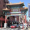
[Date dedicated]: October 8, 2010
[Location]: 913 Race St.39°57′19″N 75°09′18″W / 39.95515°N 75.15501°W / 39.95515; -75.15501
[Marker type]: City
[Topics]: Ethnic & Immigration
[Notes]:
(Historical markers) -
[Marker title]: Philadelphia College of Pharmacy and Science
[Image]:
[Date dedicated]: January 4, 1971
[Location]: At entrance, 43rd St. & Kingsessing Ave., West Philadelphia39°56′49″N 75°12′31″W / 39.947°N 75.2087°W / 39.947; -75.2087 (Philadelphia College of Pharmacy and Science)
[Marker type]: Roadside
[Topics]: Education
[Notes]:
(Historical markers) -
[Marker title]: Philadelphia College of Textiles and Science
[Image]:
[Date dedicated]: May 16, 1969
[Location]: Campus, School House land near Henry Ave., Germantown40°01′17″N 75°11′30″W / 40.0214°N 75.1916°W / 40.0214; -75.1916 (Philadelphia College of Textiles and Science)
[Marker type]: Roadside
[Topics]: Education
[Notes]:
(Historical markers) -
[Marker title]: Philadelphia Contributionship, The
[Image]: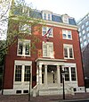
[Date dedicated]: December 17, 1954
[Location]: 212 S. 4th St., Philadelphia39°56′49″N 75°08′53″W / 39.94692°N 75.14793°W / 39.94692; -75.14793 (Philadelphia Contributionship, The)
[Marker type]: City
[Topics]: Business & Industry
[Notes]:
(Historical markers) -
[Marker title]: Philadelphia Female Anti-Slavery Society
[Image]:
[Date dedicated]: 1992
[Location]: 5th & Arch Sts., Philadelphia39°57′10″N 75°08′54″W / 39.95275°N 75.14836°W / 39.95275; -75.14836 (Philadelphia Female Anti-Slavery Society)
[Marker type]: City
[Topics]: African American, Government & Politics, Underground Railroad, Women
[Notes]:
(Historical markers) -
[Marker title]: Philadelphia General Hospital
[Image]: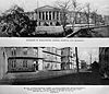
[Date dedicated]: November 5, 2007
[Location]: Curie Blvd. & Osler Circle, Penn campus39°56′56″N 75°11′47″W / 39.94884°N 75.19646°W / 39.94884; -75.19646
[Marker type]: Roadside
[Topics]: Buildings & Architecture, Science & Medicine, Professions & Vocations, Women
[Notes]:
(Historical markers) -
[Marker title]: Philadelphia Knights of Pythias
[Image]:
[Date dedicated]: 1992
[Location]: 19th & Addison Sts., Philadelphia39°56′45″N 75°10′24″W / 39.94593°N 75.1733°W / 39.94593; -75.1733 (Philadelphia Knights of Pythias)
[Marker type]: City
[Topics]: African American
[Notes]:
(Historical markers) -
[Marker title]: Philadelphia Pyramid Club
[Image]:
[Date dedicated]: 1992
[Location]: 1517 Girard Ave., Philadelphia39°58′19″N 75°09′43″W / 39.97182°N 75.1619°W / 39.97182; -75.1619 (Philadelphia Pyramid Club)
[Marker type]: City
[Topics]: African American
[Notes]:
(Historical markers) -
[Marker title]: Philadelphia Sketch Club
[Image]:
[Date dedicated]: October 11, 2008
[Location]: 235 S Camac St., Philadelphia39°56′51″N 75°09′42″W / 39.9474°N 75.16164°W / 39.9474; -75.16164
[Marker type]: City
[Topics]: Artists
[Notes]:
(Historical markers) -
[Marker title]: Philadelphia Tribune
[Image]:
[Date dedicated]: July 1, 1992
[Location]: 520-26 S 16th St., Philadelphia39°56′40″N 75°10′07″W / 39.94443°N 75.16868°W / 39.94443; -75.16868 (Philadelphia Tribune)
[Marker type]: City
[Topics]: African American, Business & Industry
[Notes]:
(Historical markers) -
[Marker title]: Philadelphia Zoo, The
[Image]:
[Date dedicated]: June 27, 1996
[Location]: 3400 Girard Ave. at zoo entrance, Philadelphia39°58′29″N 75°11′44″W / 39.9747°N 75.19557°W / 39.9747; -75.19557 (Philadelphia Zoo, The)
[Marker type]: City
[Topics]: Sports & Recreation
[Notes]:
(Historical markers) -
[Marker title]: Philip Syng, Jr. (1703–1789)
[Image]:
[Date dedicated]: September 28, 2003
[Location]: Corner of Chestnut St. & S Front St., Philadelphia39°56′59″N 75°08′32″W / 39.9496°N 75.14222°W / 39.9496; -75.14222 (Philip Syng)
[Marker type]: City
[Topics]: Government & Politics, Government & Politics 18th Century, Professions & Vocations
[Notes]:
(Historical markers) -
[Marker title]: Presbyterian Church in the U.S.A.
[Image]:
[Date dedicated]: July 1, 1989
[Location]: NW corner, Arch St. & N 3rd St., Philadelphia39°57′08″N 75°08′44″W / 39.95224°N 75.14543°W / 39.95224; -75.14543 (Presbyterian Church in the U.S.A.)
[Marker type]: City
[Topics]: Religion
[Notes]:
(Historical markers) -
[Marker title]: Prince Hall Grand Lodge
[Image]:
[Date dedicated]: September 8, 1990
[Location]: 4301 N. Broad St., between St. Luke & Bristol, Philadelphia40°01′09″N 75°08′56″W / 40.01908°N 75.1489°W / 40.01908; -75.1489 (Prince Hall Grand Lodge)
[Marker type]: City
[Topics]: African American
[Notes]:
(Historical markers) -
[Marker title]: Printz's (Old Swedes) Mill
[Image]:
[Date dedicated]: October 18, 2008
[Location]: 7303 Woodland Ave., next to Cobbs Creek, Philadelphia39°55′01″N 75°14′48″W / 39.917°N 75.2468°W / 39.917; -75.2468 (Printz's 'Old Swedes' Mill)
[Marker type]: Roadside
[Topics]: Business & Industry, Early Settlement, Mills, Native American, William Penn
[Notes]: --Missing--
(Historical markers) -
[Marker title]: PSFS Building
[Image]:
[Date dedicated]: November 11, 2005
[Location]: 1200 Market St., Philadelphia39°57′07″N 75°09′37″W / 39.9519°N 75.16037°W / 39.9519; -75.16037 (PSFS Building)
[Marker type]: City
[Topics]: Buildings
[Notes]:
(Historical markers) -
[Marker title]: Public Sector Collective Bargaining
[Image]:
[Date dedicated]: September 26, 2008
[Location]: City Hall, north side, Broad & Market Sts. (near Mother Jones marker), Philadelphia39°57′12″N 75°09′50″W / 39.95337°N 75.16378°W / 39.95337; -75.16378
[Marker type]: City
[Topics]: Government & Politics, Labor
[Notes]:
(Historical markers) -
[Marker title]: Ralph Modjeski (1861–1940)
[Image]:
[Date dedicated]: September 15, 2007
[Location]: NW corner of 6th & Race Sts., near Franklin Sq. Park entrance, Philadelphia
[Marker type]: City
[Topics]: Bridges, Business & Industry, Ethnic & Immigration, Professions & Vocations
[Notes]:
(Historical markers) -
[Marker title]: Reading Terminal and Market
[Image]:
[Date dedicated]: September 10, 2003
[Location]: On site at Market St. near 12th, at Convention Ctr., Philadelphia39°57′06″N 75°09′33″W / 39.9518°N 75.15923°W / 39.9518; -75.15923 (Reading Terminal and Market)
[Marker type]: Roadside
[Topics]: Business & Industry, Railroads, Transportation
[Notes]:
(Historical markers) -
[Marker title]: Rev. Dr. Leon Howard Sullivan (1922-2001)
[Image]:
[Date dedicated]: October 16, 2017
[Location]: At Zion Baptist Church, 3600 N Broad St., Philadelphia40°00′28″N 75°09′06″W / 40.00779°N 75.1517°W / 40.00779; -75.1517
[Marker type]: Roadside
[Topics]: African American, Civil Rights, Government & Politics, Government & Politics 20th Century, Religion
[Notes]:
(Historical markers) -
[Marker title]: Rev. Isaac Leeser (1806-1868)
[Image]:
[Date dedicated]: September 28, 1998
[Location]: Market St. between 54th & 55th, Philadelphia39°57′39″N 75°13′51″W / 39.96082°N 75.23076°W / 39.96082; -75.23076
[Marker type]: City
[Topics]: Ethnic & Immigration, Publishing & Journalism, Religion, Writers
[Notes]:
(Historical markers) -
[Marker title]: Rev. Jehu Jones, Jr. (1786-1852)
[Image]:
[Date dedicated]: February 22, 1998
[Location]: 310 S. Quince St., Philadelphia (at Mask & Wig Club)39°56′45″N 75°09′37″W / 39.94591°N 75.16041°W / 39.94591; -75.16041
[Marker type]: City
[Topics]: African American, Religion
[Notes]:
(Historical markers) -
[Marker title]: Ricketts' Circus
[Image]: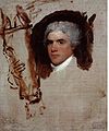
[Date dedicated]: July 15, 1982
[Location]: S 12th & Market Sts., at Loew's Hotel, Philadelphia39°57′06″N 75°09′36″W / 39.95158°N 75.15994°W / 39.95158; -75.15994
[Marker type]: City
[Topics]: George Washington, Performers
[Notes]:
(Historical markers) -
[Marker title]: Rittenhouse Town
[Image]:
[Date dedicated]: April 8, 1991
[Location]: Lincoln Dr. at Rittenhouse St. just off Wissahickon Ave., Fairmount Park, Philadelphia40°01′45″N 75°11′24″W / 40.02925°N 75.1899°W / 40.02925; -75.1899 (Rittenhouse Town)
[Marker type]: Roadside
[Topics]: Buildings & Architecture, Business & Industry, Cities & Towns, Early Settlement, Mansions & Manors, Science & Medicine, Mills, Religion
[Notes]:
(Historical markers) -
[Marker title]: Robert Aitken (1734-1802)
[Image]:
[Date dedicated]: October 19, 2012
[Location]: 11 Market St., Philadelphia39°56′59″N 75°08′33″W / 39.94965°N 75.14258°W / 39.94965; -75.14258
[Marker type]: Roadside
[Topics]: American Revolution, Government & Politics 18th Century, Professions & Vocations, Publishing & Journalism, Religion
[Notes]:
(Historical markers) -
[Marker title]: Robert Bogle (1774-1848)
[Image]:
[Date dedicated]: 1991
[Location]: 112 S 8th St., Philadelphia39°56′30″N 75°09′20″W / 39.941536°N 75.15567°W / 39.941536; -75.15567
[Marker type]: City
[Topics]: African American, Professions & Vocations
[Notes]:
(Historical markers) -
[Marker title]: Robert Cornelius
[Image]:
[Date dedicated]: December 9, 1994
[Location]: S 8th & Ranstead Sts. (next to Siegmund Lubin marker), Philadelphia39°57′02″N 75°09′13″W / 39.95047°N 75.15368°W / 39.95047; -75.15368
[Marker type]: City
[Topics]: Business & Industry, Invention, Science & Medicine, Professions & Vocations
[Notes]:
(Historical markers) -
[Marker title]: Robert Mara Adger (1837–1910)
[Image]: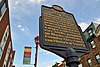
[Date dedicated]: 1993
[Location]: 823 South St. (at Darien St.), Philadelphia39°56′33″N 75°09′23″W / 39.94253°N 75.15634°W / 39.94253; -75.15634 (Robert Mara Adger)
[Marker type]: City
[Topics]: African American, Professions & Vocations, Underground Railroad
[Notes]:
(Historical markers) -
[Marker title]: Robert Patterson (1743–1824)
[Image]:
[Date dedicated]: July 22, 2004
[Location]: West side of 9th St., south of Market St., Philadelphia39°57′01″N 75°09′20″W / 39.95017°N 75.15545°W / 39.95017; -75.15545 (Robert Patterson)
[Marker type]: City
[Topics]: Education, Exploration
[Notes]:
(Historical markers) -
[Marker title]: Robert Purvis (1810-1898)
[Image]:
[Date dedicated]: February 21, 1992
[Location]: 1601 Mt. Vernon St., Philadelphia39°57′54″N 75°09′52″W / 39.96494°N 75.16432°W / 39.96494; -75.16432
[Marker type]: City
[Topics]: African American, Civil Rights, Professions & Vocations, Underground Railroad, Writers
[Notes]:
(Historical markers) -
[Marker title]: Robert Smith
[Image]:
[Date dedicated]: January 14, 1983
[Location]: 606 S. 2nd St., Philadelphia39°56′27″N 75°08′45″W / 39.94085°N 75.14578°W / 39.94085; -75.14578 (Robert Smith)
[Marker type]: City
[Topics]: Buildings, Ethnic & Immigration, Professions & Vocations
[Notes]:
(Historical markers) -
[Marker title]: Roy Campanella (1921-1993)
[Image]:
[Date dedicated]: May 29, 1996
[Location]: Simon Gratz High School, 18th St. & Hunting Park Ave., Philadelphia40°00′53″N 75°09′22″W / 40.0148°N 75.1562°W / 40.0148; -75.1562 (Roy Campanella)
[Marker type]: City
[Topics]: African American, Baseball, Sports & Recreation
[Notes]:
(Historical markers) -
[Marker title]: Sadie T.M. Alexander (1898-1989)
[Image]:
[Date dedicated]: 1993
[Location]: 700 Westview St., Philadelphia40°02′39″N 75°11′47″W / 40.0443°N 75.1963°W / 40.0443; -75.1963 (Sadie T.M. Alexander)
[Marker type]: City
[Topics]: African American, Civil Rights, Government & Politics, Government & Politics 20th Century, Women
[Notes]:
(Historical markers) -
[Marker title]: Salvation Army, The
[Image]:
[Date dedicated]: June 19, 1998
[Location]: N 4th & Oxford Sts., Philadelphia39°58′31″N 75°08′30″W / 39.9752°N 75.1418°W / 39.9752; -75.1418 (Salvation Army, The)
[Marker type]: City
[Topics]: Religion, Women
[Notes]:
(Historical markers) -
[Marker title]: Samuel Hopkins (1743–1818)
[Image]:
[Date dedicated]: July 29, 2000
[Location]: 119 Arch St., Philadelphia39°57′07″N 75°08′34″W / 39.95194°N 75.14265°W / 39.95194; -75.14265
[Marker type]: City
[Topics]: Business & Industry, George Washington, Government & Politics, Invention, Science & Medicine
[Notes]:
(Historical markers) -
[Marker title]: Samuel S. Fleisher Art Memorial
[Image]:
[Date dedicated]: September 13, 2005
[Location]: 719 Catherine St., Philadelphia39°56′21″N 75°09′19″W / 39.93903°N 75.15517°W / 39.93903; -75.15517 (Samuel S. Fleisher Art Memorial)
[Marker type]: City
[Topics]: Artists, Education
[Notes]:
(Historical markers) -
[Marker title]: Sarah Josepha Hale (1788-1879)
[Image]:
[Date dedicated]: November 14, 2015
[Location]: 922 Spruce St., Philadelphia39°56′45″N 75°09′27″W / 39.94583°N 75.15742°W / 39.94583; -75.15742
[Marker type]: City
[Topics]: Abraham Lincoln, Civil Rights, Government & Politics 19th Century, Professions & Vocations, Publishing & Journalism, Women, Writers
[Notes]:
(Historical markers) -
[Marker title]: Satterlee U.S.A. General Hospital
[Image]:
[Date dedicated]: November 8, 2003
[Location]: At the Gettysburg Stone in Clark Park, between 43rd and 44th Sts. on Baltimore Ave., Philadelphia39°56′57″N 75°12′40″W / 39.9491°N 75.211°W / 39.9491; -75.211 (Satterlee U.S.A. General Hospital)
[Marker type]: City
[Topics]: Civil War, Medicine & Science, Military
[Notes]:
(Historical markers) -
[Marker title]: Schuylkill Arsenal
[Image]:
[Date dedicated]: June 10, 2004
[Location]: E Greys Ferry Rd. at Washington Ave., Philadelphia39°56′26″N 75°11′16″W / 39.94042°N 75.18767°W / 39.94042; -75.18767 (Schuylkill Arsenal)
[Marker type]: City
[Topics]: Civil War, Exploration, Military, Military Post-Civil War
[Notes]:
(Historical markers) -
[Marker title]: Schuylkill Navy of Philadelphia
[Image]:
[Date dedicated]: October 11, 2008
[Location]: #4 Boathouse Row, Kelly Dr., Philadelphia39°58′10″N 75°11′10″W / 39.96945°N 75.1862°W / 39.96945; -75.1862
[Marker type]: Roadside
[Topics]: Buildings & Architecture, Sports & Recreation
[Notes]:
(Historical markers) -
[Marker title]: Shibe Park/Connie Mack Stadium
[Image]:
[Date dedicated]: November 1, 1997
[Location]: N 21st St. & Lehigh Ave., Philadelphia39°59′43″N 75°09′53″W / 39.9953°N 75.1646°W / 39.9953; -75.1646 (Shibe Park/Connie Mack Stadium)
[Marker type]: City
[Topics]: African American, Baseball, Sports & Recreation
[Notes]:
(Historical markers) -
[Marker title]: Shot Tower
[Image]:
[Date dedicated]: April 19, 1997
[Location]: Carpenter & Front Sts., Philadelphia39°56′05″N 75°08′47″W / 39.9348°N 75.1463°W / 39.9348; -75.1463 (Shot Tower)
[Marker type]: City
[Topics]: Buildings & Architecture, Business & Industry, Military, Religion, War of 1812
[Notes]:
(Historical markers) -
[Marker title]: Siegmund Lubin (1851-1923)
[Image]:
[Date dedicated]: April 11, 2007
[Location]: 1608 N 15th St., Philadelphia39°58′41″N 75°09′36″W / 39.97796°N 75.16003°W / 39.97796; -75.16003
[Marker type]: City
[Topics]: Invention, Motion Pictures & Television, Professions & Vocations
[Notes]:
(Historical markers) -
[Marker title]: Siegmund Lubin (1851-1923)
[Image]:
[Date dedicated]: May 6, 1994
[Location]: 21 S. 8th St., Philadelphia39°57′02″N 75°09′13″W / 39.95047°N 75.15368°W / 39.95047; -75.15368
[Marker type]: City
[Topics]: Business & Industry, Invention, Motion Pictures & Television, Professions & Vocations
[Notes]:
(Historical markers) -
[Marker title]: Sigma Sound Studios
[Image]:
[Date dedicated]: October 15, 2015
[Location]: In front of parking lot at 211-219 N 12th St. (across the st. from site), Philadelphia39°57′23″N 75°09′32″W / 39.95639°N 75.15889°W / 39.95639; -75.15889
[Marker type]: City
[Topics]: Music & Theater
[Notes]:
(Historical markers) -
[Marker title]: Sister Rosetta Tharpe (1915-1973)
[Image]:
[Date dedicated]: October 24, 2011
[Location]: 1102 Master St., Philadelphia39°58′26″N 75°09′14″W / 39.97377°N 75.15377°W / 39.97377; -75.15377
[Marker type]: City
[Topics]: African American, Music & Theater, Performers, Religion, Women
[Notes]:
(Historical markers) -
[Marker title]: Smith Memorial Playground & Playhouse
[Image]:
[Date dedicated]: September 23, 2017
[Location]: 3500 Reservoir Dr., Philadelphia39°58′58″N 75°11′40″W / 39.9828°N 75.19456°W / 39.9828; -75.19456
[Marker type]: City
[Topics]: Buildings & Architecture, Sports & Recreation
[Notes]:
(Historical markers) -
[Marker title]: Solitude, The
[Image]:
[Date dedicated]: October 11, 2009
[Location]: at site on Phila. Zoo grounds, 3400 W Girard Ave., Philadelphia39°58′22″N 75°11′44″W / 39.9729°N 75.1956°W / 39.9729; -75.1956 (Solitude, The)
[Marker type]: City
[Topics]: Buildings & Architecture, William Penn
[Notes]:
(Historical markers) -
[Marker title]: South 9th Street Curb Market
[Image]:
[Date dedicated]: October 12, 2007
[Location]: NE corner of 9th & Christian Sts., Phila.39°56′20″N 75°09′28″W / 39.939°N 75.15778°W / 39.939; -75.15778
[Marker type]: Roadside
[Topics]: Business & Industry, Ethnic & Immigration, Roads
[Notes]:
(Historical markers) -
[Marker title]: SPHAs Basketball Team, The
[Image]:
[Date dedicated]: April 14, 2013
[Location]: Broad & Wood Sts., Philadelphia39°57′32″N 75°09′44″W / 39.95883°N 75.16232°W / 39.95883; -75.16232
[Marker type]: Roadside
[Topics]: Basketball, Ethnic & Immigration, Sports & Recreation
[Notes]:
(Historical markers) -
[Marker title]: St. Augustine's Roman Catholic Church
[Image]:
[Date dedicated]: October 28, 1995
[Location]: 235 N 4th St. at New St., Philadelphia39°57′20″N 75°08′46″W / 39.95547°N 75.14617°W / 39.95547; -75.14617
[Marker type]: City
[Topics]: Buildings & Architecture, Government & Politics, Government & Politics 19th Century, Religion
[Notes]:
(Historical markers) -
[Marker title]: St. John Neumann
[Image]:
[Date dedicated]: March 28, 1981
[Location]: St. Peter's Church, N 5th St. & Girard Ave., Philadelphia39°58′12″N 75°08′41″W / 39.97013°N 75.14483°W / 39.97013; -75.14483
[Marker type]: City
[Topics]: Religion
[Notes]:
(Historical markers) -
[Marker title]: St. John the Evangelist Roman Catholic Church
[Image]:
[Date dedicated]: October 4, 2015
[Location]: 21 S 13th St (at Ludlow), Philadelphia
[Marker type]: Roadside
[Topics]: Artists, Music & Theater, Religion
[Notes]:
(Historical markers) -
[Marker title]: St. Mary Magdalen De Pazzi Parish
[Image]:
[Date dedicated]: May 2, 1994
[Location]: 714 Montrose St., Philadelphia39°56′15″N 75°09′20″W / 39.9376°N 75.1556°W / 39.9376; -75.1556 (St. Mary Magdalen De Pazzi Parish)
[Marker type]: City
[Topics]: Buildings & Architecture, Ethnic & Immigration, Religion
[Notes]:
(Historical markers) -
[Marker title]: St. Peter Claver Catholic Church
[Image]:
[Date dedicated]: 1991
[Location]: SW corner, S 12th & Lombard Sts., Philadelphia39°56′39″N 75°09′42″W / 39.94418°N 75.1617°W / 39.94418; -75.1617 (St. Peter Claver Catholic Church)
[Marker type]: City
[Topics]: African American, Buildings & Architecture, Religion
[Notes]:
(Historical markers) -
[Marker title]: St. Thomas' African Episcopal Church
[Image]:
[Date dedicated]: September 30, 1984
[Location]: SW corner, S 5th St. & St. James Ct., Philadelphia39°56′47″N 75°09′00″W / 39.9465°N 75.14995°W / 39.9465; -75.14995 (St. Thomas' African Episcopal Church)
[Marker type]: City
[Topics]: African American, Buildings & Architecture, Religion
[Notes]:
(Historical markers) -
[Marker title]: Standard Theatre
[Image]:
[Date dedicated]: 1992
[Location]: South St. between 11th & 12th, Philadelphia39°56′35″N 75°09′39″W / 39.94312°N 75.16093°W / 39.94312; -75.16093 (Standard Theatre)
[Marker type]: City
[Topics]: African American, Buildings & Architecture, Entrepreneurs, Music & Theater, Performers
[Notes]:
(Historical markers) -
[Marker title]: Stephen Decatur
[Image]:
[Date dedicated]: October 21, 1988
[Location]: 600 block, S. Front St., Philadelphia39°56′26″N 75°08′38″W / 39.94063°N 75.14402°W / 39.94063; -75.14402 (Stephen Decatur)
[Marker type]: City
[Topics]: Military, War of 1812
[Notes]:
(Historical markers) -
[Marker title]: Stephen Girard (1750–1831)
[Image]:
[Date dedicated]: October 1, 1993
[Location]: Girard Park, Shunk Sts. between S 21st & S 22nd, Philadelphia39°55′12″N 75°10′59″W / 39.92012°N 75.18305°W / 39.92012; -75.18305 (Stephen Girard)
[Marker type]: Roadside
[Topics]: Buildings & Architecture, Business & Industry, Education, Ethnic & Immigration, Mansions & Manors, Professions & Vocations
[Notes]:
(Historical markers) -
[Marker title]: Stephen Smith (1795-1873)
[Image]:
[Date dedicated]: June 19, 1991
[Location]: 1050 Belmont Ave., Philadelphia39°58′22″N 75°12′44″W / 39.9728°N 75.2122°W / 39.9728; -75.2122 (Stephen Smith)
[Marker type]: City
[Topics]: African American, Business & Industry, Coal, Professions & Vocations, Underground Railroad
[Notes]:
(Historical markers) -
[Marker title]: Sullivan Progress Plaza
[Image]:
[Date dedicated]: September 14, 2016
[Location]: 1501 N Broad St., Philadelphia39°58′35″N 75°09′30″W / 39.97652°N 75.15825°W / 39.97652; -75.15825
[Marker type]: Roadside
[Topics]: African American, Business & Industry, Government & Politics 20th Century, Religion
[Notes]:
(Historical markers) -
[Marker title]: Terminal Commerce Building
[Image]:
[Date dedicated]: September 14, 2017
[Location]: 401 N Broad St., Philadelphia39°57′35″N 75°09′43″W / 39.95979°N 75.16183°W / 39.95979; -75.16183
[Marker type]: City
[Topics]: Buildings & Architecture, Railroads
[Notes]:
(Historical markers) -
[Marker title]: Thaddeus Kosciuszko
[Image]:
[Date dedicated]: October 22, 1967
[Location]: NW corner 3rd & Pine Sts., Philadelphia39°56′36″N 75°08′51″W / 39.94342°N 75.14737°W / 39.94342; -75.14737 (Thaddeus Kosciuszko)
[Marker type]: City
[Topics]: American Revolution, Ethnic & Immigration, Military
[Notes]:
(Historical markers) -
[Marker title]: The MOVE Bombing
[Image]:
[Date dedicated]: June 24, 2017
[Location]: Cobbs Creek Pkwy. on Cobbs Creek Park side of street opposite Osage Ave.39°57′21″N 75°14′54″W / 39.95573°N 75.24834°W / 39.95573; -75.24834
[Marker type]: City
[Topics]: African American, Government & Politics 20th Century, Police and Safety
[Notes]:
(Historical markers) -
[Marker title]: Thomas A. Edison High School and the Vietnam War
[Image]:
[Date dedicated]: November 8, 2014
[Location]: 8th St. & Lehigh Ave., Philadelphia39°59′34″N 75°08′40″W / 39.99272°N 75.14438°W / 39.99272; -75.14438
[Marker type]: Roadside
[Topics]: Education, Government & Politics 20th Century, Military Post-Civil War
[Notes]:
(Historical markers) -
[Marker title]: Thomas E. Cahill (1828–1878)
[Image]:
[Date dedicated]: September 29, 2009
[Location]: E side of N Broad St., between Vine & Pearl, Philadelphia39°57′30″N 75°09′44″W / 39.95829°N 75.16222°W / 39.95829; -75.16222
[Marker type]: Roadside
[Topics]: Education, Entrepreneurs, Ethnic & Immigration, Religion
[Notes]:
(Historical markers) -
[Marker title]: Thomas Eakins (1844-1916)
[Image]:
[Date dedicated]: 1996
[Location]: 1729 Mt. Vernon St., Philadelphia39°57′55″N 75°10′01″W / 39.96531°N 75.16692°W / 39.96531; -75.16692
[Marker type]: City
[Topics]: Artists, Science & Medicine, Sports & Recreation
[Notes]:
(Historical markers) -
[Marker title]: Thomas Holme (1624–1695)
[Image]:
[Date dedicated]: July 29, 1995
[Location]: Pennypack Park, 3000 Holme Ave., Philadelphia40°03′24″N 75°12′05″W / 40.05678°N 75.20148°W / 40.05678; -75.20148 (Thomas Holme)
[Marker type]: Roadside
[Topics]: Early Settlement, Government & Politics, Government & Politics 17th Century, William Penn
[Notes]:
(Historical markers) -
[Marker title]: Thomas Ustick Walter (1804–1877)
[Image]:
[Date dedicated]: October 29, 2009
[Location]: 1218 Arch St., Philadelphia39°57′15″N 75°09′38″W / 39.95416°N 75.16043°W / 39.95416; -75.16043
[Marker type]: City
[Topics]: Buildings & Architecture, Professions & Vocations
[Notes]:
(Historical markers) -
[Marker title]: Tindley Temple
[Image]:
[Date dedicated]: 1992
[Location]: 762 S. Broad St., Philadelphia39°56′29″N 75°09′58″W / 39.94137°N 75.16607°W / 39.94137; -75.16607 (Tindley Temple)
[Marker type]: City
[Topics]: African American, Buildings & Architecture, Religion
[Notes]:
(Historical markers) -
[Marker title]: Tomas Garrigue Masaryk (1850-1937)
[Image]:
[Date dedicated]: July 23, 2002
[Location]: Independence Mall West, S 6th St. between Chestnut and Samson, Philadelphia39°56′55″N 75°09′03″W / 39.94865°N 75.15073°W / 39.94865; -75.15073
[Marker type]: City
[Topics]: Ethnic & Immigration, Government & Politics, Government & Politics 20th Century
[Notes]:
(Historical markers) -
[Marker title]: Tommy Loughran (1902–1982)
[Image]:
[Date dedicated]: July 7, 2006
[Location]: SW corner, S 17th & Ritner Sts., Philadelphia39°55′16″N 75°10′31″W / 39.9211°N 75.1754°W / 39.9211; -75.1754 (Tommy Loughran)
[Marker type]: Roadside
[Topics]: Sports & Recreation
[Notes]:
(Historical markers) -
[Marker title]: Tun Tavern
[Image]:
[Date dedicated]: November 11, 2005
[Location]: Front St., between Chestnut & Walnut, Philadelphia39°56′50″N 75°08′33″W / 39.94725°N 75.1426°W / 39.94725; -75.1426 (Tun Tavern)
[Marker type]: City
[Topics]: American Revolution, Military, Inns & Taverns
[Notes]:
(Historical markers) -
[Marker title]: U.S.S. United States
[Image]:
[Date dedicated]: October 16, 1983
[Location]: 555 S Columbus Blvd. (S of Independence Seaport Museum, and near Delaware Ave. and Chart House restaurant), Philadelphia39°56′29″N 75°08′28″W / 39.94145°N 75.14098°W / 39.94145; -75.14098
[Marker type]: City
[Topics]: Military, War of 1812
[Notes]:
(Historical markers) -
[Marker title]: Union Fire Company (1736-1843)
[Image]:
[Date dedicated]: October 1, 2011
[Location]: Market St., between 2nd & 3rd (Grindstone Alley)39°57′00″N 75°08′40″W / 39.95006°N 75.14453°W / 39.95006; -75.14453
[Marker type]: City
[Topics]: Cities & Towns, Government & Politics 18th Century, Invention, Police and Safety
[Notes]:
(Historical markers) -
[Marker title]: Union League of Philadelphia
[Image]:
[Date dedicated]: February 12, 2004
[Location]: 140 S. Broad St., Philadelphia39°57′00″N 75°09′49″W / 39.94997°N 75.16363°W / 39.94997; -75.16363 (Union League of Philadelphia)
[Marker type]: City
[Topics]: Abraham Lincoln, Civil War, Government & Politics, Military
[Notes]:
(Historical markers) -
[Marker title]: Union Local 274, American Federation of Musicians
[Image]:
[Date dedicated]: 1993
[Location]: 912 S. Broad St., Philadelphia39°56′16″N 75°09′55″W / 39.93765°N 75.16527°W / 39.93765; -75.16527 (Union Local 274, American Federation of Musicians)
[Marker type]: City
[Topics]: African American, Labor, Music & Theater, Performers
[Notes]:
(Historical markers) -
[Marker title]: Universal Negro Improvement Association
[Image]:
[Date dedicated]: April 11, 1992
[Location]: 1609–11 Cecil B. Moore Ave., Philadelphia39°58′45″N 75°09′41″W / 39.97923°N 75.16146°W / 39.97923; -75.16146
[Marker type]: City
[Topics]: African American
[Notes]:
(Historical markers) -
[Marker title]: US Sanitary Commission Great Central Fair
[Image]:
[Date dedicated]: June 16, 2012
[Location]: Logan Sq., 19th & Ben Franklin Pkwy., near Swann Fountain, Philadelphia39°57′27″N 75°10′15″W / 39.95744°N 75.17083°W / 39.95744; -75.17083
[Marker type]: Roadside
[Topics]: Abraham Lincoln, Civil War, Government & Politics 19th Century, Military, Women
[Notes]:
(Historical markers) -
[Marker title]: Veterans Stadium
[Image]:
[Date dedicated]: September 28, 2005
[Location]: NE corner, S Broad St. & Pattison Ave., Philadelphia39°54′19″N 75°10′17″W / 39.9052°N 75.1714°W / 39.9052; -75.1714 (Veterans Stadium)
[Marker type]: Roadside
[Topics]: Baseball, Football, Sports & Recreation
[Notes]:
(Historical markers) -
[Marker title]: Vincent Persichetti (1915-1987)
[Image]:
[Date dedicated]: May 9, 1997
[Location]: Curtis Institute of Music, 1724 Locust St., Philadelphia39°56′56″N 75°10′13″W / 39.9489°N 75.1704°W / 39.9489; -75.1704 (Vincent Persichetti)
[Marker type]: City
[Topics]: Education, Music & Theater
[Notes]:
(Historical markers) -
[Marker title]: Violet Oakley (1874-1961)
[Image]:
[Date dedicated]: October 20, 1998
[Location]: 615 St. George's Rd., off McCallum St., Philadelphia40°03′12″N 75°12′14″W / 40.05321°N 75.20386°W / 40.05321; -75.20386
[Marker type]: City
[Topics]: Artists, Glass, Government & Politics, Women
[Notes]:
(Historical markers) -
[Marker title]: W. C. Fields (1880-1948)
[Image]:
[Date dedicated]: October 13, 1997
[Location]: NW corner, N 8th & Market Sts., Philadelphia39°57′04″N 75°09′13″W / 39.9512°N 75.1537°W / 39.9512; -75.1537 (W. C. Fields)
[Marker type]: City
[Topics]: Motion Pictures & Television, Performers
[Notes]:
(Historical markers) -
[Marker title]: W.E.B. DuBois (1868-1963)
[Image]:
[Date dedicated]: October 29, 1995
[Location]: NW corner, S 6th & Rodman Sts., Philadelphia39°56′33″N 75°09′08″W / 39.94245°N 75.15233°W / 39.94245; -75.15233 (W.E.B. DuBois)
[Marker type]: City
[Topics]: African American, Civil Rights, Education, Writers
[Notes]:
(Historical markers) -
[Marker title]: Walnut Lane Bridge
[Image]:
[Date dedicated]: October 18, 2008
[Location]: Walnut Lane, SW side of bridge over Wissahickon Creek (Roxborough side), Philadelphia40°01′53″N 75°12′01″W / 40.0315°N 75.2003°W / 40.0315; -75.2003 (Walnut Lane Bridge)
[Marker type]: Roadside
[Topics]: Bridges, Business & Industry, Transportation
[Notes]:
(Historical markers) -
[Marker title]: Walnut Lane Bridge
[Image]:
[Date dedicated]: October 18, 2008
[Location]: Walnut Lane, NE side of bridge over Wissahickon Creek (Germantown side), Philadelphia40°01′58″N 75°11′57″W / 40.0329°N 75.1992°W / 40.0329; -75.1992 (Walnut Lane Bridge)
[Marker type]: Roadside
[Topics]: Bridges, Business & Industry, Transportation
[Notes]:
(Historical markers) -
[Marker title]: Walnut Street Prison
[Image]:
[Date dedicated]: 1964
[Location]: SE corner, S 6th St. near Walnut St., Philadelphia 39°56′51″N 75°09′04″W / 39.9475°N 75.1512°W / 39.9475; -75.1512 (Walnut Street Prison)
[Marker type]: City
[Topics]: Government & Politics, Government & Politics 18th Century
[Notes]:
(Historical markers) -
[Marker title]: Walnut Street Theatre
[Image]:
[Date dedicated]: September 25, 1996
[Location]: S 9th & Walnut Sts., Philadelphia39°56′54″N 75°09′19″W / 39.9482°N 75.1554°W / 39.9482; -75.1554 (Walnut Street Theatre)
[Marker type]: City
[Topics]: Buildings, Music & Theater, Performers
[Notes]:
(Historical markers) -
[Marker title]: Walter Golaski (1913-1996)
[Image]:
[Date dedicated]: May 17, 2014
[Location]: On Drexel campus on Lancaster Walk, near Lancaster Ave. and 34th St. interesection, Philadelphia39°57′26″N 75°11′27″W / 39.95721°N 75.19081°W / 39.95721; -75.19081
[Marker type]: Roadside
[Topics]: Business & Industry, Ethnic & Immigration, Invention, Science & Medicine, Professions & Vocations
[Notes]:
(Historical markers) -
[Marker title]: Washington Avenue Immigration Station
[Image]:
[Date dedicated]: September 14, 1994
[Location]: S Columbus Blvd. at Washington Ave., adjacent to US Coast Guard Station, Philadelphia39°55′59″N 75°08′36″W / 39.9331°N 75.1433°W / 39.9331; -75.1433 (Washington Avenue Immigration Station)
[Marker type]: City
[Topics]: Ethnic & Immigration
[Notes]:
(Historical markers) -
[Marker title]: Whitaker Mill Cedar Grove
[Image]:
[Date dedicated]: May 27, 2006
[Location]: 5100 block of Tabor Rd. betw. E Olney Ave. & Garland St., Phila.40°01′53″N 75°06′38″W / 40.03125°N 75.11065°W / 40.03125; -75.11065 (Whitaker Mill Cedar Grove)
[Marker type]: Roadside
[Topics]: Business & Industry, Mills
[Notes]:
(Historical markers) -
[Marker title]: William Allen (1704-1780)
[Image]:
[Date dedicated]: September 26, 2009
[Location]: 7300 Germantown Ave., near Allen's Ln., at Lutheran Seminary40°03′39″N 75°11′29″W / 40.06096°N 75.19151°W / 40.06096; -75.19151
[Marker type]: Roadside
[Topics]:
[Notes]:
(Historical markers) -
[Marker title]: William Lewis (1751-1819)
[Image]:
[Date dedicated]: October 19, 2013
[Location]: Historic Strawberry Mansion, 2450 Strawberry Mansion Dr., Philadelphia39°59′39″N 75°11′22″W / 39.99408°N 75.18932°W / 39.99408; -75.18932
[Marker type]: Roadside
[Topics]: African American, Government & Politics 18th Century, Professions & Vocations
[Notes]:
(Historical markers) -
[Marker title]: William Penn – Slate Roof House – PLAQUE
[Image]:
[Date dedicated]: November 1924
[Location]: 135 S. 2nd St.(SE corner 2nd & Sansom), Philadelphia39°56′50″N 75°08′40″W / 39.947155°N 75.144338°W / 39.947155; -75.144338
[Marker type]: Plaque
[Topics]: Buildings, Government & Politics 17th Century, Houses & Homesteads, William Penn
[Notes]: --Missing--
(Historical markers) -
[Marker title]: William Penn Charter School
[Image]:
[Date dedicated]: October 23, 2015
[Location]: Left side of main entrance, 3000 W Schoolhouse Ln., Philadelphia40°01′20″N 75°11′13″W / 40.02212°N 75.18689°W / 40.02212; -75.18689
[Marker type]: Roadside
[Topics]: African American, Education, Religion, William Penn, Women
[Notes]:
(Historical markers) -
[Marker title]: William Still (1821–1902)
[Image]:
[Date dedicated]: July 3, 1991
[Location]: 244 S 12th St., Philadelphia39°56′49″N 75°09′40″W / 39.94699°N 75.16101°W / 39.94699; -75.16101
[Marker type]: City
[Topics]: African American, Coal, Underground Railroad
[Notes]:
(Historical markers) -
[Marker title]: William Whipper (1804?–1876)
[Image]:
[Date dedicated]: June 28, 1992
[Location]: 919 Lombard St., Philadelphia39°56′37″N 75°09′27″W / 39.94373°N 75.15753°W / 39.94373; -75.15753 (William Whipper)
[Marker type]: City
[Topics]: African American, Business & Industry, Underground Railroad, Writers
[Notes]:
(Historical markers) -
[Marker title]: Wills Eye Hospital
[Image]:
[Date dedicated]: October 9, 2009
[Location]: 840 Walnut St., Philadelphia39°56′53″N 75°09′19″W / 39.9481°N 75.1554°W / 39.9481; -75.1554 (Wills Eye Institute)
[Marker type]: City
[Topics]: Education, Invention, Medicine & Science, Professions & Vocations
[Notes]:
(Historical markers) -
[Marker title]: Wilt Chamberlain (1936-1999)
[Image]:
[Date dedicated]: September 28, 2000
[Location]: Overbrook High School, 59th & Lancaster Sts., Philadelphia39°58′51″N 75°14′21″W / 39.98087°N 75.23925°W / 39.98087; -75.23925 (Wilt Chamberlain)
[Marker type]: Roadside
[Topics]: Basketball, Sports & Recreation
[Notes]:
(Historical markers) -
[Marker title]: Wissahickon Boys Club
[Image]:
[Date dedicated]: 2001
[Location]: 328 West Coulter St., Germantown, Philadelphia40°01′37″N 75°10′37″W / 40.027°N 75.177°W / 40.027; -75.177 (Wissahickon Boys Club)
[Marker type]: Roadside
[Topics]: African American
[Notes]:
(Historical markers) -
[Marker title]: Wissahickon Inn
[Image]:
[Date dedicated]: June 14, 1988
[Location]: Springfield Ave. in front of inn, Chestnut Hill Academy, Philadelphia40°03′44″N 75°12′26″W / 40.0621°N 75.2073°W / 40.0621; -75.2073 (Wissahickon Inn)
[Marker type]: City
[Topics]: Buildings, Business & Industry, Education, Inns & Taverns
[Notes]:
(Historical markers) -
[Marker title]: Wistar Institute For Anatomy and Biology, The
[Image]:
[Date dedicated]: November 14, 2007
[Location]: 3601 Spruce St.39°57′03″N 75°11′44″W / 39.950934°N 75.195485°W / 39.950934; -75.195485
[Marker type]: City
[Topics]: Education, Invention, Medicine & Science
[Notes]:
(Historical markers) -
[Marker title]: Wood Street Riverbank Steps
[Image]:
[Date dedicated]: October 12, 2013
[Location]: 323 N Front St., between Vine & Callowhill Sts., Philadelphia39°57′22″N 75°08′24″W / 39.95624°N 75.1401°W / 39.95624; -75.1401
[Marker type]: City
[Topics]: Business & Industry, Government & Politics 18th Century, Transportation, William Penn
[Notes]:
(Historical markers) -
[Marker title]: Woodlands, The
[Image]:
[Date dedicated]: December 28, 1996
[Location]: 4000 Woodland Ave., Philadelphia39°56′56″N 75°12′12″W / 39.94902°N 75.20343°W / 39.94902; -75.20343 (Woodlands, The)
[Marker type]: Roadside
[Topics]: Buildings, Environment, Mansions & Manors
[Notes]:
(Historical markers) -
[Marker title]: Wyoming Branch of the Free Library
[Image]:
[Date dedicated]: October 29, 2005
[Location]: 231 E Wyoming Ave., or "B" St. & Wyoming Ave., Phila
[Marker type]: City
[Topics]: Buildings, Business & Industry, Education
[Notes]:
(Historical markers)
New Random Display Display All Items(315)