


-
[]: 8
[Name]: Upper Red Lake Peatland
[Image]: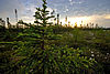
[Date]: 1975
[Location]: 48°11′34″N 94°30′43″W / 48.19278°N 94.51194°W / 48.19278; -94.51194
[County]: Beltrami
[Ownership]: mixed- federal, state, private, native
[Description]: One of the largest peatlands remaining in the conterminous United States. -
[]: 6
[Name]: Lake Agassiz Peatlands Natural Area
[Image]:
[Date]: 1965
[Location]: 48°02′13″N 93°28′30″W / 48.037°N 93.475°W / 48.037; -93.475
[County]: Koochiching
[Ownership]: state
[Description]: An example of the extensive peatlands occupying the bed of ancient glacial Lake Agassiz. -
[]: 7
[Name]: Pine Point Research Natural Area
[Image]:
[Date]: 1975
[Location]: 47°7′52.83″N 94°33′19.09″W / 47.1313417°N 94.5553028°W / 47.1313417; -94.5553028
[County]: Cass
[Ownership]: federal (Chippewa National Forest)
[Description]: Contains undisturbed stands of red and mixed pine. -
[]: 2
[Name]: Cedar Creek Natural History Area
[Image]:
[Date]: 1975
[Location]: 45°24′7.29″N 93°11′57.85″W / 45.4020250°N 93.1994028°W / 45.4020250; -93.1994028
[County]: Anoka, Isanti
[Ownership]: mixed- state, private
[Description]: A relatively undisturbed area where tall grass prairie, eastern deciduous forest and boreal coniferous forest biomes meet. -
[]: 1
[Name]: Ancient River Warren Channel
[Image]:
[Date]: 1966
[Location]: 45°35′6″N 96°49′48″W / 45.58500°N 96.83000°W / 45.58500; -96.83000
[County]: Big Stone
[Ownership]: mixed- state, private
[Description]: A channel cut by the Ancient River Warren during the Ice Age. Extends into South Dakota. -
[]: 3
[Name]: Itasca Natural Area
[Image]:
[Date]: 1975
[Location]: 47°11′40.21″N 95°9′55.22″W / 47.1945028°N 95.1653389°W / 47.1945028; -95.1653389
[County]: Clearwater
[Ownership]: state (Itasca State Park)
[Description]: Contains some of the finest remaining stands of virgin red pine, spruce- balsam fir, and maple-basswood-aspen forest.
New Random Display Display All Items(8)